20180326_Cawston to Bilton Green & Back (after knee op’s)

20180326_Cawston to Bilton Green & Back (after knee op’s)

When : 26th March 2018
Who : Just me (oh, and my camera and my new metal knees)
Where : Cawston/Bilton to the south west of Rugby Town, Warwickshire

20180326-39b_Bee on Crocuses - Bilton Green (Rugby)

Start and End Point : SP470,735 Trussell Way.
Distance : Approx 2.6 miles (4.2 km)
Significant heights : None to speak of.

Maps : There was no point in using a map as this was only a local wander, but, if you want to know, the 1:25,000 OS Explorer map that covers the area is Map No.222 Rugby & Daventry.

Summary : A very little walk in some rare 2018 spring sunshine to stretch my legs after recent knee surgery.

If you click on a pic’, it should launch as a larger image on my photostream on Flickr … a right click should give you the option of launching in a separate window/page.
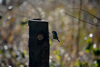
20140202_18_Coombe Country Park -Blue-Tit at the feeding postIf you’ve read my previous post [Coombe Abbey Walk] you’ll know that I’ve recently had surgery giving me two, brand new, half knee replacements (done at the same time), and as part of my recuperation I’ve been trying to get some walking miles “under my belt”, or really “in my legs” trying to get back to some kind of fitness.

Well, the day after the “Coombe Walk”, I mentioned on FB this comment :-

“After my 2.3 miler yesterday, thought a wander down to Mosaic Coffee shop for brunch would be good – So, today my muscles felt like I’d done a 17 miler the day before – Strewth I’ve got some work to do to get back to reasonable fitness levels !!!!!!!!”.

20180326-18_Mosaic Coffee Shop Main Street Bilton RugbyThat little walk to the lovely little coffee shop, on the 23rd March, was only ¾ mile, but was probably needed, just to loosen the muscles up a tad. So, to keep up the effort, I decided another local walk was needed and this time I decided a little further would be in order.

Now, the weather of late winter and early spring 2018 had been particularly poor, with periods of snow and ice making going outside a tad hazardous, especially hobbling around with two crutches, and even when there was no snow and ice, it was cold and wet and grey and miserable; Pretty much trapping me indoors and limiting me to just wandering around a supermarket’s aisles – Not very inspiring at the best of times. So, when the weather finally 20180326-26_The George (Pub) Bilton Green - Rugbyrelented, and a drop of sunshine decided to make an appearance, I decided a “stroll” down to the local village of Bilton would be a good thing to try.
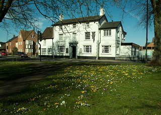
I made Bilton Green the focal point of the walk, as it was covered in its annual display of crocuses and I thought trying to get a few photos would be a good motivator. It’s also a perfectly pleasant walk through the Cawston Grange estate, especially the green spaces that have been provided as part of the housing development. The area is becoming more mature now, trees and shrubs reaching a decent size, softening the hard edges of roads and houses.
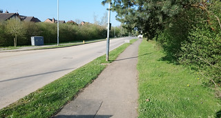
20180420-H_Trussell Way (Looking Towards Cawston Grange Drive)_XperiaAs several of my past walks diaries have used Trussell Way as a start point, I’ll once again describe starting on Trussell Way on the outskirts of the estate. Until recently this was a “dead-end”, with direct access onto the perimeter path and there was roadside parking that wouldn’t have infringed too much on local residents. However, the dead-end has recently been removed; the road now pushing further on into what was farmland and is now being built on by Mssrs William Davis enlarging the housing estate further south. There are currently restrictions on the house builders parking here, but I guess the restrictions will only be relatively temporary.

To describe getting to the start-point:-

Leave Cawston Grange Drive at an island, into Trussell Way, pass the side roads of Cave Close (on the right) and Durrell Drive (on the left), and then soon after, Trussell Way crosses a grassy area, just before it starts to rise again into the new housing being built.
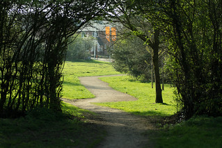
20180420-G2_Trussell Way (was dead end - Now extended southwards)_Anotated

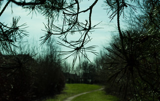
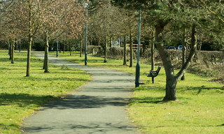
20180420-I_Cawston Grange Perimeter PathThe grassy strip includes the current perimeter cinder path, which I picked up gently rising in a south easterly direction, to pass through a tall hedge line, the small trees forming an inviting arch over the path, to emerge into a narrower strip of greenery with the established houses of Durrell Drive on my left and new housing going up behind trees/hedging/shrubbery on my right. Continuing on, the path flattens out and much of the existing housing is shielded by shrubs (red stemmed cornus predominantly) maintaining a rural feel, although I guess that will wane as 20180326-01_Cawston Grange Perimeter Paththe new housing goes up and becomes lived in. I particularly like the shapes some conifer trees made here against the pale blue sky in the weak sunshine.


20180326-02_Conifer needles

20180326-03_Sunlight through the conifer branches

20180326-04_Conifer branches - Cawston Perimeter Path

At the top of the path, after passing through another hedge line, a tarmac path (walking and cycleway) is reached in front of a stand of large trees and undergrowth separating the path from the B4642 Coventry Road (was the A4071 until a few years ago).
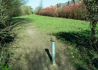
20180326-05_Cawston Grange Perimeter PathIncidentally, the anti-vehicle post here was adorned with a woolly hat, I don’t know if it had been lost or if someone had taken pity on the metal post and decided it needed warming up during the recent chilly weather.

Anyway, that’s beside the point really, because, I was to turn left here, but immediately stopped to take a few photos of some cheery daffodils/narcissi that come up here every year. It wasn’t the best display I’ve seen since they were planted, but I guess that might be down to the comings and goings of all the building works happening nearby, or maybe just down to the awful winter weather.
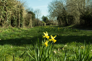
20180326-06_Daffodils - Cawston RugbyGetting low enough to take the pic’s wasn’t terribly easy as my knees didn’t want to bend very far, and I certainly couldn’t kneel down (far too painful !), so it was a case of spreading my feet as far as I dared, bending over as far as possible, using the live view rotatable screen on my camera and at full stretch trying to keep the camera as still as I could. Being 6’4”plus, I must have looked like some kind of strange giraffe trying to take a drink in that position. I must admit most pics failed due to camera shake, but some I think look Okish.
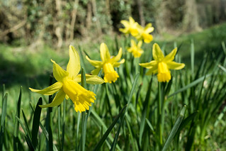
20180326-08_Daffodils - Cawston Rugby20180326-09_Daffodils - Cawston RugbyOnce I’d managed to stand upright again and just a few paces further on, the combined path/cycleway reaches Cawston Grange Drive, which I crossed straight over to a “Welcome to the Parish of CAWSTON” brick-built planter 20180326-10_Welcome to Cawston Grangeand sign. To my mind an attractive way to say hello to the estate. However, I have heard a dissenting voice from residents of what could be described as “old Cawston” down the Coventry Road, who feel the sign should be further down towards the Brickhouse Spinney area and so include them in the welcoming of visitors; either that or it was suggested the sign ought to read welcome to Cawston Grange Estate. Looking at the parish boundary map, they do have a teeny-weeny bit of a point. Whatever the politics, personally I have no problems with the wording or the sighting of the sign, which is backed by a small stand of trees and shrubs, an attractive way to welcome visitors to the area.

20180326-11_Silver Birch (Betula) - Cawston GrangeAnyway, I passed to the left of the signage and the stand of trees to pick up a wide tarmac footpath heading across a green with a large Christmas Tree to my right [that gets lit up in the winter each year], and a line of individual trees just to the left, including some quite mature cherry trees that were just waiting for warmer times to burst into flower. They look great when they do, albeit for a very short time, and the cherries taste good later in the year too. The tarmac path follows the line of an official right of way (a bridle track) which dates way, way back, to long before the idea of a housing estate here had probably ever been dreamt up.
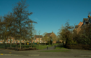
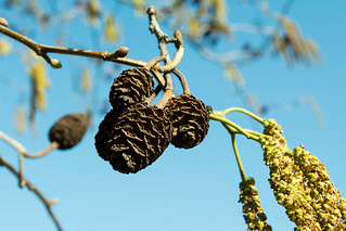
20180326-12_Green Space + The Bridle Way - CawstonAfter a short stretch down the tarmac bridle way, I reached and crossed Turchil Road passing a small fenced off play area designed for younger kids. This is a roughly triangular space surrounded by grass and trees softening the hard edges of the adjacent houses. All in all, a quite attractive estate green space. I particularly liked some catkins and cones hanging from a tree against the perfect early spring sky-blue sky; even local to home it’s worth looking for the little details that bring a little happiness – after-all, who doesn’t like spring catkins?

20180326-14_Catkins + Cones - Cawston

20180326-13_Catkins by the Bridle Path - CawstonThe next bit I’m gonna skip over quite quickly as I continued on, on the tarmac path, reaching Gerard Road where I then turned right, passed the small group of shops (A Chippy, Chinese Take-Away, Hair and Beauty Salon and a local CO-OP store), reaching and then crossing directly over Calvestone Road, across a small green with a few 20180326-15_Path beside the big playing field - Cawstontrees to pick up another tarmac path that soon emerges into a wide open “sports” field.

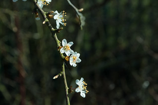
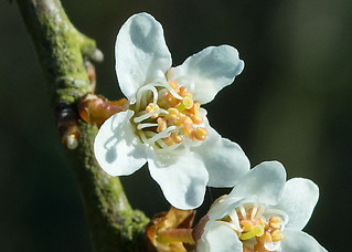
I say sports field but in reality, there’s only one “goal post” for anyone to use, but it is a large expanse of flat grassland. The path follows the edge of the field with a boundary fence separating the public space from Bilton School’s sports/playing fields along with a series of trees and large shrub hedging just coming into flower – I think probably Blackthorn (Sloe), the pretty slightly off-white petalled flowers with yellow centres indicating warmer times were on their way, hopefully a good spring being just around the corner.
20180326-16a_Spring Flowers (Blackthorn I think)

20180326-16b_Spring Flowers (Blackthorn I think)

20180326-16c_Spring Flowers (Blackthorn I think)

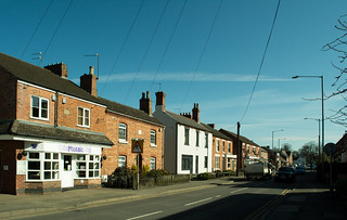
20180326-17_Mosaic Coffee Shop Main Street Bilton RugbyAgain, trying to stay a little brief, the path emerges onto the Coventry Road (B4642) where I crossed to the opposite side, turned left and walked into Bilton Village where the road continues as the B4642 but under the name of Main Street. Bilton itself is to me an unassuming place with a pleasant mix of housing (from old to brand spanking new), a selection of shops (including a Tesco Express and a CO-OP), some small businesses, a doctors surgery, Two Pubs (The Black Horse and The George), a butchers, a specialist cheese shop, several take-away outlets, four churches (Bilton Evangelical, Bilton Methodist, Sacred Heart RC, all within shouting distance of each other and at the opposite end of the village is St. Mark’s CofE not reached on this walk). There’s also a small (and free at the time of writing) car park just behind the Tesco store.
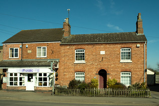
20180326-19_Ewart House 1890 + Rose Cottage 1885 Main Street BiltonThe other place I haven’t mentioned above, is Mosaic Coffee Shop/Café, a lovely friendly place that I would have called in to for a coffee or maybe a hot chocolate, but unfortunately, it’s closed on Mondays, so wasn’t available today.

Mosaic’s building has a plaque saying it’s called Ewarts House built 1890 and next door is Rose Cottage built 1885. If only the red brick walls could speak of all the changes they’ve seen over the last 130 years or so.
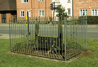
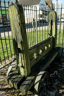
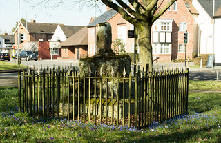
20180326-20_Stocks - Bilton GreenTalking of history, outside the CO-OP is a set of wheeled stocks kept safely behind a set of be-spiked metal railings and then a short distance away in the middle of the Triangular Green (bounded by roads) is the old Butter Cross. I say cross, but the top half is now long gone leaving just the heavy tiered stone base and bottom stump of the cross itself. The monument is also kept safe inside metal railings also adorned with spikes and with crosses at each corner. I wonder how many people even notice it’s there as they negotiate this busy junction of roads controlled by traffic lights and overlooked by the white-washed frontage of The George pub across the road.

20180326-21_Stocks - Bilton Green

20180326-25_Bilton Green - Butter Cross - The George (Pub) - Rugby

20180326-27_Fence Railings Around the Butter Cross - Bilton Green

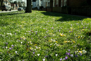
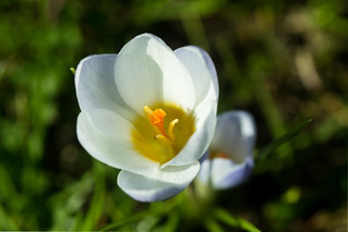
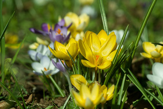
20180326-28_Fence Railings Cross - Butter Cross - Bilton Green20180326-29_Fence Railings Cross - Butter Cross - Bilton Green20180326-30_Fence Railings - Spikes - Butter Cross - Bilton Green20180326-22_Crocuses - Bilton Green (Rugby)It was this area of “The Green” that was my motivation for the walk, as each spring the ground is briefly bedecked in the whites, purples and yellows of crocuses.

It really is quite special, especially with the sun shining and it was well worth pushing my knees to reach here for a closer lingering look, rather than a passing glance from the car window.

Anyway,I shot off far too many pic’s (again!) …. there really isn’t a shot to take that couldn’t be described as a cliché in one way or another, but hey, I don’t care.

20180326-24b_Crocuses - Bilton Green (Rugby)Crocuses are cheery, happy little flowers and I enjoyed trying to capture their character as best I could, and I make no apologies for the images contained here.

I particularly enjoyed watching a few bees attracted to the flowers, braving the chill in the air despite the early season sunshine being quite pleasant, especially compared to some of the sub-zero temperatures we‘d been experiencing not long before.
 

20180326-31_Crocuses - Bilton Green (Rugby)

20180326-33_Crocuses - Bilton Green (Rugby)

20180326-36a_Crocuses - Bilton Green (Rugby)My knees were feeling the strain somewhat, so I took time out to sit on a bench just inside the nearby Assheton Recreation Ground for a bit of rest and recuperation before thinking about the walk home. I must admit it made me feel just a little sad that a slow, flat, easy walk for little more than a mile had resulted in having to sit and rest because of pain and tiredness. I guess having to overcome self-doubt about whether it was right to have such surgery is just as important as working the physical side of building muscles and stretching tendons.

20180326-42_Perimeter Path beside the big playing field - CawstonSorry, that got a little downbeat there, but no, I picked myself up, brushed myself down and gave myself a bit of a talking to, re-motivating myself and re-cajoled my knees to straighten-up as much as possible again and carry me back down Main Street, re-passing all the previously mentioned places en-route, and re-crossing the Coventry Road back into the large sports field effectively separating Cawston from Bilton. Instead of heading back up the boundary to Bilton School, I turned left following the tarmac path running parallel to the Coventry Road separated by a mature hedge.

20180326-43_Perimeter Path beside the big playing field - CawstonThe path here is bounded by a line of trees which will in time become an avenue to walk down. Also here several stands of trees/shrub planting are now growing to be quite sizeable and break up the view across the large field. I like this path – in fact I like living on our housing estate, and it’s not only the physical surroundings, it’s the people too. Invariably most people I pass on these paths will nod, smile or say hello – I guess it’s called community.

20180326-44_Perimeter Path beside the big playing field - Cawston

Anyway, at the end of the path, it was back into streets, where I followed Kalfs Close left into Gold Avenue and left onto Calvestone Road crossing over to meet Cawston Grange Drive back at the stand of silver birch trees and the brick “welcome to Cawston” planter/sign.
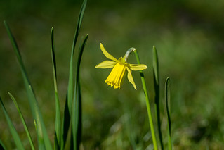
20180326-45_Silver Birch (Betula) - Cawston Grange

20180326-47_Daffodil - Cawston RugbyIt was now back to re-following my earlier steps, crossing Cawston Grange Drive, passing the daffs (more pic’s taken), then right onto the perimeter path down to Trussell Way and the start point and then back to home.
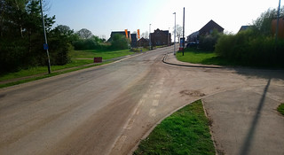
20180326-46_Daffodil - Cawston Rugby20180326-01_Cawston Grange Perimeter Path

20180420-I_Cawston Grange Perimeter Path

20180420-G1_Trussell Way (was dead end - Now extended southwards)_XperiaNot quite 2½ miles but I was pretty much cream-crackered, but really very satisfied that I’d managed it, although the amount of post exercise discomfort was yet to kick in. But that’s why they supply prescription strength drugs! …. The walk also had the knock-on effect of giving me something to occupy my mind whilst in enforced rest – namely reviewing, deleting and editing my pic’s.

Well, I hope you enjoyed my scribblings …. If you’d like to comment on my diary or any of my pic’s please feel welcome. I’d love to hear from you.

T.T.F.N. Gary.

PS. I’ve now finished and published the above diary in July 2018, some 4-months after I did the walk ….. and I’m now back at work and, amongst other walks, I’ve completed a 12 miler up in the White Peak, and a nearly 14-miler locally. Knees seem to be holding up. When I find time I’ll have to write them up/publish as well.


20180322_Coombe Abbey Country Park Walk, near Coventry

20180322_Coombe Abbey Country Park Walk, near Coventry

When : 22nd March 2018
Where : Coombe Abbey Country Park (just outside Coventry, in Warwickshire)
Distance : Approx 2.3 miles (3.7 km)
Significant heights, climbed or descended : None

Maps :
1:25,000 OS Explorer Map 222 Rugby & Daventry
1:25,000 OS Explorer Map 221 Coventry & Warwick
Start and End Point : SP404,795 Main Country Park Car Park (on map 222), although to be fair, you don’t really need a map at-all, and there are leaflets available from the visitor centre and at least one large notice board with a map.

20180322_A Coombe Abbey Country Park Walk (near Coventry)

If you click on a pic’, it should launch as a larger image on my photostream on Flickr … a right click should give you the option of launching in a separate window/page.

Some Background Info :-
In a way this little walk, a very gentle wander around our local country park and not even 2½ miles, is, in its own way, quite significant to me.

Why?

The Oxford Partial KneeWell, as noted in my previous post, seven weeks ago today (writing on 26th March) I had knee surgery on both my knees (half, partial or Oxford knee replacements whichever term you prefer). I’ve now had several bits of bone cut out and non-existent cartilage replaced with some very clever metal and plastic parts.

It’s no lie that getting back to some sort of normal mobility and reducing pain to a manageable level, whilst at the same time reducing the use of strong opiates, has been a bit of a challenge. The weather hasn’t helped either, with snow & ice and what seems like continuous rain and cold miserable conditions preventing me from getting out and about (even with crutches) as it often just wasn’t safe. But, I’ve done my indoors home exercises, as well as the scheduled physio sessions at the hospital, strengthening and stretching muscles and tendons and working scar tissue. I’ve even borrowed an exercise bike, now taking pride of place in my dining room for ease of use.

Slowly, as I improved, I introduced a wander down the street and back, short trips around the supermarket and a longer walk to the local shops (about a mile round trip). I started off with two crutches, then one (which didn’t work very well as I felt totally unbalanced), and I’ve pretty much discarded both crutches all the time now. That felt brilliant, especially as I could stand tall again and move a little more naturally.

So, back to Coombe Abbey …. This was to be the furthest I’d have walked since the op’s … and … with walking boots on !… and … on slightly rougher ground !… and … I must admit with a slight feeling of trepidation over how my new knees might cope.

The Walk :-
It was a dry day, quite chilly, overcast and grey, some might even say decidedly gloomy, but just about nice enough to venture out a bit further afield as there was no rain forecast. It was the sort 20180322-00_Coombe Abbey Country Park - Car Park Charges (Mar-2018)of day that you wouldn’t want to stop and linger for very long in any one place. So, accompanied by my wife and daughter, we headed the few miles to the east side of Coventry to Coombe Abbey Country Park. We parked up in the car-park (the first car-park off the main drive, not the second car-park which is to service the hotel) making a note of the charges vs times. We decided up to two hours stay would probably be about right which would cost us £2.00, over two hours would cost £3.80 quite a jump to the next time slot of two-four hours.

We started off walking over to the large visitor centre, going down the right-hand side of the large, and to my mind, ugly building (we stayed away from the other side and the rather noisier 20180322-01_Coombe Abbey Country Park - Visitor Centrekiddie’s play area). Just for your info’, if you’re in need, the toilets are down this right-hand side, near the far end of the building. From here we took the wide modern surfaced path down the slope (looking back I think the building still looks rather out of place). The park has recently developed a wildflower meadow off to the left here, but it was the wrong time of year to see anything of note, and off to the right are views across a picnic field to the old abbey buildings, albeit much of the top half has been rebuilt in modern times when it was converted into a hotel (quite a posh one at that!).

20180322-02_Coombe Abbey Country Park - Picnic Fields + Abbey Hotel

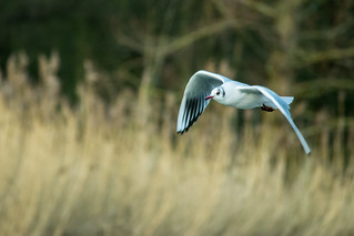
20160116-13_Coombe Abbey_Gull_In FlightDropping further down the wide path, brings you to an almost equally wide causeway. To the left is the main lake (Coombe Pool) which has been allowed to naturalize over recent years to become a major attraction for water birds, as opposed to a pleasure boating pool as it was going back to my childhood in the 60s/70s. You’ll find the obligatory mallard ducks, geese and serene snow-white swans, but there were various other sorts of ducks and gulls on show and we caught 20180322-03_Coombe Abbey Country Park - Pigeonsa glimpse of a grebe, albeit briefly, before it vanished under the water.

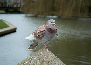
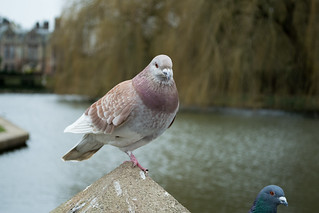
We didn’t stop long here, just enough time for me to snap a photo of a line of pigeons sat atop a fence and the ornamental stone balustrade (to the right of the causeway) that separates the naturalistic lake from an ornamental pool, with views up to the abbey hotel, where the rectangular pool morphs into a moat around one side of the building.

Once over the causeway, there are several options to take, too numerous to mention here right 20180322-05_Coombe Abbey Country Park - Daffodilsnow, other than to say we turned right, following the path running along-side the ornamental pool heading towards the hotel. There are several benches here, sat in front of a stone wall with various dormant climbing roses just waiting for some spring warmth to burst into life.. The wall itself retains a higher terraced area which we could have chosen to be our route. Towards the far end of the wall I particularly liked a bed of daffodils, their cheery vibrant yellow blooms brightening up the area, even in the grey overcast conditions.20180322-06_Coombe Abbey Country Park - - Daffodils

20180322-07 (20171109)_Coombe Abbey_Xperia XA1

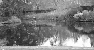
20180322-08b_b+w_Coombe Abbey Country Park - Knot Garden & Abbey HotelWe’d now reached the top end of the ornamental pool and quite close to the abbey’s west frontage and a traditional hedge knot garden. You can enter the garden, for the classic view back down the ornamental pool to the balustrade/causeway and Coombe Pool beyond. Please note that the sun terrace directly in front of the hotel is for paying guests only.

We didn’t bother with the knot garden area 20180322-09_Coombe Abbey Country Park - Griffins or Eagles Stone Statuestoday, instead passing two stone sentinels (stylised eagles/griffins?) stood either side of a set of stone steps. My two fave ladies had made their way up a sloping path here and turned left along another path heading away from the hotel. However, as I’d dropped behind (taking a couple of photos of the daffodils and the griffins) I climbed the steps and headed off across a lawned area, cutting the corner off, as a mini-short cut, re-joining the girls near the “doggy grave stones”.

20180322-11_Coombe Abbey Country Park - Doggy Grave StonesGrowing up we’d been under the assumption that the gravestones marked where the pets were buried, which seems a reasonable assumption, but we learnt a while ago that the actual graves are elsewhere on the estate but the gravestones had been relocated to their current site many years ago. Some more clumps of cheery daff’s enhanced the area here, adding a welcome splash of colour.


20180322-10_Coombe Abbey Country Park - Daffodils

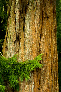
20160116-27_Coombe Country Park_Pine Needles RossetteThe path continues on, with private grounds off to the right and to the left, planted on a large raised bank is an arboretum, the area dominated by tall redwoods as well as other conifers and some broad-leaved trees. I just love the soft fibrous texture of the redwoods’ bark, extremely attractive and equally tactile. There are always squirrels to be seen here, obviously attracted by the cones on these conifers. I know grey squirrels are effectively an invasive species having supplanted our native red squirrels, but they are rather cute hopping about on the ground and scurrying up the trees at the slightest hint of danger.

20160116-24_Coombe Country Park_Redwood

20180322-13_Coombe Abbey Country Park - Tall RedwoodsAt the far end of the redwood area, another path joins from the left. Now, the lovely ladies in my life asked how my knees were holding up, especially as I had opted to leave my crutches at home; effectively they were giving me the option to turn left which would very quickly take me back to the causeway and the main pool. I was however feeling OK, so opted to continue on, on the perimeter path to reach “Top Pool”. This is very much smaller than Coombe Pool, and was once the kiddie’s boating pool a long time ago. Again, nature is taking over with reed beds and over-hanging trees. There always seems to be swans here too; the old landing stage now used by the swans rather than pedaloes and rowing boats. Near here is a toilet block (not open all the time) which we passed by on what was now more of a roadway than a path, soon reaching an area where The Smite Brook passes under the path/roadway.

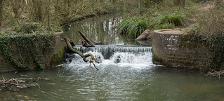
20180322-14_Coombe Abbey Country Park - The Smite Brook Weir

Again, I could have turned left here (over Wrautums Field) to head back towards the causeway, but I was happy to carry on, the path heading out into an area of more naturalistic woodland, somewhat wilder than the walk done so far, and a complete contrast to the hotel/ornamental pool area.

20180322-16_Coombe Abbey Country Park - Buds Waiting for SpringI like it out here, the perimeter path becomes a little more rough and ready, you see fewer people, and somehow, I felt closer to nature; perhaps it was the birdsong all around and occasional glimpse of a blue tit or robin flitting between the branches, or the buds on the otherwise naked trees just starting to open-up. At one point, the path takes a right bend down a little slope and then a left to rise back up again. The path at this point skirts the outer limits of the park grounds, only separated by a line of trees most notably some tall gnarly pines (Scots Pine I think). The view out over the nearby farmland is to a large (quite ugly) building complex. It looks rather like a factory or a warehouse, but is Coventry and Warwickshire’s largest hospital at Walsgrave on the very edge of Coventry.

20140202_18_Coombe Country Park -Blue-Tit at the feeding postThe path reaches the far end of the park, well at least the part of the park with public access. The area of woods straight ahead is set aside as a nature reserve, forcing the path to take a sharp left-hand turn, dropping gently down through the woodland (the inaccessible nature reserve on the right), until it reaches the bird hide. The hide looks out over Coombe Pool, with an area of marshy ground, reeds, etc, and a small clearing with bird-feeders. The main attraction however for many people is, off to the right, an island in the lake which is the home to a sizeable heronry.

Today, it looked like there were a number of people in the hide already, so we turned left on the perimeter path, now following Coombe Pool on our right, at times quite close to the serpentine lake 20180322-18_Coombe Abbey Country Park - Glimpse of the Main Lakewhere it also feels airier where the trees make way for more open ground.

Not far after however, the path re-enters the woods, winding its way onwards a little further away from the lakeside, but where glimpses of the lake can still be had; later the path again gets very close to the lake with views emerging of the causeway and then soon after reaching an arched wooden footbridge over the Smite Brook.

20180322-19_Coombe Abbey Country Park - Bridge over The Smite Brook

20180322-20_Coombe Abbey Country Park - PigeonCrossing the bridge brought us back to near the end of the causeway, and then it was just a case of re-crossing the pool (balustrade rail on our left this time) where I stopped for more pigeon photos. Although not exactly posing, they did seem reasonably happy to oblige me; I think they are completely happy with the proximity of people who cross here, often milling around in their crowds feeding the water birds.


20180322-21_Coombe Abbey Country Park - Pigeon

20180322-22_Coombe Abbey Country Park - Pigeon

20180322-23_Coombe Abbey Country Park - Pigeon

20180322-24_Coombe Abbey Country Park - Daffodils + Avenue of TreesI must admit, my knees were now starting to twinge a bit, but a slow wander back up to the visitor centre was negotiated easily enough, and I felt OK enough to have a final little wander taking a few photos of large clumps of daffodils looking fantastic around the base of the trees that form an impressive avenue down the sides of the main drive.


20180322-25_Coombe Abbey Country Park - Daffodils + Avenue of Trees

And then, that was that, back to the car, and the drive home – but – calling in at The Old Smithy, a pub in Church Lawford, where we indulged with a spot of lunch in their conservatory, a super way to finish a good morning, and a good test of my new artificial knees.

The afternoon largely consisted of elevating feet and legs, applying ice packs and not much more in a well-tested method to reduce any swelling from the mornings exertions. Sounds easy, but probably one of the hardest parts of my rehabilitation. I hate being laid up inactive, makes me feel just a tad useless. I can’t wait to get back to a degree of normality and ultimately to get back to work and equally important to my wellbeing back onto the hills, valleys, moors, fells and mountains of our great country. In the meantime, though, I’ll suffice with the gentle parks and countryside of Warwickshire.

I hope you enjoyed my scribblings …. If you’d like to comment on my diary or any of my pic’s please feel welcome. I’d love to hear from you.

T.T.F.N. Gary.

20170331_A short Robin Hoods Bay walk on the beach

20170331_A short Robin Hoods Bay walk on the beach

Along the Beach from Boggle Hole to Robin Hoods Bay Village and Back Again

20170331-28_Big Skies over Coastal Cliffs - Robin Hoods BayWhen : 31 March 2017
Who : Just Me
Where : North Yorkshire Moors and Coast
Start and End Point : NZ954,038
Distance : Approx 3 miles (5 km)

Significant heights : Nothing to speak of … except the paths around Robin Hoods Bay village streets, which are quite steep, but you don’t have to go exploring if you don’t want to.

20170331_Boggle Hole to Robin Hoods Bay Photographic WanderWhole Walk Summary :
A wander from Boggle Hole to Robin Hoods Bay village on the beach and wave cut platforms, just enjoying a drop of sunshine, taking photo’s and generally taking it easy.

Took most of the day to walk about 3-miles, wandering back and forth trying to take arty pics of rocks and cliffs, including a wander around the village itself.

If you click on a pic’, it should launch as a larger image on my photostream on Flickr … a right click should give you the option of launching in a separate window/page.

If you’d like to see more pic’s, please use “this link” to go to the full set that I’ve uploaded to flickr. There’s another thirty nine images to see if you’re interested.

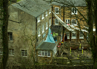
I was staying at Boggle Hole Youth Hostel, but rather than start at the hostel’s front door, I’ll 20170329-65_Boggle Hole Youth Hostelstart my description from the small car park just up the road (and steeply up hill) from the hostel so making it more like someone just parking up for the day. In reality, it’s also quite accurate from the “walk’s point of view”, ‘cause as it was my last day of my short break, I had to transport all my gear from the youth hostel up to the car park and load the boot up with my bags etc.

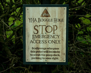
20170329-64_Boggle Hole Humourous Warning SignThe car park itself is free, with an honesty box for donations towards its up-keep, but of course, I suppose this could well change in the future. For your info’ the car park is situated at the end of Bridge Holm Road.

So, I stuck all my gear in the boot of the car, raised ruck sack onto my back (very lightly packed as it was to be an easy short day) and slung my camera bag over a shoulder which actually weighed more than my rucksack. Once set, I headed back down the steep hill 20090827-09_End of the road - Boggle Holetowards Boggle Hole Youth Hostel. By the way, please heed the warning signs and DO NOT drive down here thinking it’ll save a bit of a walk down to the beach. The road drops straight down to the beach area, just becoming a cobbled slipway at the bottom, and gets covered when the tide is in. The only motor-powered access is for the youth hostel service vehicles only, and they can only get 20170329-01_Boggle Hole Beach and Youth Hostelright up to the hostel when the tide is out and when the stream isn’t too full.

Once I’d made my way back down the tarmac to the youth hostel and then the cobbled slipway had been negotiated once again, I headed out onto the beach area, with the sole purpose of wandering around trying to find interesting photo-opportunities, which I figured wouldn’t be too difficult as I think this is a really interesting section of coast here.

20170331-03_Mill Beck - Mini Cascades across the beach - Boggle HoleBoggle Hole Youth Hostel is an old mill building set down in a steep side valley, through which Mill Beck flows. When the tide is out, the stream flows directly out onto the beach and then spreads out over a series of broad rocky steps as a number of little cascades, eventually making its way to the sea, joining the waves and waters of The North Sea. When the tide is in however, the beach disappears completely, the sea coming into the valley mouth, right up to the youth hostel. In fact, when the tide is in, there is absolutely no access onto the beach, as the sea comes in as far as and up the base of the surrounding cliffs.

20170331-11_Rocky Beach + Cliffs - Boggle HoleThe cliffs here-abouts are not the tallest in the country by any means and are made of quite soft material and as such are easily eroded away by the sea. There is always the risk of rock-falls and I’d recommend you stay vigilant if you’re near the base of the cliffs. In fact, the series of rock steps on the beach mentioned earlier, are the remnants of where the cliffs used to be, showing where the sea has cut back into the coastline enlarging the extent of Robin Hoods Bay. In geographical terms the flat rocky areas are 20170331-25_Rock Strewn Beach - Wavecut Platform - Robin Hoods Bayknown as wave cut platforms. It’s not quite so apparent at beach level, but from above on the cliffs, you can see the arching shape of the platforms heading out to sea. To the south of Boggle Hole, the rocky strips are called “Low Scar” and “High Scar”. To the north heading towards Robin Hoods Bay village, the strips are known as “Cowling Scar”, “Dab Dumps”, “East Scar” and “Landing Scar”.

20170331-29_Rock Strewn Beach - Wavecut Platform - Robin Hoods Bay20170331-27_Sky and Beach Reflections - Boggle HoleBetween the separate lines of rocky platforms, shall we call them strata, rock pools are trapped, some quite deep and sizeable and some areas of the rocks are covered with extensive areas of slippery seaweed. Also interspersed and strewn across the whole area are stand-alone boulders and individual rocks.

You would almost say they look like someone 20170331-31_Wave Action - Sand and Rocks - Robin Hoods Bayhas placed them in little groups in an arty deliberate way. A word of warning here, if you go exploring on the rocks, please keep an eye on the tide, because as the whole beach area is quite flat, the sea comes in quickly and it especially follows the lines of the strata.

I reckon with the tide coming in, it’d very easy to get cut off from the safety of the 20170331-17_Graded Sands + Rock Poolmainland. Having said that, even with one eye on the sea, I thoroughly enjoyed my explore of the beach area between Boggle Hole and Robin Hoods Bay village.

In fact, I spent absolutely ages wandering (almost aimlessly) zig-zagging back and forth, trying to get some arty looking photo’s; subjects attempted included :-

  • The mini-waterfalls of Mill Beck cascading across the rocks (trying to get a soft milky feel to the flowing water with extended shutter speeds).
  • Wider views of the beach, cliffs and big skies.
  • Close ups of limpets, periwinkles, barnacles, rocks and sand patterns.
  • A horse being ridden across the sands.
  • Boulders, rock pools and reflections.
  • And quite a few views of Robin Hoods Bay village hugging onto the hillside, as I got closer and closer as I made my way across the rocky striations.

20170331-16_Smooth amongst the Rough

20170331-13_Barnacles on the Rocks - DoF

20170331-20_Horse Rider on the Sands - Boggle Hole20170331-39_Robin Hoods Bay - Rocky Beach - Tide Out

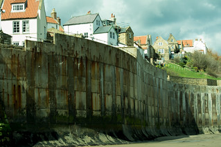
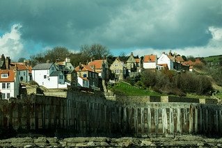
For those in the know, The “A Coast to Coast” long distance footpath (that starts on the Irish Sea at St Bees on the opposite side of the country, ends here, the idea being to pick up a pebble from the beach at the start of the walk, and deposit it in the sea here at Robin Hoods Bay. So, 20170331-43_Robin Hoods Bay - Massive Sea WallI wonder how many “non-native” stones I walked over or past as I made my way up to the slipway and thence up into the village. Just to the right of the slipway the precariously perched buildings are protected from the sea by the tallest sea-wall I think I’ve ever seen. With the sun shining, the white-washed houses with their neatly tiled rooves (or roofs if you prefer that spelling) look attractive and friendly. However, I can imagine with a storm coming in off The North Sea at high tide, you could feel quite vulnerable with the waves crashing in immediately below.

20170331-42_Robin Hoods Bay - Massive Sea WallToday though, the weather was benign, sunny with big fluffy clouds, and reasonably warm in the sun, but the breeze was a little chilly; every now and again the clouds would turn a heavy greeny shade of grey indicating how quickly the weather could turn if it had a mind to. However, I particularly liked the contrast of the bright against dark and the associated shadows.

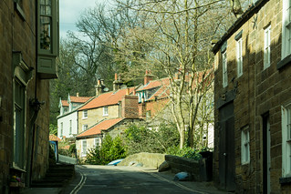
20170331-44_Robin Hoods Bay VillageWith the conditions so nice, I decided to head up into the village for a different set of photo’s, stone built houses, red tiled rooves, narrow streets and walkways, white-washed walls set against a vivid blue sky.

I like Robin Hoods Bay village, it’s pretty, looked after, touristy but not overly so. It hasn’t gone down the “tacky” route that other seaside towns have gone over the years and for me, it still feels like real people may well live here and with 20170331-46_Footpath Steps Walkway - Robin Hoods Bay Villagea pride in the place. Having said that, there are several pubs and tea-shops and a few trinket/touristy shops, one of which I visited to buy some boxes of fudge/toffees as gifts to be taken home.

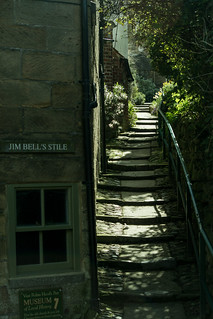
The streets and paths through the village are sometimes steep, not surprising really given it’s clinging on to the cliff side, but well worth the effort to explore, as they twist and turn and divide and re-join, and reach dead ends and you have to turn around and end up back where you’ve been already.

You get to look up narrow sets of steps and down over roof tops and if you end up where I did, you could end up on top of the tall sea wall looking out over the coastline. All in all, it’s just a super place to wander through.

20170331-54_Sea Wall - Robin Hoods Bay

20170331-52a_The Old Bakery Tea Rooms - Robin Hoods Bay Village Roof Tops

20170331-50_Footpath Walkway - Robin Hoods Bay Village

20170331-49_Ornate Street Light - Robin Hoods Bay Village

20170331-53_View to the Beach - Robin Hoods Bay Wave Cut Platform

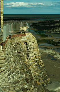
20170331-55_Standing Guard on Sea Wall and Life Size Model SheepTo finish my time in the village (after I’d bought my sweet gifts for home), I found my way up a side street/pathway and through to the top of some smaller sea defences (to the south of the slipway area) where I sat myself down on a bench, cracked open my packed lunch of a spicy beef pastry, hot cross buns with blackcurrant jam (a staple of mine when out walking), and other bits and pieces.

Sat in the sun, looking out over the coast I felt very relaxed. I also felt somewhat protected by a guard-sheep looking out to sea from a nearby terrace. It was of course a life-size model rather than a real live sheep; I imagined it being quite fierce, perhaps a deterrent to any lurking smugglers out in the bay waiting for nightfall to bring in their contraband, or perhaps I’m going a long way back in time to when smuggling was 20170331-56_On the Beach - Ice Cream Van - Robin Hoods Bayindeed rife in the area.

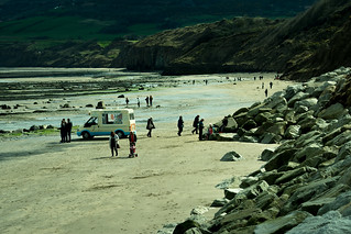
Eventually, I needed to move, I had the mile southwards along the beach to complete, (I resisted the ice cream van parked on the sands en-route), which I did without as much zig-zagging of the walk earlier in the day, only really stopping when I’d reached the Boggle Hole valley.

.

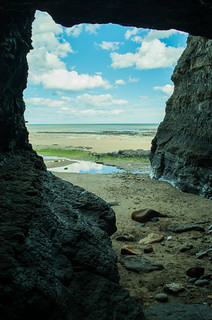
20170331-57_Sea Cut Cave - The Boggles Hole at Boggle Hole

20170331-59b_Sea Cut Cave - The Boggles Hole at Boggle HoleI took a few pic’s of the cave in the base of the cliffs here.

This is The Boggle’s cave or hole, that gives its name to the youth hostel.

Please see my earlier post from a few years earlier that gives some more info’ on what or who a Boggle is, you might find it amusing.

Again, be careful if you visit here, lumps of rock from the ceiling can and do fall to the floor of the cave.

20170331-58a_Sea Cut Cave - The Boggles Hole at Boggle HoleWell, once again, I needed to move, first heading up the slipway, and then 20170330-02_Boggle Hole Youth Hostelback up the steep road rising above and away from the youth hostel and up to the car-park. I don’t know how I’d managed it, but I’d spent all morning and half the afternoon doing just three miles. I don’t suppose that matters though, I’d done my bigger distances on day-1 (16.5 miles) and day-2 (10 miles) out on the moors, so I didn’t feel I needed to do any more today. Besides I enjoyed the “playing” of taking photos with more time to think about the images than I normally get when out on a walk. I still probably took far too many pic’s, but hey it’s not often I get to the seaside (I live just about as far from the sea as you can in England, living in 20090828-99_Sanderling [or similar]_Boggle Hole BeachThe Midlands) so I think I can be forgiven for getting a little carried away.

And that was that, apart from the long drive back home, that was the end of my short break on The North York Moors and Coast.

Just as a final comment, if the tide is in, the beach walk is impossible, however there are a few alternatives.

  • Alternative-1 = There is a footpath (part of The Cleveland Way) that runs along the top of the cliffs with access at both ends.
  • Alternative-2 = Further inland there is a dismantled railway, with permissive access for walkers and cyclists. At the Boggle Hole end, you’d need to walk from the little car-park, up the quiet Bridge Holm Lane in a south westerly direction, after about a mile branch right down another minor road and then pick up the railway heading north. The old track-bed makes a number of sweeping curves to arrive at the Robin Hoods Bay end of the walk at the top of the town. This quite a bit longer than both the beach and cliff top options.
  • Alternative-3 = A combination of options 1 & 2 above, say we were going from Boggle Hole to Robin Hoods Bay, take the footbridge over Mill Beck near the youth hostel, then climb up out of the valley onto the cliff path. After a while, instead of continuing along the cliff top, take a left turn onto a footpath (called Mark Lane) and then pick up the old railway (turn right) to continue to the top of Robin Hoods Bay village. This is longer than option-1 but shorter than option-2.

Any of the above could be combined with the beach route to make more of a circular walk.

Map Used :
1:25,000 Outdoor Leisure Map No.27 … North York Moors Eastern Area.
20170331-37_Robin Hoods Bay Village - Big Stormy Sky[My map is pretty much an ancient relic, probably a slight over statement, but it did only cost me £2.95 which gives an idea of its vintage. I’ve no idea how old it actually is, but essentially the moors don’t change much and despite it being in a slightly dilapidated state (slowly falling apart at the folds) it did me fine for my trip. Next time however, I think a new map may well be on the cards, and won’t need Sellotape to hold it together].

I hope you’ve enjoyed my scribblings ….

If you’d like to comment on my diary or any of my pic’s please feel welcome. I’d love to hear from you.

T.T.F.N. Gary.

Post Script …
My map has finally fallen apart and has made its final journey…
All the way – To the bin!


20150405_Great Witley_Clifton Upon Teme_Circular Walk

20150405_Great Witley_Woodbury Hill_Teme Valley_Clifton Upon Teme_Circular Walk

When : 5th April 2015
Who : 11 members of the Coventry CHA Rambling Club (including me).
Where : Great Witley, Worcestershire
Start and End Point : SO,753,663
Distance : Approx 11.75 miles ( 19 km)
Significant Heights : 1,805 ft up and 1,560 ft down … details at the end, after the text.
Maps : 1:25000 O.S. Explorer Map No. 204 Worcester & Droitwich Spa.

20150405_A Hilly Teme Valley Walk

Waking Route mapped out on “WalkJogRun”

Summary : A strenuous (at least for me) circular walk in the hills either side of The River Teme a good few miles to the west of Droitwich Spa. Starting at Great Witley ; over Woodbury Hill ; Worcestershire Way over the ridge of Rodge Hill/Pudford Hill ; Across the River Teme at Ham Bridge ; Rise up to Clifton Upon Teme ; Down and over The Teme again at New Mill Bridge ; and then a final climb back over the ridge before dropping back to Great Witley to finish.

I’m a member of The Coventry CHA Rambling Club and this walk was one from the Sunday A+ walks programme. These “A+” walks take place on the first Sunday of the month. If you’d like to know a little more about The Cov-CHA Rambling club, please see my previous blog-post or for more details please go to their web-site.

20150405_By Gerry West_Coventry CHA_Great Witley Walk

By Gerry West_Coventry CHA_Great Witley Walk (Me striding out)

I would normally now give a link to an extensive set of photo’s I’d taken during the walk, on my photostream on Flickr. But, I was very annoyed with myself, for, when I took my camera out for the first photo of the day, I found I hadn’t inserted the SD card (it was still in my computer at home, coz I’d been downloading photo’s the night before).

This became doubly annoying as the walk took in some absolutely beautiful scenery that I’d never walked through before … and … it turned out to be the best day’s weather of the year so far, a perfect spring day for a good walk and for taking photo’s … Grrrrr …

However, a couple of my friends in the party have shared a few pic’s of their own with me and, with their permissions, I’ve been able to attach them to the post, along with some “generic” non-specific images of my own and I hope these make for an interesting post for you.

Many thanks to Gerry and John for use of their images.

I’d arranged to share a lift with a couple of ladies that were going on the walk; the meeting time in Coventry based on some details emailed out by the walks leader. I won’t mention names in the interest of privacy, but thanks to the lady who drove, it was very much appreciated. We were the first of three cars to arrive at the starting point, a large car park just to the side of The Hundred House Inn at Great Witley in Worcestershire, on the A443 road between Droitwich Spa and Tenbury Wells. The impressive grade-2 listed building looked decidedly closed and tired (writing in Apr-2015) and a quick search on the web suggests it may have been that way since 2013. Anyway, that’s where we parked.

20150405_By Gerry West_Coventry CHA_Ploughed Field Crossing

By Gerry West_Coventry CHA_Ploughed Field Crossing

Once we’d all gathered, donned boots and adjusted walking poles to desired lengths, we set off in a southerly direction, crossing the main road with care because there was virtually no road-side verge in front of the stile on the other side. As with all stile crossings, the party quickly started to string-out somewhat. This wasn’t helped in that, once over the stile, we were greeted by a wide, very rough-ploughed field. The path hadn’t been re-instigated across the churned up lumpy soil, but luckily we’d had a little period of dry weather and the crests of the ploughing were reasonably solid. Even my weight was supported OK!, so progress across to the far side wasn’t too bad (quite frankly it could have been horrible if we’d had recent rain). Hopefully the farmer will put the path back in again (as he is legally supposed to do) in a short time.

20140309-03_Cawston Grange Pussy Willow

One of my “generic/stock” photo’s – Pussy Willow.

We soon regrouped to cross another couple of fields, eventually reaching a minor road which was reached by means of another stile. This one was particularly rickety, the tread being held in place on its rotting upright by the end point of a single nail. To hinder some more, the whole thing was also at an awkward angle. The slow progress here (even with only eleven of us) meant the group got rather spread out again very rapidly, especially as the onward route was on the road (after turning left over the stile) and the first people over obviously moved relatively quickly on the tarmac surface.

20150405_By John Osbourne_Coventry CHA_Above The Teme Valley

By John Osbourne_Coventry CHA_Above The Teme Valley

After just a couple of hundred yards along the road, a side track leaves the road on the right. Bisecting this track and the road is a footpath heading up into some woodland, this was a little indistinct at first and as the walkers at the front started to disappear up into the trees, I held back a touch to ensure the back markers (who’d stopped briefly to shed coats in the warm spring air) knew which way to come. I soon came to realise I should have put my own fleece into my ruck-sack, but I waited until I reached the top of the climb as we all re-grouped again. We’d now completed the first climb (about 460 feet) and it felt good to have raised a little sweat and, as we moved on, it was great to be high above the surrounding countryside spread out in a superb vista – a very English feel of mixed farmland, small fields, hills and valleys, farmsteads and pristine country cottages (well some were more akin to small country mansions). Having made the climb, the path (continuing pretty much southwards) promptly dropped, forcing us to quite rapidly loose most of the height previously gained, passing around Lippitts Farm en-route and then further down to Woodbury Old Farm situated on another minor road.

Our route was left along the road (Camp Lane) skirting high above a deep flooded quarry. It must be something about the minerals in quarry lakes, but the colour of the water was a notably turquoise bluey-green; it was quite beautiful looking down into the man-made bowl with sparkling jewels of light playing on the water below us. After a short distance we took a right hand turn onto another minor road (heading west). We were still dropping in height.

We were now on The Worcestershire Way and after a short distance, we turned left, off the road and onto a footpath (still on The Worcestershire Way) heading up Cockshot Hill and alongside/into another area of woodland (Cockshot Coppice). The climb started steeply, but eased somewhat to become a long ridge of maybe two miles long, including Rodge Hill and Pudford Hill. About half way along the ridge, a perfectly situated bench prompted a short break for some well-earned drinks and nibbles (we’d completed just over 3-miles by now). It was here that a box of Quality Street chocolates were dug out from a ruck-sack and handed around several times. Well it was Easter Sunday, and chocolate is THE order of the day (isn’t it?). Anyway thanks Jan’, very nice thank you very much.

20150405_By John Osbourne_Coventry CHA_Near The River Teme

By John Osbourne_Coventry CHA_Near The River Teme

Some lovely wide open views had opened up here out to the west, over The Teme Valley and up to Clifton Upon Teme high up in the distance (the church spire just about visible). Our leader for the day pointed out part of the route we’d be taking to get to the village, our intended lunch stop. This including crossing The Teme via a bridge. Now you’ve probably guessed that as we were high on the east side of the valley, and Clifton was high on the west side we first had quite a drop to negotiate, still following the ridge southwards; as we descended through some more woodland (Callow Coppice) it was just a tad muddy and slippery in places. After a while, we crossed a minor road (Pudford Lane) and then after a couple of fields, crossed what felt like a main road (in fact it was just a B-road; the B4204). After a little drop down some roughish pastureland we arrived right down on the banks of the river.

20150405_By Gerry West_Coventry CHA_Great Witley Walk_Mistletoe

By Gerry West_Coventry CHA_Great Witley Walk_Mistletoe

I was really enjoying the day and turning north along the river bank added yet another dimension to the walk – Pretty much flat walking! I will admit, it felt good. Although the map shows a path heading diagonally across to Hambridge Farm, the footpath in fact hugs the line of the river to arrive at where the B4204 crosses the river via Ham Bridge. The re-routed path happily prevents the need to do some road walking. We regrouped and crossed the bridge in a neat single file, but not needing to worry about vehicles – there weren’t any around.

Once over the bridge and after a hundred yards or so, we turned right off the B4204 into a minor road, giving way for a sizeable tractor and a large fork-lift truck to rattle past at quite a speed, they certainly weren’t worth arguing with for space on the road. This tarmac section didn’t last long at-all, instead we turned left onto a bridlepath. I seem to remember it was quite muddy here, but extensive muddy sections seem to be more of a a recurring theme on country walks these days, perhaps a sign of global warming and differing rain patterns over recent years?

We now had a long climb ahead of us, rising about 500 feet over about a mile. At first through some woodland (Slashes Coppice), but soon after, exiting the trees into a grassy field still rising steadily following the edge of the woods and then more open farmland. The warm spring sunshine and the exertions needed for the climb raised a sweat across my brow. In fact, it was quite a pull, however it was definitely worth it as the views once again were simply beautiful and a good excuse for a breather-stop every now and again to look behind, back down into the Teme Valley. The gradient eventually started to ease and soon after passing through Church House Farm, we entered Clifton Upon Teme, emerging in the village next to the spired church.

Clifton became our lunch stop, where we given about half-an-hour, it was also pointed out that there was seating in the church yard, and also on the triangular green situated opposite one of the village pubs (The Lion Inn, if memory serves me right about the name). The pub was open, but none of us investigated the charms inside, preferring to sit outside and chat, whilst eating our packed lunches.

IMGP5253_wood anemone

One of my “generic/stock” photo’s – Wood Anemone

We were now over half-way (around-about 7 miles completed) and we had some easy walking to re-start the walk; at first retracing our steps past the church and out into farmland, picking up a route over/around a few fields (with a degree of muddiness) to arrive at some more woodland hugging the steep western flanks of The Teme Valley between Harrisfield and Top Barn. Our way was directly into the trees on a narrow path descending steeply in a small side valley heading down towards The Teme. We were entering the brilliantly named Withery Hole in Rock Wood. The way was, well, difficult underfoot, being wet, muddy and steep, at times with fallen trees and branches across our route and always just wide enough for one person at a time. Sometimes it was a case of just planting a foot and letting it slide in the clay and leaf mold whilst hoping not to be the first to “come a cropper”. Progress certainly wasn’t as elegant as skiing or ice-skating but kind of felt akin to them both. I was pleased to have carried two walking-poles with me; they’ve paid for themselves on this trip alone.

The descent through Withery Hole [I love that name] was slow going, probably the slowest pace of the whole walk, but the half mile or so was eventually negotiated and, as far as I know, not one person ended up going head over heels or even sat down in the mud. A short section after exiting the trees (more muddy bits) brought us out onto a road which in turn soon brought us to New Mill Bridge and our second crossing of The River Teme.

There was now about ¾ of a mile of flat riverside walking (heading north), sandwiched above the high banks of the river and farmland, some arable and some pasture, walking on the rivers’ flood-plain until heading gently up to Brockhill Court. There was a lovely display of daffodils here, which just kind of fits in with my write up at this point in the walk, but the spring flowers had adorned several places along the walk, along with primroses, and various other pretty starry flowers adding attractive displays along the route. I’m no wild-flower expert but I think these included celandines, wood anemones, miniature violets and such like. I like spring!

20130330-19_Daffodils - Cawston Rugby

One of my “generic/stock” photo’s – Daffodil – A happy sunny flower.

Having not walked very much during the winter, I was starting to feel the walk now, but a short rest-stop as we re-grouped again, a drink and a chocy-bar revived me somewhat as we chatted. The way ahead (more or less north-eastwards) was over more pastureland rising steadily over quite undulating ground. The way was very indistinct here and I’m sure our leader would have been concentrating hard at this point, but his skill wasn’t at-all in doubt and the way into a small wood was reached dead-on, absolutely perfect!

IMGP5185_wood anemone

One of my “generic/stock” photo’s – Wood Anemone

If the path just followed was indistinct, then the way in the woods was practically non-existent. But we wound our way onwards, picking our way through, crossing a small stream en-route (the foot-bridge marked on the map no longer crossing the stream, but uselessly placed at a slant up the far bank). The ground was covered with the thick new-growth leaves of wild garlic (not in flower yet) but decidedly smelly when-ever it was stood on or even brushed against. I don’t find the pungent aroma unpleasant, but you certainly wouldn’t want to wear it as a perfume! It’s not a floral scent at all !

We were still generally climbing as we wound on through the woods and this continued after we exited the trees heading upwards (still north-easterly) towards the very aptly named Hillside Farm. In fact this hummocky grassy field was quite awkward to negotiate as we had to climb half left; the slope trying to throw me off to the right added a particular strain on my ankles and knees, again, my walking poles came into their own. Upon reaching the farm we joined a wide well-kept drive still climbing but much easier underfoot and we emerged onto a minor road (Camp Road again as it happens).

We had now increased our height by about 120m (over about a mile) since leaving the riverside. However, the climbing wasn’t over yet, as we crossed the road to pick up a distinct footpath heading up into a narrow strip of woodland. We were now back on The Worcestershire Way, heading almost northwards now and soon found ourselves turning almost back on ourselves as the path made a single hairpin bend and a very short (still upward) section brought us to the top of the hill … Yay, made it ! … In fact, we’d been climbing up the western side of a ridge stretching south from Walsgrove Hill maybe half a mile to the north. Effectively this ridge was the very same one as the one we’d followed during the morning, just separated briefly by the quarry area we’d walked around several hours earlier.

IMGP5199_Celandines (I think)

One of my “generic/stock” photo’s – Celadine ( at least I think they are Celandine – can anyone confirm please ? )

Our route from here was away from the trees dropping into farmland above Easthope Farm. The views were once again more than worth the exertions of the climb and as we turned north again we could see our finishing area about a mile away. Our way was pretty much contouring/slowly descending now with the views off to our right kind of spoilt by a messy plethora of caravans, motor homes and food & beer trailers scattered across the large field below us.

This turned out to be the Red Marley motor-biking hill climb meet, an annual event each Easter Sunday & Monday. Our path had to cross the actual hill climb route, forcing us to step over the bright tapes marking the course boundaries. I say we had to step over the plastic ribbons, but in fact only the taller of us straddled the tapes, many of the party choosing instead to stoop low to pass underneath, although I didn’t see anyone actually try limbo dancing – Maybe it was a little late in the day for that, or maybe heavy muddy hiking boots don’t lend themselves to limbo (he-he, it’d be fun to watch though). Thankfully, there were no motors heading up the course, making the crossing no problem at-all.

Once over the course route, we made our way down to the buildings of Walsgrove Farm, picking up a surfaced drive dropping past the red brick buildings with two distinctive oast house tops (you’d think we could have been in Kent rather than Worcestershire). We now had a section of road walking along a very minor road (heading north) pretty much on the flat now. The walking was easy but we just had to step aside several times as some rather large camper vans etc., trundled past heading towards the hill climb base-camp. To end the walk, we left the road, headed around a field boundary to emerge out onto the A443 main road almost exactly opposite The Hundred House Inn and our parked cars.

Well, what a superb day of walking.
• A sense of discovering an area previously not walked through.
• Descent spring weather, the best of the year so far.
• Varied and interesting terrain, including :-
• Woods; Farmland, Riverside; Hills; Ascents; Descents; A pretty Village,
• and, Lovely views throughout the day.
And most of all …. The most excellent company to walk with.

The end.

I hope you enjoyed my scribblings.
T.T.F.N. Gary

And finally, as promised earlier, the Significant Heights – Both Ups and Downs.
Approx. only; by reading contours on my map.

1. Great Witley to Woodbury Hill.
135m to 275m = Approx 140m ascent (460 ft).

2. Woodbury Hill to Near Flooded Quarry.
275m to 160m = Approx 115m descent (380 ft).

3. Above Flooded Quarry Along the Ridge of Rodge Hill / Pudford Hill.
120m to 200m = Approx 80m ascent (260 ft ).

4. Ridge of Rodge Hill / Pudford Hill to River Teme.
200m to 35m = Approx 165m descent (540 ft).

5. Ham Bridge (Over River teme) up to Clifton Upon Teme.
35m to 190m = Approx 155m ascent (510 ft).

6. Steep Slippery Descent through Withery Hollow.
150m to 40m = Approx 110m descent (360 ft)

7. Brockhill Court over the Ridge of Walsgrove Hill.
45m to 220m = Approx 175m ascent (575 ft).

8. Ridge of Walsgrove Hill to Great Witley.
220m to 135m = Approx 85m descent (280 ft).

Approx total significant ascents = 550m (1,805 ft).
Approx total significant decents = 475m (1,560 ft).

T.T.F.N. Gary.

20150405_Some Info about the Coventry CHA Rambling Club

20150405_Some Info about the Coventry CHA Rambling Club

This is a sort of a pre-amble to my next walks post (Great Witley Circular, Worcestershire) as I think a little bit of back-ground about a walking club I belong to might be a good post to publish first.

20090517-44_Me (Gary Hadden)-CrickhowellNow, I enjoy walking on my own, always have and probably always will …. You can go and stop when you want to; you can go as fast or as slow as you feel; you get a sense of discovery you don’t get when walking with others; a feeling of solitude (not loneliness) is possible and you can get to see wildlife that a larger group would scare off long before you get near them.

Having said that, I met my wife (of nearly 20-years now) in what was the Coventry YHA local group on a walk I was leading in The Peak District (from Over Haddon near the delightful Lathkill Dale). In the last few years, I’ve also been able to enjoy country walks with my son (currently 13 years old), most recently a 10.3 mile circular in the Chatsworth Park/Bakewell area of The Peak District, just a metaphorical stones-throw away from where I met my lovely wife.

However, I’m also a member of The Coventry CHA Rambling Club, which allows walking as part of a larger group. My Mum, Dad, two sisters and I were 20090517-09_Path to Sugar Loafmembers many years ago, I think I first joined in about 1982/1983-ish. In fact Dad and I led many walks for the club, including youth hostel week-ends away.

For several years I stopped going out with the club, mainly due to family and work commitments (young children and homebuilding in particular can take up an enormous amount of time and quite rightly so) but various other interests also took up my time as well. However, in recent times I’ve rejoined the CHA again, the A+ walking programme fitting my needs perfectly at the moment. In fact, last year, my son came out with us, making it three generations of my family having walked with the club.

I think therefore, it’d be worthwhile giving some details about the club itself.

It was founded in 1911, yes, that’s right, NINETEEN-11 … it’s now several years past the club’s centenary celebrations. Being well over one hundred years old, it has survived two world wars and also a huge change in the social make-up of both Coventry, Warwickshire and the whole country. Obviously the club has had to adapt itself over the decades to suit these wider changes. There have also been changes on how to access our beautiful and varied countryside and the infrastructure to reach those places.

20121111-05_Autumn Colours - Between Stanton + Stanway

The club has a large membership of widely differing walking abilities, but with a walks programme to match, to try and suit all needs. The programme can be split down into several “sub-sections”. The following is a précis from the clubs own web-site, if you are looking for a walking group, you may find something in the programme to suit your requirements :-

SUNSET STROLLS

On summer evenings, approximately 4 miles in length, ending at a Pub for a meal and drink if you want. Cars are used to reach the starting point.

SATURDAY WALKS

These walks use public transport and are very popular with ramblers who prefer to do only about 4 to 5 miles. These walks are usually held in the West Midlands or Warwickshire Counties, some are within the Coventry City limits.

SUNDAY (COACH) WALKS

20090517-48_Coach Pick Up-CrickhowellThese take place on nearly every Sunday in the year, and are coach-based walks. A place needs to be pre-booked on the coach. Areas visited are within an 80 mile radius of Coventry. At lunchtime we meet the coach for a break and pub stop, and in the afternoon, if you do not want to continue the walk, there is usually an option of visiting country towns, garden centres and other places of interest nearby. Sunday walks are usually 4 to 5 miles long in the morning and the same in the afternoon.

20121111-23_Cotswolds Church + Pub - Snowshill

WEEKEND TRIPS

The Club also has several walking weekends a year staying at Youth Hostels and Hotels in England and Wales. The coach leaves Coventry on a Friday evening, enabling the party to enjoy two full days rambling before returning early Sunday evening.

20121111-18_Approaching Snowshill from the West

HOLIDAYS
Most years, The Club arranges walking holidays at home and abroad.

SUNDAY (A+) WALKS

This is the most recent “innovation” within The Club, where the walks take place on the first Sunday of each month. Transport is by car-sharing and involves a smaller party (normally around about a dozen people) and the walks are more strenuous than the usual Sunday coach outings. This can be because of longer walks, more hills, steeper climbs to greater heights or a combination of all these. It often involves travelling further afield as well. Walkers should carry food and drink for the day because walks are not based on having a lunchtime coach/pub stop.

20121111-08_Coventry CHA Rambling Club - In Silhouette

It’s the A+ walkers that I have been walking with over the last few years and there are a core set of people that regularly lead and walk in this friendly group. I personally can’t always make each walk but I certainly enjoy the walks when I can. I intend my next blog-post to be about the A+ walk on 6th April 2015 – Easter Sunday.

Well, I think that just about sums up The Coventry CHA Rambling club, but there are far more details on their web-site, including the current walks programme, contact details, walk and membership costs, etc.,

Maybe I’ll see you on a CHA walk soon.

T.T.F.N. Gary.

20141231_A Frosty Winter Photo Walk in Braunston – Post 2of 2

20141231_A Frosty Winter Photo Walk in Braunston – Post 2of 2
When : 31st December 2014

Who : Just me

Where : Braunston, Northamptonshire, between Rugby and Daventry

Start Point and End Point : Lay-by on the A45 London Road SP533,663

20141231_Another Braunston Winter Canal Side Photographic Walk

Route Map – Traced out on WalkJogRun Website

Distance : Approx 4 miles (6.5 km)

Significant heights : None to speak of – Very gentle

Maps : 1:25,000 OS Explorer Map No. 222 Rugby & Daventry

I’ve split this walk into two blog-posts just to make the writing (and reading perhaps) a little more manageable. This post is post-2 of 2. So if you want to read post-1 first, please use this link :- GO TO BLOG POST 1 OF 2.

If you click on a photo’ [when I’ve added them] it should launch my set of imges on my photostream on Flickr

20141231-41_Braunston Marina - Arched Bridge

Bridge over entrance into Braunston Marina

The tow path had led to another attractively arching iron bridge spanning a side-arm of the canal heading into the large marina at Braunston. Normally, I would walk straight on here, over the bridge, to continue on the tow path. But, today, I chose to head up into the marina itself to gain a different perspective on the area, including the boat-works, just a short walk along the water’s edge.

20141231-25_Braunston Marina - Static Crane

Standing Crane Winding Wheel + Gear

Just outside the works buildings (near a car-park) I came across a standing crane, the upright steels and boom painted a shiny jet black and the winding gear a vivid bright red. This really stood out against the lovely blue sky. I took far too many pic’s here, (most of which I later dumped into my computer’s recycling bin upon close inspection).

20141231-45_Braunston Marina - Workshop Walkways + Ice

Braunston Marina Workshop Walkways

20141231-26_Braunston Marina - Narrow Boat Workshop

Braunston Marina – Boat Works

Moving on over a few narrow walkway bridges, I met a chap who was working in the boat-yard and I stopped for a chat, during which I asked if I had permission to go further into the marina area. He was very pleasant and accommodating, saying yes there was no objection to me continuing on, but he asked politely that I refrain from falling in the water, as it was a tad cold [typically English understatement] and he really didn’t want to fish me out. I really wasn’t planning on going for an impromptu swim, so I readily agreed to his request. During our conversation he mentioned just how many people take photo’s of the crane just left behind, which kind of took away some of my earlier feelings of discovery. Still I didn’t really believe I was the first one to have ever taken a shot or two of the structure. After some final felicitations, we both set off in separate directions.

20141231-32_Braunston Marina - Crane - Cogs

Braunston Marina – Crane Cogs + Gears

Heading further into the marina area, it didn’t really matter which way I looked, there always seemed to be an image to be captured, but none more so than another black and red crane, this one on wheels and track and sporting a handsome array of deeply toothed cogs and associated wheels, ratchets, pulleys and such like. Again, many pic’s were taken here, but more “keepers” for storage on my lap-top and eventual upload to my “photostream” on Flickr.

20141231-37_Braunston Marina - Crane - Boom and Hook

Braunston Marina – Crane Hook

More wonderings and meanderings, resulted in even more photo’s – The whole place just screamed (in a quiet understated English sort of way) please take my photo again and again …. And again!
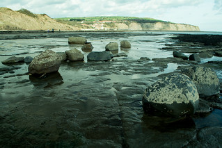
20141231-28_Braunston Marina

Braunston Marina – Narrow Boats


20141231-42_Braunston Marina - Arched Bridge + Winding Gear

Braunston Marina – Winding Gear


20141231-44_Braunston Marina - Narrow Boats

Braunston Marina – Moored Narrow Boats


I was starting to feel a little chill now, so I headed into a shop (maybe a chandlers or similar) and asked if they sold teas or coffee – They didn’t. This was a shame because the boat-café on the canal by the marina entrance was not open today either, so when I had negotiated the slippery icy pathways back to the canal/iron bridge/marina entrance, I just continued on over the arching bridge and then back on the tow path once again, again with the canal on my left.

20141231-47_Braunston - Brick Bridge - Narrow Boat Joey - Grand Union Canal

Joey – Narrow Boat in Braunston

There still weren’t many boats moving around but I was in the right place at the right time as the boat “Joey” came towards me to pass under one of the brick bridges that straddle the canal. To repeat myself from a past blog-post (with no apologies) I like these old brick bridges, they’ve been around for so long they’ve sort of weathered their way into the landscape, taking on a natural patina of lichens and with mosses hanging on in the many hollows and cracks. The surface of the brickwork has certainly seen better times, and there are now some pretty major looking cracks appearing in places, but I like the unkempt look and today the reflections were just stunning in the icy water.

20141231-49_Braunston Marina - Narrow Boats

Braunston Marina – Moored Narrow Boats

20141231-51_Sheep + All Saints' Church - Braunston - Cathedral of the Canals

Sheep – All Saints’ Church – Braunston

I could’ve headed straight under the bridge arch, but there was a way up onto the bridge, where a foot-path crosses the canal here. After just a few yards along the path, it facilitated a view back over the marina. The elevated position gave an opportunity for some interesting pic’s looking back down the marina, using my long lens to try to foreshorten the perspective in an attempt to make the boats look all bunched up, hopefully in an arty kind of way. Rather than move far along the path, I headed back down to the towpath and continued in the same direction as earlier. The tow path separates the canal (on the left) and the marina (on the right), and a little further on is a narrow footbridge that must be negotiated. There is no alternative to be able to carry on, because it passes over another access point from the waterway into the moorings. This foot-bridge is accessed and exited via some rather steep steps; not too much of a problem for walkers, but decidedly awkward for people pushing push chairs and equally if not more awkward for cyclists.

20141231-53_Braunston - Moored Narrow Boat

Narrow Boat – Braunston

This little walk was beginning to take quite a long time, but I suppose it always was going to be that way, with a very slow pace, especially as it was such a stunningly beautiful day and it had been planned out as a photographic walk. I normally describe myself as a walker who takes photo’s, but today I was far more a photographer who was going on a bit of a walk. Anyway, trying to push my writings on a tad, the tow path led on to the bottom lock and its collection of nearby buildings. Along the way I passed 20141231-52_Tree Trunk Detail _ Barkmore moored boats, views across sheep fields to the church, shiny light playing on the ice, interesting textured bark on trees, smoke coming out of boat roofs and hanging about in the cold air, old pump house buildings, another boat-works, and more… All these things were interesting to see and at least worthy of a little note. Also worth noting, is a small shop adjacent to the bottom lock (I’ve bought ice cream here in the past, in warmer times) and I hoped they would sell hot drinks – I was disappointed again, they didn’t! Perhaps on my next frosty walk I’ll remember to make up a flask of hot drink

Although continuing a few hundred yards past the bottom lock, I now consciously chose not to continue up the canal, foregoing the chance of a visit to The Admiral Nelson pub next to another lock and further on the entrance to Braunston Tunnel. This Georgian engineering feat is now well over 200 years old and over a mile long. The tow path ends at the tunnel entrance, which is set into the hillside like a black mouth waiting to swallow up any boat heading eastwards or regurgitate anyone who’d travelled from the Welton end.

20141231-56_Braunston - Bottom Lock - Grand Union Canal

Bottom Lock Reflections

20141231-60_Braunston - Jetty Fields - Seat with a view

Jetty Fields Seating – Braunston

Today I felt I didn’t need to head that far up the canal. Instead I returned to and headed over the brick bridge at the bottom lock, to climb a gently rising track away from the canal side. After a hundred yards or so, upon reaching a minor road (it goes down to The Admiral Nelson pub) I turned left on a footpath and then soon after, right, heading gently up a small public area of grassland (Jetty Fields) with some individual large trees and seating. The tree branches hereabouts took my eye, being old and gnarly and full of nooks and crannies. I liked the contrast of this against the blue winter sky.

20141231-59_Braunston - No smoke without fire

Smoke

I also liked the billowing shapes in a cloud of smoke from a fire created by a couple of workmen (thinning a hedge I think) just down-a-ways towards the canal. A warm outdoors job on a cold frosty morning. A short way up the slope the trees become closer together forming a small coppice where I stopped a while to watch several pairs of blue tits flitting about in the branches above me: a charming sight.

20141231-62_Braunston - Jetty Fields

Jetty Fields Path – Braunston

Continuing on, the path narrows between some properties, to emerge on the principle road through the village (named Welton Road and High Street). The aspect is quite open here with a number of grassy greens and verges with The Wheatsheaf pub directly opposite. I again resisted the temptations within, instead turning left along the road side to pass an eclectic mix of red brick, mellow stone and half-timbered houses/cottages both old and new. I knew there was a small café (Poppies) along the road, but was again disappointed, as it too was shut, so preventing the purchase of a cup of tea or coffee. Almost opposite is a small convenience store (a Londis I think) – again no hot drinks, but it did give the opportunity of picking up a couple of sandwiches and a cold drink.

20141231-66_Braunston - High Street - Cottages and Windmill

Braunston Cottages + Windmill

Soon after I passed by yet another pub (The Old Plough) before reaching the western end of the village, dominated by thee buildings:- The first an old windmill, now a home minus its sails. The second a typically English church with tall spire pointing skywards (or should that be heavenwards). And thirdly, Braunston Manor on the opposite side of the road from the church.

20141231-67_All Saints' Church - Braunston - Cathedral of the Canals

All Saints’ Church – Braunston – Cathedral of the Canals


20141231-70_Graveyard Cross_All Saints' Church - Braunston

All Saints’ Church – Braunston


20141231-71_War Memorial_All Saints' Church - Braunston

War Memorial – All Saints’ Church

I spent a few moments outside the church, often known as The Cathedral of The Canals, and yes you’ve guessed it, taking some more photo’s but with a little more time in contemplation at the war memorial in the corner of the graveyard; perfectly positioned to be seen from all angles in full view as it should be, in memory of our fallen forebears; local heroes of a time rapidly becoming history rather than current affairs.

From the church grounds, I re-joined the main road to pick up a footpath (directly opposite the junction with Church Road), to the side of Braunston Manor, the first or in my case today, the last building in the village. The path drops diagonally half-right to rejoin High Street, just where it meets the A45 main road. I now had a tiny bit more tarmac path to use, alongside the A45, over a canal bridge and then very soon afterwards turned left on a pathway (still quite slippery with frost) dropping down to the tow path.

20141231-73_Twin Arched Bridges - Braunston - Grand Union + Oxford Canal Junction

Twin Arched Bridges – Braunston Canal Junction

The walk was almost over, having now come full circle back to the canal. Once on the tow path I immediately turned left, under the bridge I’d just crossed over and I was now on ground previously walked on earlier in the day, only now the water was on my right. I then re-passed The Boat House pub (on the opposite bank), reached and crossed the double-span iron bridge at the canal Tee-junction and swung right past moored boats again to meet the other utilitarian bridge carrying the A45 over the cut.

20141231-74_Braunston - Oxford Canal - Bridge - Stagecoach Bus

Utilitarian Bridge – A45 over Canal – Braunston

Most of the ice had now melted, leaving only a few places where the canal was still frozen, on the whole it was now mostly free water – I suppose the ducks must have been much happier and far less bemused now. I was still taking photo’s, but not as frequently now and after rising up the side path (just before the bridge) to the A45, the last couple of images taken were back to the church again before arriving back at the lay-by and my little car which had sat patiently in the cold for my return. It was still parked all alone by the road-side, I wonder if it had had any fellow vehicles parked here during the day to keep it company whilst I was away.

Well, that’s about it for this walks diary ….  When I’d made the short drive home, a nice warming cup of coffee was high on the agenda, and I was really ready for it as I sat down in the friendly warmth of my home and family. What a simply super few hours.

I’ve attached (or will be attaching) a selection of photo’s from the day, but there are more to be seen on my flickr account if you want to see just images of Braunston (and nearby) please use this link, or go to my photostream for all photo’s I’ve posted.

I hope you enjoyed my scribblings …. If you’d like to comment on my diary or any of my pic’s please feel welcome. I’d love to hear from you.

T.T.F.N. Gary.

20141231_A Frosty Winter Photo Walk in Braunston (Post1of2)

20141231_A Frosty Winter Photo Walk in Braunston – Post 1of 2

When : 31st December 2014
Who : Just me
Where : Braunston, Northamptonshire, between Rugby and Daventry
Start Point and End Point : Lay-by on the A45 London Road SP533,663
20141231_Another Braunston Winter Canal Side Photographic WalkDistance : Approx 4 miles (6.5 km)
Significant Heights : None to speak of – Very gentle
Maps : 1:25,000 OS Explorer Map No. 222 Rugby & Daventry

Summary : An opportunity for a few hours to take some wintertime photo’s down on the canals in Braunston (Grand Union and Oxford Canals) …. but it’d be a perfectly nice walk to do without a camera, There are a couple of pubs by the canal side and a couple in the village as well if that’s your want from a walk (or crawl).

I’m splitting the walk into two blog-posts just to make the writing (and reading perhaps) a little more manageable. This post is post-1 of 2. (Use this link for post-2).

If you click on a photo’ it should launch on my photostream on Flickr where you’ll find a few more images to those shown here.

It was a very cold and frosty morning, ice on the roads and a typically wintry blue sky with light high clouds and the promise that it was going to stay fine for the day. So, it was an easy decision to spend a few hours out and about on a mini-walk with my camera. The more difficult bit was deciding just where to head off to.

• Did I want to drive ?
• If not, it meant walking on very familiar ground, yes or no ?
• Did I want a pub ?
• What type of scenery did I fancy : Farmland, Woods, Town/village, canals, country parks, or even a city ?

In the end, I decided to drive, chose canals as a good base subject, assuming the waters might be frozen-over in places, the potential for good reflections and maybe some mists swirling around above the water; Once that was decided, that led to the next decision – Where to go ?

• Hillmorton Locks ?
• Newbold-on-Avon (and the long tunnel) ?
• Crick ?
• Cathiron ?
• Braunston ?
• And one or two other places here-abouts ?

Well, in the end, Braunston won despite me having been there many times over the years … Why ? … Because it’s not very far away, has a pretty canal 20141231-22_Braunston Marinajunction, various styles of bridges, a large marina, boat works, historic buildings, several locks, one end of a very long canal tunnel and several pubs. Of course there’s also the village itself, including a long main street with an eclectic mix of buildings, including an old windmill next to a typically English church on a hill. If I needed anything else, another good reason, is that my photography tutor (David Harding / Percival Guildhouse) likes the area, and I thought it’d be interesting to compare our images at some point in the future.

Anyway, I packed up my camera, couple of lens (complete with polarizing filters), grabbed walking boots and headed off, the drive firstly taking me through the famous village of Dunchurch and then on the A45 heading towards Daventry; Braunston village being just off the main road a few miles before the Northamptonshire town.
On the way, not quite a mile past the small village of Willoughby is a reasonably sized lay-by (on the left hand side) just before reaching Braunston – This is immediately before the road passes over the canal and is often used by people parking their cars in a line here, I assume mostly by fishermen; I decided this lay-by would suit my purposes just fine, and actually today it was completely free of other cars.

If this hadn’t been available, there’s road side parking in the village itself (take a sharp left turn just past The Boat House pub/restaurant) or there is a large car-park at The Boat House itself, which I know people use whilst going off for a walk, but I don’t like doing this unless I intend to use the pub as a patron, it just doesn’t seem right otherwise.

20141231-01_All Saints' Church - Braunston - Cathedral of the Canals

All Saints’ Church, Braunston

20141231-02_Braunston - Ridge and Furrow Strip Farming

Ridge and Furrow Strip Farming – Braunston

Enough of the pre-amble, I’ve been rambling on somewhat, so on to my walk itself. After donning my boots, I set off on the rough grassy verge by the side of the road, although you may find this surprising, away from Braunston and the canal. This wasn’t by accident or bad map reading, no, on the drive down the A45, there was a superb view of Braunston’s church spire silhouetted against the pale blue sky and in front, the land was striped with shadows formed by some ancient ridge and furrow field structures. In order to try and capture this image, I had to head back up the road to find a place where I could see over/through the large hedgerow alongside the road. Despite walking several hundred yards and being well over 6-foot tall, I still needed my long zoom to get anything like an acceptable shot.

Turning around through 180-degrees and once back past the car I reached where the road crosses a canal; near here the church was more hidden from view but the ridge and furrow field was far more evident and the views up the canal were very pleasant with a couple of boats moored in the icy waters.
20141231-03_Braunston_Frosted Barn

Frosted Barn – Braunston

20141231-05_Braunston - Moored Narrow Boats Oxford Canal

Moored Narrow Boats, Oxford Canal, Braunston

From here I crossed the main road, to where a path drops down to the tow path, where initially I turned left, under the quite ugly steel and concrete road bridge and continued up the tow path for several hundred yards. I had to adjust my camera settings to suit the different quality of light by the cut, as I was in quite deep shadow now. Anyway after taking a few shots here, I about-turned, walked back under the utilitarian road bridge and continued on the tow path (water on my left/hedgerow on my right).
It had been a very cold night (and it was still a very cold morning), so much so that the canal was completely frozen over, the narrow boats moored along the banks being iced in and the local ducks appearing very bemused. One pair were walking, (well slipping) about in the center of the canal, I suppose looking for some clear water to swim in.

20141231-07_Braunston - Mallard Ducks - Skating on Ice

Bemused Ducks Skating on Ice

20141231-08_Twin Arched Bridges_Braunston_Grand Union+Oxford Canal

Approaching the Twin Ironwork Bridges, Junction of Grand Union and Oxford Canals, Braunston

20141231-10_Braunston - Life Bouy - Seen Better Days

Seen Better Days – Please do not fall in here !!!

A little further on, as the canal takes a sweeping left bend, there are a couple of attractive arched black and white iron-work bridges; the perfect twins forming a double span over a Tee-junction of canals. I could have just crossed straight over the pair, but instead chose to take the right hand canal branch, going under the arch of the first bridge, before heading off in a south westerly direction on the well surfaced tow path. I particularly liked the way the low sun picked up and highlighted attractive patterns in the ice and whilst I was composing a couple of photo’s here, a couple walking over the bridges stopped to pass the time of day with me and then moved off towards where I’d come from a few moments earlier.

20141231-11_Braunston - Look-out cat - Window frame

Look Out Cat, Braunston

After a very short stretch along the towpath, I used a brick built bridge to cross to the other bank and then back (north-eastwards) towards the iron bridges and the canal tee-junction once again, passing a brick-built cottage en-route. An emergency buoyancy aid caught my eye hung on a wall here, but I don’t know how much I’d trust it, as it looked well past its best. A cat was sat in a widow frame here also, obviously enjoying the warmth of indoors watching the world go by, rather than braving the chill outside.

20141231-12_Ice Breaker_Arched Bridge_Braunston_Grand Union+Oxford Canal

Hector – Breaking the Ice – Hard to turn the corner.

As I reached where the canal splits left and right, a strange loud cracking scraping noise suddenly struck up. It was very odd and I just couldn’t place what it could be. It didn’t even seem to be coming from a particular direction, the sound seeming to fill the cold air all around.


20141231-13_Ice Breaker_Arched Bridge_Braunston_Grand Union+Oxford Canal

Hector – Didn’t manage the bend Hit the bank with a glacing bump !

It soon became apparent though, as the couple who’d I spoken with earlier had unmoored their small narrow boat and as they moved off they were breaking the sheet ice on the water’s surface. In fact, as the boat tried to negotiate the bend the ice resisted the crafts desired path forcing it over into the bank with quite a bump.


20141231-14_Ice Breaker_Braunston - Grand Union Canal

Hector – Moving on. Alls well now 🙂

The blow turned the bows as the boat glanced off the bankside and allowed the chap on the teller to move off in the right direction.

I guess his journey to where-ever he was heading wasn’t going to be an easy one, especially when passing other boats on the cut.


20141231-15_Ice Breaker_Arched Bridge_Braunston_Grand Union+Oxford Canal

Ironwork railings – One of the Twin Arched Bridges

I then turned my attention to trying to create some arty shots of the double span of bridges. At the very least, I tried to find some different angles/view points compared to previous visits as I’ve taken pic’s here on numerous occasions in the past. I’m sure they must be one of the most photographed features around Braunston – I defy anyone with a camera to just walk by without taking at least one photo’ despite how many times they may have been here before … These bridges really are very photogenic.

20141231-18_Ice Breaker_Arched Bridge_Braunston_Grand Union+Oxford Canal

Twin Arched Bridges – Very Photogenic. Junction of Grand Union and Oxford Canals


20141231-19_Relections in Ice - Braunston

Icy Reflections

Moving on, I took the tow path away from the bridges (water on my left again). On the opposite bank here is a small area of light industrial units closely followed by The Boat House pub mentioned earlier. The pub is a tad modern and twee to be truly photogenic, but I did like the distorted reflection of a far more pristine looking buoyancy ring in the ice-covered water.

20141231-21_All Saints' Church - Braunston - Cathedral of the Canals

All Saints’ Church – Braunston

Soon after, I passed under the A45 road again as it crosses overhead via another utilitarian and not very attractive modern bridge.

The dominant view here is across the canal to the opposite bank with fields and hedges rising up to the church spire and some impressive looking houses which kind of draw the eye away from the canal and moored boats.

However, I did like the smoke emanating from a few of the boats’ stubby little chimneys, obviously some kind of coal/wood burner inside keeping the residents warm and cosy.


20141231-20_Braunston - Moored Narrow Boats Grand Union Canal

Approaching the old Toll House

The tow path then led me past the old toll house, where the major point of interest soon changes back to the canal on the near bank, as another arching iron bridge is reached, spanning a side-arm of the canal heading into a large marina with a plethora of craft moored in a multitude of lines. As I’ve written before, the craft here always make a very colourful sight, all bar none painted in bright primary colours – Canal folk just don’t seem to do pastels in their boat liveries. As always, I don’t think there was a shabby looking boat in sight!

Normally, I would walk straight on here, over the bridge to continue on the tow path. But, today, I chose to head up into the marina itself to try and gain a different perspective on the area including the boat-works just a short walk along the water’s edge.

I think here would be a good point to switch to the second blog-post as this seems a kind of natural break in the time-line of the day. To continue reading please use this link : GO TO BLOG POST-2 OF 2.

T.T.F.N.
Gary

20140309_A Short Springtime Warwickshire Walk Cawston to Dunchurch

20140309_A Short Springtime Warwickshire Walk Cawston to Dunchurch

When : 9th March 2014
Who : Me and Craig
Where : Cawston and Dunchurch (near Rugby), Warwickshire
Map : 1:25,000 OS Explorer Map No. 222, Rugby & Daventry
20140309_A short Springtime Walk Cawston to Dunchurch (Nr Rugby)Start Point : SP 470,737
End Point : SP 485,713
Distance : Approx. 2.5 miles (4 km)
Significant Heights: None to speak of

Summary : A short spring time walk in Warwickshire – Just because we could, and because the weather had improved enough to think we might enjoy no rain and maybe not much mud underfoot – Both a rarity in the winter of 2013/2014 as we’d had excessive amounts of rain and therefore lots of mud to go with it. After over six years of writing about my walks, this is my first ever sponsored blog post.

If you click on a pic’ hopefully it should launch as a larger image on my flickr photostream.

I’m currently sat at home during the Christmas Holidays (2014 if you happen to be reading this in some future year). It is very cold and frosty with temperatures barely reaching above freezing during the day. It feels as if winter is just really taking hold and that spring is some way away. 20140309-20_Dunchurch Roofs + St Peter's Church TowerWell, spring IS just around the corner, and I thought that this short walk I did last March would be good reminder that pussy willow, daffodils, spring crops and the like are maybe just eight weeks or so away.

We’d planned a family lunch time meal at The Dun Cow Inn in Dunchurch, so, just because I could, I decided that a quick walk there would be a pleasant thing to do. I would then meet my family who would have driven the short distance up Cawston Lane. It then transpired that my 12 y.o. son wanted to come with me, so we sorted out our walking boots and set off with just ourselves, my ancient old Karrimor Hot Ice ruck sack (more of that later) and my camera for the short walk after throwing a change of shoes into the boot of the car for when we got to the pub/restaurant. We guesstimated it would take about 40-45 minutes if we put our best foot forward.

20140309-01_Cawston Grange Perimeter Path

Cawston Grange perimeter path. (looking back towards Trussell Way)

Now, we live on the new Cawston Grange Estate to the South West of Rugby, but you don’t really want to hear of the route taken through the estate, so, just for the purposes of this blog post, I’ll start on Trussell Way just past Cave Close and Durrell Drive on the edge of the estate. If you fancy doing this walk in some form or another, it’s a good parking spot at the moment as Trussell Way is currently a dead end and with no house drives or side roads/traffic to contend with. However, I’m pretty sure Trussell Way will be extended into what is currently local farmland when (that’s WHEN, not IF) the housing estate is enlarged right down to the old railway bridge near Potford’s Dam/the A4071 Western Bypass island.

20140309-02_Cawston Grange Perimeter Path

Cawston Grange perimeter path, heading towards B4642.

Anyway, that’s by-the-by for now, we made our way to the nearby path that runs around the estate, turned left and walked up to meet the B4642 Coventry Road, (which used to be called the A4071 before the Rugby Western Relief Road was built). From here we turned right to follow the road on a tarmac path. We are right on the edge of Rugby here, with a view over farmland on the other side of the main road bounded by an attractively ramshackle old wooden picket fence. I’m trying to make the most of this view every time I pass by, because this field too is earmarked for a housing development which I understand could be started imminently. As we walked, it was a joy to see the spring flowers in the soft sunshine, I especially like the newly budding pussy-willow and large clumps of happy smiley daff’s growing around the base of the trees lining the roadside.

20140309-03_Cawston Grange Pussy Willow

Springtime pussy willow

20140309-04_Cawston Grange Path near B4642 Coventry Road (old A4071)

Daff’s near B4642 – Coventry Road – Cawston

20140309-05_Road-side trees + Fence_Cawston B4642 Coventry Road (old A4071)

This view soon to be obliterated when the field becomes a new housing development.

20140309-08_Road-side Daffs + Hedge_Cawston B4642 Coventry Road (old A4071)

Roadside daff’s – A happy sight.

20140309-06_Cawston Rugby - Renatus

Renatus – Cawston

Anyway, we stayed on our side of the road, on the tarmac path, passing the older part of Cawston with some rather grand looking houses, the first of which is now a much extended, rebuilt and re-invented building which is some-sort of cosmetic procedure clinic nowadays (Renatus I think it’s called).

20140309-07_Cawston Rugby_B4642 Coventry Road (old A4071)

B4642 Coventry Road (Junction with Cawston Lane)

20140309-09_Cawston Farm + Public Footpath

Cawston Farm

We soon reached the point where we needed to cross the road (opposite the Nature Trails Nursery) to pick up a farm track heading down the side of brick built farm buildings and the nursery school building. The farm by the way is, unimaginatively (but perfectly descriptively) called Cawston Farm.

20140309-10_Cawston Farm + Public Footpath

Farm Track – Heading towards Cawston Woods

Continuing on, the track heads gently downhill (very easy walking) past a series of low wooden sheds. I’ve often wondered what these sheds are for :-

• They seem far too low for sheep or cow barns.
• Maybe pigs ? (but there’s never been much smell as we pass by).
• So chickens would be my next guess ? (always far too quiet for that).
• It’d remained a mystery for the 12+ years we’ve lived near-by.
• Well today, for the first time amongst all the times I’ve passed by, all the shed doors were wide open and the mystery was solved :-

20140309-11_Cawston Farm + Chitting potatoes

Chitting potatoes

In each shed there were thousands of boxes-cum-trays stacked one on top the other in long rows. Between the rows were a series of vertically hanging fluorescent strip lights – Very odd! …. It just HAD to be investigated closer – and then it all made sense, the trays-cum-boxes were filled with POTATOES! being “chitted” ready for the forthcoming planting season. Chitting is the term given to where little shoots are encouraged to grow from the “eyes” or dimples on the potatoes, and this gives the plants a head-start when they do eventually get planted. My dad used to do this when I was a lad when he kept an allotment. The only difference here was the industrial scale.

20140309-12_Approaching Cawston Woods_Public Footpath on farm track

Gentle descent towards Cawston Woods

Moving on, the track heads into an area of woodland, known locally as Cawston woods, but more accurately these are Cawston Spinney on one side (no entry-nature reserve these days) and Fox Covert (access allowed at owners discretion, but in practice just open to the public). I think the woods are owned by Mitchell’s Potatoes, which would link nicely with the sheds’ usage just passed by). Today’s walk took us straight through the wooded area, now rising gently but staying on the track, to emerge into farmland of both ploughed fields and pastureland bounded by mature hedges. There’s nothing overly exciting here just typical pleasant mixed Warwickshire farmland. Livestock kept hereabouts are sheep and cattle and one or two fields have horses and crops grown are of course the spuds as well as wheat, oil seed rape, maize and beets.

20140309-13_Stile _ Farmland near Cawston Woods

Looking back toward Cawston Woods (from the path joggle)

At the end of the first field, the farm track makes a 90-degree bend to the right and heads off into the distance, but, the right of way, now a path, goes straight on, with a hedge on the left and a ploughed field on the right, to reach a stile in the field’s far left hand corner. Once over the stile, the route here joggles left and then right ignoring the path off to the left heading towards a different part of the woods. The path then follows another hedge (still on our left) to reach Windmill Farm. The route here carries straight on through part of the farm yard via a couple of stiles. Please be warned it can be rather muddy underfoot here, but you’ll soon emerge out onto another wide farmtrack/drive, which is Northampton Lane.

20140309-14_A little bit of mud (bypassable today) at Windmill Farm - Dunchurch

It is often muddy through Windmill Farm and on Northampton Lane

Navigation and gradient (or lack of) is easy here, as it’s a simple turn to the left along Northampton Lane to just follow the wide track for quite some distance (we passed a group of farm implements including a muck-spreader en-route). These bits of equipment always seem to be here and somehow have a timelessness about them, they’re still of a scale to suit smaller fields rather the larger “prairie” fields that seem to be so prevalent in many places these days. Still, such is modern farming practices I suppose. Happily the farm fields around Dunchurch still appear on the whole to be on the smaller scale.

20140309-17_Northampton Lane - escaped chicken (Red Hen) Dunchurch

Braving the traffic ? – A game of chicken I suppose

Northampton Lane is quite long and straight, disappearing into the distance but is easy going (especially today, as it wasn’t at-all muddy, which it can be) to reach Cawston Lane (where there was a little mud to negotiate). Directly opposite, Northampton Lane continues, but now as a proper tarmac’d road, with houses along one side. However, the only “traffic” today was a lone red hen looking for food on the path and road. I was going to call the bird a chicken, but I understand chicken is a term reserved for when a hen is dead and about to become food!

20140309-16_Spring Crocuses_Dunchurch

Cheery spring crocuses

The continuation of Northampton Lane was not our route now though, although road walking was indeed required to our final destination …. We turned right into and along Cawston Lane, the path after crossing to the opposite side, becoming more built up with houses along the way, passing Addison Road and a Methodist Church en-route, and including passing a patch of cheerful crocuses on a patch of green. After re-crossing Cawston Lane we soon reached a Tee-junction with a main road (A426, Rugby Road) where we turned right heading towards Dunchurch Village Centre with an attractive mix of cottages, some thatched, but all slightly dominated by the tower of St. Peter’s Church.

20140309-18_Dunchurch Cottages + Church Tower

Dunchurch cottages & St. Peter’s Church tower.

20140309-19_Dunchurch Thatched Roof + Bird Sculpture

Ornamented thatch + peacock sculpture.

We arrived at The Dun Cow just before 1pm almost exactly 45 minutes 20140309-21_Dunchurch Cottages + Dun Cow Inn - Signageafter we’d set off, changed foot-ware and threw rucksack and boots into the boot of the car, which we found quite easily in the pub’s car park and went in to find my lovely wife and daughter, enjoyed a good dinner and a well-earned pint (or three) for me.

Just to finish, a little about my favourite ever ruck sack – I bought this way back in the mists of time and at some point I modified the waist strap by stitching on a wider padded version for a more comfortable carry. It has served me tremendously well for many years now, but is n20140309-23_Hot Ice 30 - Karrimorow finally showing its age (a bit like my knees), the bright red when new is now a dusky pinky colour and the stitching in places is finally giving way. I’ve been looking for a new day-sack for some time now, but nothing has quite fitted my criteria as I’m 6-foot 4-inches tall and I’ve not found a 30/35 litre capacity sack long enough to suit my back length. It seems most sacks have gone kind of short and bulbous, meaning I have to go to a small back-pack sized sack. I have a decent Berghaus Verden 45+8 litre sack with an adjustable Biofit back, but it’s really just a bit large and heavy for a day walk and now 20140309-22_Clean Boots - Salomonmy son is walking with me more often, he tends to carry the Hot Ice leaving me with the big bag.

Now, there are very few outlets in Rugby, meaning I have to travel to try on kit. Normally, I go to the far side of Coventry or down to Leamington Spa where there are a couple of decent sized shops but I’ve just learnt that Cotswold Outdoors have recently opened a store just off the M6 in Coventry (in the Leekes shop) which will be easy to get to. So, now that Christmas is over, I think a visit will be in order, especially as I’ve read on-line that they do a ruck-sack fitting service. Perhaps it’ll kick start my 2015 walking.

I hope you enjoyed my scribblings …. If you’d like to comment on my diary or any of my pic’s please feel welcome. I’d love to hear from you.

T.T.F.N. Gary.

April 2014 = Excited

I am excited !

Why ?

Coz I’ve just booked a 3-day / 2-night break in The Peak Distict.

Who’s going ?

Just me and my 12-y.o son.

What’s the plan ?

Day-1 …. Drive up into The Peak District …. Do a bit of a walk – Maybe around the Dove Dale area …. Drive to Ravenstor Youth Hostel to Over-night.

Day-2 …. Leave car at the hostel and walk to Youlgreave Youth Hostel, carrying all our over-night gear – So I guess you could call it sort of back-packing. Anticipate going through places like Water-Cum-Jolly Dale, Monsal Head and Lathkill Dale?

Dat-3 …. Walk back to Ravenstor YH, via a different route, perhaps taking in Over Haddon, Magpie Mine and Sheldon ? drive home to exchange stories with the girls – Anticipate them having days out in Birmingham etc.

Now, all we need is firstly the weather to be dry and then hopefully warm [but not too warm] and most preferably sunny …. What’s the chances of 3-days like that in England.

and at some point I’m sure I’ll post up some write ups at some point.


TTFN.

Gary

20140222_Staverton (Northamptonshire) – Flecknoe (Warwickshire) Circular Walk

20140222_Staverton – Flecknoe Circular Walk

20140222-30a_Horse (Near Flecknoe)When : 22nd February 2014

Who : Me and Craig

Where : Staverton and Flecknoe, Northamptonshire and Warwickshire.

Start and End Point : SP 539,612

Distance : Approx 6.1 miles (9.7 km)

Heights : 3 separate rises, although nothing significant. See end of post for details.

Map : 1:25,000 Ordnance Survey Explorer Map No.222, Rugby & Daventry

Summary : A pleasant countryside walk over rolling Midlands farmland.

If you click on a pic’  it should launch as a larger image on my flickr photostream.

This walk was unusual, but only in that it was on a Saturday (Sunday walks being much, much more common), daughter had been dropped off at her job and my lovely wife was unfortunately suffering with flu, not just a heavy cold as many people call flu, but full 20140222-01_Staverton Village Green + Cottagesblown diagnosed by a doctor type of flu and as such I felt it best to leave her to rest and take my 12 year old son out for a walk. Apart from leaving the house quiet for my wife, it would also serve two other purposes : I’d been feeling quite over-loaded at work and I’d been doing a fair few extra hours and I really needed some exercise and fresh air to recharge my internal batteries. Craig on the other hand had been ensconced indoors for the best part of a week during the first half-term of 2014 and I felt some good old-fashioned “get-out-and-about” would do him a world of good too, to burn off some of that energy that all young men have an excess of.

I’d left out my fave’ three books of local walks for Craig to look through and so pick out a walk or two, whilst I was taking my daughter to work; he chose a 5.25 miler straddling the border between Warwickshire and Northamptonshire and taking in two villages : Staverton and Flecknoe, neither of which I could remember having ever visited in the 20140222-50_Cottages + Village Green Stavertonpast. Why get Craig to pick a walk ? … well, I figured if he’d picked the walk, he’d potentially be much more engaged in the day. I reckon it was nearer 6-miles long in the end.

A little note about the title – Maybe a little more descriptive would have been Staverton – Flecknoe A Triangular walk rather than Circular; the route basically being north, then west and finally south-east making a right angled triangle, with the last and slightly longest leg being the triangles hypotenuse. It’s also probably worth mentioning the three books I often dip into for local walks, either to follow exactly the walks described within them, or, just as an idea to adapt using my map(s) to suit my needs on the day.

20140222_Staverton - Flecknoe Circular Walk

Map plotted on WalkJogRun – will launch bigger if you click on it

• Evening Telegraph Country Walks, Brian Keates [Coventry Newspapers Ltd.]
• Country Walks in the Rugby Area, Jim Watson [This Way Books]
• More Country Walks in the Rugby Area, Jim Watson [This Way Books]

This walk was lifted straight out of the last one of these books, perhaps it’s a tad lazy, but hey why not every now and again? So off we set, with me getting Craig to follow the drive to the start on the map, through Dunchurch, Willoughby, Braunston and on to Daventry 20140222-07_Staverton Village Cottageson the A45 and then the A425 for the last mile and a bit to Staverton; entering the village via a side road and then following my nose to reach the village green where I parked up as neatly and as considerately as possible. We booted up, I found my bearings, and we set off with light hearts and a spring in our steps.

Staverton village is charming, an eclectic mix of old and new; many of the cottages are very attractive indeed. In fact the village as a whole is attractive with warm Cotswoldy stone side by side with red brick, detached and terraced properties, different roof levels, buttressed walls, some cottages around the green even had corrugated rusting metal roofs. These in themselves weren’t unattractive but had obviously seen better days; I wouldn’t mind betting they let water in, especially around the chimney stacks. …. all in all Staverton is a very pleasant place to walk through, which 20140222-08_Heading North out of Staverton on Jurassic Waywe obviously had to do, firstly picking up Oakham Lane, walking away from the green and then joining Braunston Lane heading north away from the village.

After not very far, Braunston Lane becomes a dead end for traffic, leaving the village behind, but continues on as tarmac, reducing in width beyond a pair of metal gates serving no other purpose than preventing vehicular traffic. The way ahead is on The Jurassic Way and is bounded by grassy verges, ditches and large hedges interspersed with mature trees. It 20140222-12_Across the Fields to Flecknoe (from Staverton)looks for all the world that this may indeed have once been a “proper” road between Staverton and Braunston just like its name implies.

The views from the track are super, with a wide vista over both Northamptonshire and Warwickshire farmland. Off to the left across a shallow valley the fields rise to the village of Flecknoe near the top of its own hill. A dominant feature much further in the distance, protruding 20140222-09_Rugby Cement from Staverton (approx 9-10 miles)well above the horizon, is the Rugby Cement works (currently called Cemex) which is some 9-10 miles away as-the-crow-flies. Continuing pretty much due north (give or take a bend or two) the tarmac’d surface gives way to a wide farm track, quite rutted and muddy in places, reasonably firm and dry in others, dropping down off the hill that Staverton sits upon. Craig was quite happy with the change in surface, as he didn’t really want to be on the hard man-made stuff, preferring the natural ground underfoot.

 20140222-10_Jurassic Way Track North of Staverton (Nikon)     20140222-13_Jurassic Way_Track north of Staverton

20140222-15_Manure Heap + Slurry Mud

20140222-16_Lots of Mud + PuddlesThis was to change though, as the track levels out, crossing over a couple of small streams and being at the bottom of the surrounding hills (on three sides) the track had become very churned up, muddy and slurry-like. In fact some of it was real slurry, as there was a large pile of farmyard manure in a field on our left and it was seeping smelly yukky liquid into the tractor ruts along our route. Although the ugghy stuff didn’t stretch a long distance, it still necessitated some careful negotiating before the track started to rise again and in the process return to much dryer, easier and more pleasant walking.

20140222-18_Braunston Church Spire from Jurassic Way (Nr Berry Fields)Our route was to turn left (westwards) at a “cross-road” of bridle-paths, but rather than do that straight away, we decided to carry on up to the top of the rise to regain the views lost whilst we were in the dip, although I wasn’t sure quite what could be seen from here, I was hoping for a decent view to Braunston Village. I wasn’t disappointed, as the sun had picked out the church spire and the old windmill at the western end of Braunston village well over a mile away, and it gave the opportunity for me to try out my new 300mm lens on my camera. I was quite happy with the results. Once pic’s were taken, we turned around, 20140222-19_Wet Soggy Farmland_Just off the Jurassic Waydropped back to the afore-mentioned cross-road of paths, turned right and followed a farm track with a hedge on our right and an open unbounded field on our left (looking south into the sun). As a recurring theme over the winter of 2013-2014, the field was sodden with water and the infant crop looked far from healthy. I wonder how many 20140222-21_Tractor Tracks + Rutscrops will have failed and just got ploughed back into the ground so becoming the latest victims of the wettest winter since official UK records began over a hundred years ago.


Anyway that’s by-the-by really, we now had to follow the hedge on our right, dropping down a slope (with more deep tractor ruts), to reach the bottom where it again became a little soggy underfoot, but we picked our way through to a sturdy, utilitarian wooden bridge across a small river. This is the infant river Leam, which forms the border between Northamptonshire and Warwickshire here.

20140222-22_Miry Bridge over infant River Leam

20140222-23_Infant River Leam at Miry BridgeNow, despite its spelling, this isn’t pronounced “Leem” as might be thought, but “Lem”. However you might pronounce its name, the river isn’t very big at this stage of its life. Its future path is north almost to Braunston, bisecting the now disappeared medieval villages of Braunstonbury and Wolhampcote before swinging west past Draycote Water (it is used to top up the reservoir at times) and then on, eventually to Royal Leamington Spa to join The River Avon (The Warwickshire Avon or Shakespeare’s Avon) at Warwick.

All that is superfluous really, as we crossed straight over – No we didn’t ! I’ve lied to you : We first stopped for a rest and to take on board some refreshment, a drink of water and some nibbles – and only then did we cross straight over via the wooden bridge, called Miry Bridge on my map, heading away uphill (not steep) across a field in a westerly direction. 20140222-26_How Deep (Flooded ridge and furrows near Flecknoe)As it levels out, one of the fields has the rolling remains of ancient ridge and furrow farming methods. Each of the furrows were rather waterlogged to start with, and as we progress across the field these became areas of standing water, too deep for my walking boots, so necessitating a series of zig-zags along the top of the ridges to avoid the fingers of mini-lakes. Craig in wellies however had no problems wading straight through, in a much more direct line to reach a bridge over an old disused railway.

There are so many of these old railway routes criss-crossing our countryside; it’s hard to imagine the steam traffic that must have serviced all the villages and towns along their routes. This particular one heads north into Rugby which was once a major rail interchange, but now less so. Just to one side of the bridge, the railway has been deliberately flooded making a small fishing pond, although I think probably not used much looking at the state of the small landing stages. A little further on the fields on our right became horse paddocks – One horse in particular was a right poser in front of the camera!

20140222-27_Fish Pond + Dilapidated Landing Stages          20140222-30a_Horse (Near Flecknoe)

 20140222-32_Short signpost FlecknoeFrom here we picked up a farm track, which soon led us into the village of Flecknoe. The first thing of note is a traffic sign-post. Nothing particularly unusual in a road having a sign post you might think; except in this case its height above the ground. There can’t be many signposts much shorter than this one, even the surrounding snowdrops almost reached the bottom edge … in text speak – LOL.

From here we walked up the road passing the rather imposing Manor House. There were a couple of happy smiley daffs in the verge here in full flower – The 20140222-36_Old Olive Bush Pub - Flecknoefirst of the year. Moving on up the road, brought us into the village proper; the road bending one way and then the other, passing attractive cottages on the way, soon bringing us to the pub – The Old Olive Bush.

The hostelry looked very inviting in a homely understated sort of way and it would have been rude not to partake of a drink (I’d planned to stop anyway).

Rather than drink inside though we sat at a small table just outside the front door in the sunshine; me with an excellent pint of Doombar ale plus a bag of cheese & onion crisps, Craig with a J20 and his fave pub nibbles, salted peanuts. Without fail, every local who either came in or out of the pub passed the time of day with us – Friendly people!, Friendly Pub!.

 20140222-37_Full Pint of Beer - Doombar Ale          20140222-39_Emptied Pint of Beer - Doombar Ale

As much as a second pint would have gone down a treat, we really needed to move on, so, ignoring the path almost directly opposite (more of that in a mo’) we headed off down the road in the same direction as before (roughly westerly). At the next road junction we turned left (away from Nerthercote), and then, around left again still on the road. Now, the guide book suggests carrying on up the road to then take the next left on another minor road. However at a small chapel there is a passageway (marked as a public footpath on my map), so we decided to leave the road-walking and head off eastwards looking out for the 2nd footpath on the right for our route away from the village.

20140222-40_Pink Washed Cottages - FlecknoeNow you may have worked out that after this many left turns, we were now heading more or less back towards the pub, and yes indeed we were, the passageway track/path crossing the top of the little footpath directly opposite the pub mentioned earlier; so we could have cut out the walk around the village. Anyway, we found the path we wanted, crossing a grassy field towards a group of buildings. Where upon we had to enter the back garden of one of the houses and then head down the side of the house (on its left) to then pass through the front garden. It does feel strange doing this, and Craig actually said he didn’t like it as we passed through the nicely kept gardens. But it’s a right of way, so no problem is what I told him.

We had to then cross a minor road to pick up a path heading through the middle of a sizeable field, although it was worth the turn around to view the pink washed dwellings we’d just come past. We were also now back “on-route” per the guide book directions. Dropping across the field it would have been easy to assume it heads straight to the bottom, but no, about half way down the route takes a slight bend to the left, passes through a line of a hedge and then continues in more or less the same direction (SE) to rise up the bank of a disused railway (the same one as crossed earlier by the fish pond). After a little joggle to the right along the old track bed the path drops down the far bank, through a stand of trees and then following a sign post across the corner of a field to reach a small footbridge over a ditch/brook. The path then carries on in the same direction across a few fields to reach and the cross the River Leam again and in doing so cross back in Northamptonshire leaving our home county of Warwickshire behind.

Our walk was now nearing its final section, with about five fields to negotiate before arrival back at Staverton. 20140222-44_Dwarfed by the reedsThe crop in the first couple of these fields was one I’d never come across before. Not your normal, beets, wheat, maize, potatoes, etc., that are often encountered but reeds. Tall, dry, blown about in the wind type reeds, or maybe it was bamboo.

What-ever the actual stuff was, Craig wanted to walk straight through, I didn’t!!! So he disappeared (almost literally) into the margins, the height of the crop dwarfing him, but I soon called him back out to join me 20140222-45_Silver Birchin the walk around the left hand side of the crop, following alongside a small stream. A wide margin had been left uncultivated and apart from some surface slipperiness the going was quite easy, just rising gently as we went (Craig heading off into the reed crop margins every now and again enjoying the adventure. After a while of steady uphill we crossed over the stream/ditch and through the hedge line via a small bridge and then immediately turned right to continue upwards (with the hedge on our right), just a few yards further on we reached what looked like a point-to-point horse jumping rail and fence marking the start of a wood. Continuing on between the wood and the hedge, we reached another fence/jump, entered the next field leaving the trees behind and promptly passed by a couple more jumps. How having a cross country horse jumping route following the line of a public footpath works I don’t know, but that’s exactly how it is on the ground. However, we soon had to cross a fence (near a 20140222-48_Cottages + Village Green Stavertonsmall animal house) and the path steepened as it made its way up the middle of a small valley, eventually picking up a drive way (Well Lane Track) as the path passed a large house and then up into the village of Staverton reaching Manor Road.


20140222-54_Cottages StavertonTurning right along the road, passing attractive cottages as we went, brought us back to our car, parked by the side of the village green. The next few minutes were spent removing boots (Craig sat in the car boot to do this) and I wandered around the green taking a last few photo’s and then in the car for the drive home. But first I drove around to join the A425 Daventry Road, just to see what the pub looked like and find out its name – Purely to add it at the end of this diary, and so give you the final bit of info’ that you might find useful …. We didn’t go in, so I can’t comment on what it’s actually like, I’ll leave you to discover that yourself if you want to. Oh and it’s name? : “The Countryman”.

20140222-55_The Countryman Pub _ Staverton

Approx’ Heights “climbed” during the walk.
• Muddy valley bottom north of Staverton to Berry Fields = 25m (82 ft)
• River Leam at Miry Bridge to Flecknoe Village = 35m (115 ft)
• River Leam to Staverton Village = 70m (230 ft)
The last 30-35m in height being the steepest part of the walk, but not by any means a problem.
• Total = 130m (427 ft)
• None of the downhill sections were difficult enough to warrant a separate mention.

So, that’s it …. I hope you enjoyed my scribblings …. If you’d like to comment on my diary or any of my pic’s please feel welcome. I’d love to hear from you.

T.T.F.N. Gary.