20090831_A very short walk on Jugger Howe Moor (near Fylingdales Moor)

20090831_A very short walk on Jugger Howe Moor (near Fylingdales Moor)

When : 31st August 2009

Who : Me and my family

Where : North York Moors a couple of miles or so inland from Ravenscar (as the crow flies).

Map : OS 1:25000 Outdoor Leisure Map 27 – North York Moors Eastern Area.

Start + End Point : 944,002 (car-park / lay-by track off the A171 main road)

Farthest Point reached : approx 933,995

Distance : Approx 2 miles (3.2 km)

Heights : Approx 190 feet (but all quite gentle really)

Summary : An amble along a track heading into the heather clad Yorkshire Moors followed by a visit to The Staintondale Shire Horse Farm just to the north of Scarborough.

Well the long week-end was coming to an end, and I’d got plenty of walking in and also a trip down memory lane to see the Naval Warfare in Scarborough’s Peasholm Park. Now it was time for something pretty much for the kids, especially daughter, so we said we’d head off to Staintondale Shire Horse Farm between Ravenscar and Scarborough. My lovely wife had suggested maybe I could take myself off and walk to the farm whilst she took the kids there by road …. which sounded great until I started to seriously look at possible routes and distances especially as we also had a longish drive home ahead of us during the afternoon. I decided a biggish walk wasn’t really on the cards and maybe it wouldn’t be fair on the rest of the family either …. I wasn’t too disappointed then to say I’d drop the idea.

However, Justine did say she’d like to do a bit of a walk on the moors, especially as we’d pretty much stayed by the coast for most of our time at Boggle Hole.  So a quick look on the map showed a car-park just off the A171 between Stony Marl and Jugger Howe Moors. The map showed a number of tracks and paths that might be suitable for a little wander. So once loaded up for the journey home, we set off saying our farewells to Boggle Hole. We were soon pulling in to the almost deserted car-park and we donned boots for our wander out onto the moor (although it turned out trainers would have sufficed for what we did) . We soon noticed by a sign welcoming us to Fylingdales Moor, of which Jugger Howe Moor is a small part.

The open access info’ was most welcome as it allowed permission to use the large track heading away (in a generally south westerly direction) even though it’s not marked as a right of way on the map. The track started off more like a proper road (made of large concrete slabs) that looked pretty well maintained, first climbing away from the car park to pass over a rise in the moor and then dropping gently away from the small hill surrounded by flowering heather. The track was basically running parallel to a shallow valley (Burn Howe Dale) which more or less marked the boundary between the rough purple clad moor and slightly lower green farmland with a patchwork of fields bounded by walls, hedges and pockets of woodland; a lovely pretty contrast to the wilder terrain where we were walking.


The UK really is a country with a lovely varied countryside; with mountains, lowlands, pretty rivers; rugged moors, gentle farmland and a fantastic coastline amongst all its other attractions. In contrast to the rest of the world, the UK maybe hasn’t got the biggest/best/most spectacular or most awe-inspiring of anything; but I love it in all it’s different guises.

The track gave way to be less made up, but still very easy to walk on, dropping towards the deeper valley of Jugger Howe Beck. Beyond was the much wilder looking expanse of Fylingdales Moor itself. It would have been sooooo easy to just keep going, the continuing track ahead very, very, inviting – But NO! – that wasn’t the plan; so my head persuaded my feet and legs to turn around and we re-traced our steps along the track back through the heather to reach the car. You’d hardly know there was a main road just yards away, apart from the glimpse of the occasional vehicle zooming past through a gap in the moorland terrain.

Pulling away, we rejoined the road (heading towards Scarborough) with me making a mental “note to self” that this could be a good starting point for a full size walk at some time in the future should we ever return this way! After only a couple of miles we turned off left into minor roads, eventually finding our way down a drive way to find Staintondale Shire Horse Farm. This is a very small-scale attraction run by the slightly larger than life character of Tony Jenkins. Well they have a few shire horses, some small Shetland ponies and a palomino horse.

The farm spreads out over a number of fields with a route (which we walked) around the meadows giving some super views out over the coastline to the North Sea.


A good proportion of the time was taken up with a demonstration show, where a couple of the shire horses were “dressed-up” with their tack and brasses as if they were about to be hitched up to a wagon or carriage of some sort. I was surprised by the number of people who’d made the trip here …. Turns out the BBC programme “Country File” had featured the attraction giving the farm a new lease of life after the owner had almost shut it down due I think to dwindling visitor numbers. After the show, the children (and a few adults for that matter) in the audience were allowed to stand between the horses for photographs. The two horses must have been very used to this, as they stood patiently for quite some time as the pic’s were taken one by one.

Given the small size of the place we spent quite some time here and we had to pull ourselves away for the journey home … I think the sun shining on us again was so nice we really didn’t want the week-end to end! …. but all good things come to an end eventually (even on my birthday!) and school, work and university studies needed to be brought back into focus again, so off to home we set – week-end finished – but with some really good memories to take us into the autumn and winter seasons. I always think of my Birthday as the last full day of summer; the next day (1st September) being the 1st day of autumn in my mind.

Anyway that’s about it for this diary entry, and the last of the Boggle Hole Holiday entries as well. I hope you enjoyed my scribblings and pic’s.

Next walks diary = 20090906_A Coventry Way – Ryton to Kenilworth Walk

20090831_A 3rd Dawn Explore on Boggle Hole Beach

20090831_A 3rd Dawn Explore on Boggle Hole Beach

When : 31st August 2009

Who : Just Me

Where : Boggle Hole Youth Hostel, Robin Hoods Bay, Between Scarborough and Whitby on the North Yorkshire / North Sea Coast.

Map : OS Outdoor Leisure Map no.27 North York Moors Eastern Area.

Grid Ref : 955,041

Summary : A final wander down to the sea edge with my camera as it was yet another superb morning to wake up to. A super start to a birthday!

If you’ve already read my other two diaries about my wanders on the Beach at dawn then this might seem just a tad repetitive, but I’m definitely not sorry ‘cause the early mornings just before and after sunrise were just soooo magical. I don’t normally wake up before 5am but it was a pleasure to do so on this long weekend and I thoroughly enjoyed having an hour or so to myself, to have a “play” with my camera …. Even if it meant having to dress VERY quietly in the youth hostel dorm’, and tip-toe past all the other dorm’s in the annexe.

Each morning was subtly different from the previous one, slightly differing cloud cover and intensity of colours, but the common factor was the peacefulness and beauty of the sun rising over the North Sea horizon. Another difference today, was a lone figure of a fisherman casting his line out into the sea from one of the long, low and very flat wave cut rock platforms that protrude out into the sea, remnants of the base of the cliffs still being eroded here. His dog sat patiently, or wandered back and forth nearby, seemingly quite happy to be there with his master. Their silhouettes against the sparkling waters and sky enhancing the scene rather than detracting from it … They kind of put a human scale to the views across the bay.

This final day of our short break also happily coincided with it being my birthday and what a way to celebrate with a paddle in the sea. The chilly waters almost hurt at first until my feet and toes got used to it (or numbed to the point of being anaesthetised to the cold). It was also another chance to try and capture some half-decent images with the beach almost completely to myself. I tried to spend some time composing my pic’s as well as possible, looking for different angles and patterns in the sand and rocks, reflections in the rock pools, light dancing on the waters or on the seaweed, etc. So, once again, the rest of this diary is really to “show off” some of my (very amateurish) pic’s and say that all the photographic books that talk about “The Golden Hour” really are right, the light was just wonderful, whether you’d want to take photo’s or just stand and stare at the scene … and I did both!

I wandered just a little further this time, maybe ½ mile down the coast to Stoupe Beck Sands and back again, taking care not to get too close to the cliffs as lumps have a habit of falling off …. in fact I could hear little groans and cracks as the sun warmed the sheer slopes and occasionally the sound of little bits of earth and stones rolling and clattering down to the singles below. If you visit, don’t sit with a picnic directly at the base of the cliffs – You have been warned !!! – And definitely do not try to climb on them!!!


Once back in the hostel dorm’ I rejoined my family who were beginning to rise, and it wasn’t long before they’d handed me a birthday card and a few presents … Several pairs of new walking socks (thin and thick) which are always very welcome and a Coventry City FC T-shirt …. Dark blue rather than the sky blue you might have expected, with one of the best crests in the country embroidered on the front, perfect for any forthcoming trips up to the Ricoh for the season just started … Come on you sky Blues!

Then it was a nice cup of tea, breakfast, and another nice cup of tea and the not so nice packing of bags to go home. This was aided by the kids heading down to the common room to watch kids-TV. Then it was the hassle of loading the car up for the journey home …. On the way, as the weather was just too nice to waste, we stopped off for a very short wander up on the moors in the heather and a visit to Staintondale Shire Horse Farm [especially for our daughter who just loves horses] which is positioned just north of Scarborough.

I hope you enjoyed my scribblings and pic’s ….

Next walk ….. 20090831_Very short walk on Jugger Howe Moor (near Fylingdales Moor)

20090830_Boggle Hole-Robin Hoods Bay-Whitby Walk

20090830_Boggle Hole-Robin Hoods Bay-Whitby Walk

When : 30th August 2009

Who : Just Me

Where : Boggle Hole Youth Hostel, Robin Hoods Bay and Whitby on the North Yorkshire / North Sea Coast.

Map : 1:25,000 OS Outdoor Leisure map North York Moors NE sheet

Start Point : 955,040 (Boggle Hole Youth Hostel).

Finish Point : 905,110 (ish) Car Park near Whitby Abbey.

Approx Distance : 9.75 miles (15.6 km)

Approx Heights climbed : 1800 ft, [but most of that would be up through Robin Hoods Bay Village and two hills climbed in Whitby all on roads/pavements… probably not much of the height climbed was on the coast path itself, although there were one or two pulls (it is a cliff top path after-all).]


Summary : A linear walk on the Cleveland Way coast path  between Boggle Hole and Whitby. 

There’s not that much to say in the way of a pre-amble to this walk, other to say we decided to go our separate ways as a family, me taking myself off for a relatively energetic walk, at least until just after lunch when I was to meet up with my lovely wife and kids in Whitby. They were to drive up to Whitby and do a bit of shopping and touristy things and meet up with me as I finished my little trek along the coast on The Cleveland Way. Pulling on my memory from way back when, I suggested meeting under the arch made of whale bones on the hill above the River Esk … I vaguely remembered it being up near the Abbey ruins, incorrectly as it happens, as it’s actually on the hill on the other side of the River Esk … which added a bit of distance [and height] at the end of the walk.

As I left the youth hostel at Boggle Hole, I immediately had a choice to make :-

1)      Climb up onto the cliff top path … or …

2)      Head out onto the beach.

The tide was out, so it didn’t take long to decide on the beach route ….. if the tide had been in, the beach route would have been a no-no and the cliff top the only choice. Either way the path ends up on the front at Robin Hoods Bay village.

It was a stunningly beautiful morning with bright blue skies and only one or two high white clouds to be seen … a perfect start to late summer’s day.

The wander along the beach (about a mile) took a bit longer than it might otherwise have done, just because I took quite a bit of time trying to find interesting places to take some photo’s : I think I did OK looking back to the land from the lines of rocks heading out into the sea. I also tried to capture the dramatic scale of the fairly new sea wall that’s been built to stop Robin Hood’s Bay (the village) falling into Robin Hood’s Bay (the North Sea).

Leaving the beach via the large slipway, next to The Bay Hotel, I decided to make my way up through Robin Hood’s Bay via back-streets and alley-ways as much as possible (just for a bit of an explore) to find some nooks and crannies not seen when I was there earlier in the hol’s. I particularly liked the red tiled roofs, almost piled one on top of another as the settlement climbed up the steep hill side. Eventually I had to join the main road up the hill to the top of the village (near the main car-park) and I retraced my earlier walk route to join the coast path to the north of the village, to reach the rocket post on the cliff top.

From now, I anticipated route finding was to be very easy … just keep the sea on my right, land on my left and eventually I’d end up in Whitby. The weather had changed quite quickly, with a good deal of cloud rolling in obliterating much of the blue sky, although it remained quite bright and I really liked the way patches of light sparkled their way across the bay. The path ahead was indeed easy to follow, in fact in places it felt a bit like a 6-lane motorway as it hugged the cliff tops. On the whole the way ahead was quite easy with gentle ups and downs, but every now and again there was a short stiffer climb to negotiate, nothing really to write home about though.

Something that might have warranted a write home – even a note to the national press – happened as I looked out to sea.  I’d been watching a tall sailing ship heading north some way off the shore, but, moving much quicker coming up behind was a much larger cargo ship. Maybe it was my line of sight, but it looked like a collision was inevitable. I stood transfixed for some minutes and was relieved to see the larger ship pass behind the sails of the smaller vessel. It certainly looked a very near miss but maybe there was more water between them than I could see.

Once that drama was over, I moved on, really enjoying the expanse of the cliffs both in front and behind me but it wasn’t long before another mini drama unfolded ahead of me and much closer as well. All was peaceful butterflies flitting about between wild flowers and then, all of a sudden, I heard a low rumbling sound up ahead and then a large plume of dust appeared in front of me, marking a landslide of rocks down the cliff face to the rocks below. The sound didn’t last long but it took some time for the dust to settle and disperse ,,, and then it dawned on me – I had to walk over the top of that very cliff that had just partially collapsed; I didn’t hang around over that section let me tell you. In fact I guess it brings it home that when the authorities say “unstable cliffs”-“do not climb”-“stay away from the edge”, they say it with good reason!

Although the clouds hadn’t dispersed completely it was still a really nice day for walking and I pressed on passing the Whitby Fog Signal Station on route, It’s lighthouse tower really short and squat looking, but it doesn’t need to be a tall construction being perched on the cliff tops some 50 metres above the rocks of Whitestone point.

Not long after, after a short break watching a large gull wheeling around under a particularly craggy cliff, a shapely rock formation came into view. I couldn’t help thinking it looked like a distorted giant submarine, its stump of a stack forming the conning tower (oh the power of imagination). In fact this is Black Nab, and apparently it can be walked to when the tide is out and I believe there are the bones of at least one wrecked ship on the beach nearby.

Black Nab marks one end of Saltwick Bay; the other end is bounded by the more substantial Saltwick Nab. Between these two markers lies a small beach accessed by a steep path. An even better view of Black Nab was had from above the beach and it wasn’t long before I reached the first major settlement seen since Robin Hood’s Bay. I say settlement but really it was a sprawl of holiday homes/caravans and the obligatory service and reception buildings …. a bit of an eyesore to be honest. The path itself goes straight through the holiday parks which took a little concentration on map my reading, not aided by some sort of fete going on with stalls and VERY loud pop music blaring out from numerous speakers. There were a lot of people milling around and I felt quite over dressed in my hiking gear as I passed through. I wasn’t sorry to leave this behind.

From here the path was much more made up with a gravel surface and bounded by wire fences and it didn’t take long before Whitby Abbey came into view. The old ruins make a superb landmark and dominate the skyline above Whitby Town. 

The Abbey, and nearby church, kind of marked the end of the walk …. but this was a false ending as there was still some more distance to be done, as I realised that the whale bone arch wasn’t here as I had thought first thing in the morning! …. No it was through the town, over the River Esk and up the hill on the other side. The church was used in the original Dracula story, a thing not lost on the tourist industry in Whitby. The views down into the town and over the River Esk’s outflow into the North Sea are brill. The piers protruding out into the sea form a safe haven for the mix of craft that moor by the quaysides in the town.


There were crowds of people milling around the Abbey area, but this was nothing to those in the narrow streets I had to negotiate after the steep descent into the town.

The good bank holiday weather had seemingly brought out the whole of the North East and they’d all come to Whitby!

Eventually, I managed to get through the crowds to reach the bridge over The Esk, only to cross into even more crowds on the opposite bank! I started to lose the worst of the crush as I climbed up to the whale bone arch adjacent to a statue of Captain James Cook, commemorating the ships “Endeavour”, “Resolution”, “Adventure” and “Discovery”. I hung around for a while trying to find my family … no-where to be seen! So after finding a signal on my mobile phone I had a conversation with my wife, who was somewhere beneath me on the beach …. so, I took a long sloping path down to the beach (heading away from the town) and I was soon on Whitby Sands. I turned to head back towards the town figuring I’d meet my family somewhere along the way … I did eventually, they were almost sat under the walls of the west pier and were happily playing in the sand.

After a while, we all headed back into the crowds, buying some dressed crab on the way from one of the many quayside stalls as a tasty little snack. Then, once we’d re-crossed the bridge we had to fairly push our way back through the narrow streets and climb back up to the car-park up near the Abbey. I felt extremely large in the throng (which I suppose I am really at 6’4”and the best part of 16 st.) but even more so because of my ruck-sack slung on my back. Apart from leaving at the end of a football match or rock concert, I don’t think I’ve seen so many people together in one place. All shuffling along at a snail’s pace …. but it was short lived and it wasn’t long before we’d climbed the steep hill out of the town to reach the car to  head back to Boggle Hole along the A171.

And that was that, walk done and a good one too !

I hope you enjoyed my scribblings,

Next post = 20090831_A 3rd Dawn Explore on Boggle Hole Beach

TTFN, Gary.

20090829_ Trip to Scarborough including Sea Battle re-enactment.

20090829_ Trip to Scarborough including Sea Battle re-enactment.

When : 29th August 2009

Who : Me and my Family

Where : Scarborough – Yorkshire – North Sea Coast

Summary : A trip back in time to re-live a little slice of my childhood

This isn’t a walk’s diary but it fits in well with the long week-end bank-holiday we spent at Boggle Hole Youth Hostel. Boggle Hole is really very close to Scarborough so we decided it’d be nice to relive some of my childhood memories of when my parents took me there on our annual summer holidays (for three consecutive years). We stayed at a little guest house in Scarborough’s back streets of terraced houses, and to this day I can remember the land-ladies name … Mrs Lowther … and the three holidays were brill’, many good memories sticking in the mind.

These memories included; :-

  • Of course playing on the beach, making sand castles, Dad digging out sand motor boats or aeroplanes and we kids splashing in the sea whilst mum and dad were wrapped up in coats in deck-chairs against the chill north sea winds and sea frets (a proper traditional British summer holiday!).
  • Visiting The Mere, a park with a small isle in the middle of a lake made up to be Treasure Island and a small scale Hispaniola Galleon that took us out to the island to search for Gold Doubloons (well plastic ones) buried in the sand of the island … a real treasure hunt for kids.
  • Heading up onto the moors in our little Triumph Herald – adults in the front, kids in the back – Quite a tight fit, but do-able (we’re all spoilt for room in our big modern cars these days).
  • AND …. going to Peasholm Park near Scarborough Town centre, to take rowing boats out on the pool and most spectacularly to watch the scale model sea battle re-enactment.

Well, although the beaches are great, we didn’t go to Scarborough for the sands – there was a perfectly acceptable one at Boggle Hole. But we did walk up into the town passing elegant terraces of guest houses (they’ve probably seen better days though) on the cliff top above the north beach arching around towards the castle up on the promontory … In the town we did a bit of shopping and found an internet cafe for a coffee, as my wife and daughter in particular wanted to check their emails and facebook stuff etc. and I took the opportunity to check my flickr (photo’s) and wordpress (blog) sites. When I was a kid the World Wide Web obviously hadn’t been rolled out to the masses, but we didn’t even have a land-line ‘phone at home! How things change!

The Mere was apparently allowed to fall into complete disrepair but I’ve read has now been resurrected as a country park and the pool is used for fishing. I’ve seen on the internet that the Hispaniola is still sailing though, now taking trips out into the north sea from the small harbour on the front.

As for the high moors, they don’t seem to have changed much at-all, maybe there’s a few more cars around now (well that’s a given), but people still love the trip up away from the coast to see the heather in full bloom …. Perhaps our conservation groups are winning the battle to keep our wild and beautiful places, errrm, wild and beautiful.

And finally, the main reason for revisiting Scarborough – The sea battle at Peasholm Park. I was hoping that I wouldn’t be disappointed as I’d really built it up to my family and I suppose to myself as well. Well, the park was really well kept, obviously there’s still a lot of civic pride with flower beds, manicured lawns (probably kept short by the resident geese) and mature trees all around the central boating lake. The one slight disappointment was the island in the middle of the lake … It used to have lots of fairy lights and figurines (Disney cartoon characters and the like if my memory serves me correctly) and they’d all light up in the evenings with a walk way winding its way in a series of zigzags around the island – well the walkway is still there but the characters are now sadly gone. The pleasure boats are still there though, and we hired a dragon pedalo (in keeping with the Chinese theme of the park) to take us out around the island – boy-oh-boy did my legs know they’d worked hard!

The central island doubles up as the harbour area for the scaled down warships, and as I pedalo’d my family around we could see a gentleman thigh deep in the water (full length waders keeping him dry) preparing the ships for the show to be put on later in the afternoon.


The ships are big enough to be crewed by a single man sat inside steering and controlling speed etc. A commentator sits in a square pagoda sat out in the lake playing a selection of tunes on an electric organ in a mini one-man concert before the ships appear. The park itself is free to visitors, except when the shows are being put on through the summer. Just before the performance is due, the park is emptied of people who then have to queue up and pay a small amount to get back in again. There is a terrace area and grass bank with some bench seating that overlooks the boating lake and that’s where everyone congregates to watch the Naval Warfare.

The small glossy brochure you can purchase says that this unique holiday attraction could be the longest running show of all time and they believe the first performance was held around 1927. The earliest vessels depicted WW1 dreadnought battleships and similar and at more than 20 ft long were man powered. Electric power was introduced in 1929. After WW2 a new “fleet” was built, initially based on the recently fought Battle of The River Plate. Each ship was to scale and included the ships HMS Ajax, HMNZS Achilles and HMS Exeter and of course the German Pocket Battleship the Admiral Graf Spee as the enemy. Other ships and formats were introduced, including aircraft around 1960, and it was in the 60’s or possibly early 70’s when we first visited and I can still vividly remember the planes zipping down wires stretched above our heads and across the lake to the island. Modern sensitivities and awareness (some might even say overly intrusive political correctness) has resulted in the WW2 associations being dropped and the “Enemy” not “German” battle ship being renamed although we still more or less know what it’s really depicting (don’t we?).


Anyway, the ships are set up with explosive charges which are set off in puffs of smoke as the battle “rages” and the vessels fire upon each other, and model planes still fly across the action on the zip-wire from behind and above the audience “dropping bombs” as they go. After a good while, the show ceases, the good guys are the victors and all the ships do a lap of honour, the crews emerging to take a bow and accept the applause.

I thoroughly enjoyed the show …. It didn’t disappoint at-all …. this was obviously helped being sat up on the grassy bank in the shining sun. There must have been hundreds of people in the audience and I’m sure the look on our 8.y.o. son’s face during the show will mean he’ll have similar memories as I have from my childhood. It’d be nice to think the show will still be running when my kids have kids of their own. [ for a few more pic’s of the show, please go to my flickr photo site ].

Well, after the show finished with another burst of music on the organ, crowds of people headed for the rowing boats etc, we had a final walk around the park and then drove up into the town to see if we could find the street where I stayed on those three occasions, all that time ago. 


We eventually found the street (after ringing my Mum to find out it’s name – St Johns Road) but I couldn’t figure out which particular house it was.

It was then back to Boggle Hole and a spot of fossil hunting on the beach with my kids; splitting open the loose soft rocks with a hammer and screw driver … with a certain degree of success, albeit tiny little examples. Oh and there was a lovely sunset just to seal the day superbly.

And that’s about it for the day.

I hope you enjoyed my scribblings even if it didn’t describe a walk as such.

TTFN, Gary.

Next walk = 20090830_Boggle Hole-Robin Hoods Bay-Whitby Walk

[NB: Old Photo of peasholm park is “borrowed” from davewebster14’s flickr pages. Image is circa 1920,s]

20090829_A Boggle – What is it – Who is it

20090829_A Boggle  – What is it – Who is it

Where : Boggle Hole Youth Hostel, Robin Hoods Bay, Between Scarborough and Whitby on the North Yorkshire / North Sea Coast.

Summary : What is a Boggle ? Who is a Boggle ? Where does it live ? What does it do ?

Boggle Hole is such a strange name and it’s all to do with the local Yorkshire version of an imp or hob-goblin type of being and I remembered there being a specific legend about the Boggle of Boggle Hole. So I emailed the Youth Hostel to see if they could give an account for me to share in my blog …. and here is what I received in reply …. Many thanks to Nick at the hostel.

Dear Gary, apologies for the delay in getting back to you. I was hoping there was something about the Boggle on our computer that I could attach for you, but it seems to have vanished! Anyway, here is what I know about Boggles.

A Boggle is a kind of pixie or brownie (perhaps “house elf” would be a more modern term), who would, if treated kindly, be happy to help with household chores, in return for a saucer or two of milk. Mean and ill tempered householders would find Boggles rather less helpful! Stories have been told of Boggles smashing dishes, or blowing soot from the chimney all over the house. It is always best to be nice to Boggles!

Boggles were often believed to live in small caves or holes in cliff-sides. The name “Boggle Hole” comes from a cave in the headland near the hostel, on the right hand side as you look out to sea, although if our Boggle still lives in this cave he must get very wet at high tide, as the sea goes all the way in! Local people used to believe that Boggles had healing powers, and would sometimes bring their poorly children to holes, called “hob holes”, where Boggles were thought to live, in the hope that the children would be cured. If the Boggle still lives around the hostel, he keeps himself to himself for the most part, and is very rarely seen.

There are some people who believe that Boggles were something made up by local smugglers to keep customs officers away (what might be called the Scooby Doo version), as in more superstitious times people may well have wanted to avoid places where mischievous goblins were at play. I tend not to believe this version, if only because there are stories of Boggles in places far from the sea and its smugglers where there would have been no need to make the Boggle up, but it may well be that resourceful smugglers turned an existing legend to their advantage.

That really is about as much as I know, except to add this little poem

“If you are kind with a generous mind,

The Boggle for you will care,

But if you are seen as lazy and mean,

Then you really must take care!”

I’m not sure who wrote the poem, perhaps the Boggle himself! I’m sorry I have no pictures I can send you, but I hope this is of some use to you. I’m glad you enjoyed your stay with us, and I hope we might see you again.

Regards,

Nick

To add to the above, I remember reading during my stay at the hostel, that Boggle Hole’s Boggle hailed originally from Robin Hood’s Bay village, and after a particularly spiteful piece of mischief he (or it) was banished from the settlement to live out his life in the cave in the cliff mentioned above.

Also, just to finish off, if you go hunting for the Boggle in the cave, please be very careful as the cliffs are very unstable, evidenced by a very large lump of rock that fell overnight from the roof of the cave whilst we were staying there … all the more note-worthy as the weather was settled, there were no high sea’s or any other apparent reason for the cave’s roof to collapse, it just did! …. So, again, please be very careful!


Oh, and I can thoroughly recommend the youth hostel as a place to stay in a simply superb setting! And yes Nick, I really want to return some time in the future as we had a brill’ long week-end.

I hope you enjoyed my scribbling, well mostly Nick’s scribblings. T.T.F.N.

Next post : 20090829_Trip to Scarborough including Sea Battle re-enactment.

20090829_A 2nd Dawn Explore on Boggle Hole Beach

20090829_A 2nd Dawn Explore on Boggle Hole Beach

When : 29th August 2009

Who : Just Me

Where : Boggle Hole Youth Hostel, Robin Hoods Bay, Between Scarborough and Whitby on the North Yorkshire / North Sea Coast.

Map : OS Outdoor Leisure Map no.27 North York Moors Eastern Area.

Grid Ref : 955,041

Summary : Another wander down to the sea edge with my camera to experiment with some dawn photography.

Considering the summer had been pretty much abysmal during 2009, this long week-end was turning out to be quite good, with some settled, dry and at times sunny weather. Even though Craig hadn’t woken very early this morning (we must have tired him out the day before) I myself was wide awake very early again. So, rather than snooze for another hour or so, I decided to go for another wander on the beach, long before most other people would be stirring.


As before, apart from looking at my pic’s there’s not much more to tell. Just that I felt quite privileged to witness another beautiful sunrise over the North Sea .. superb!!! … so I’ll just stop typing and hope you like my pic’s.


I hope you enjoyed my scribbling.

Next post : 20090829_A Boggle – What is it – Who is it

20090828_Rocket Post – Robin Hoods Bay Cliff Tops

20090828_Rocket Post – Robin Hoods Bay Cliff Tops

When : 28th August 2009

Where : Just north of Robin Hoods Bay Village, North York Moors / North Sea Coast.

Map : 1:25,000 OS Outdoor Leisure map North York Moors NE sheet

Grid ref. : 977,015


.

Whilst on the coast path north of Robin Hoods Bay Village, I came upon a strange looking pole or post in the middle of a field on the top of the cliffs, and at first guess I thought it might have been a beacon used in the past to warn shipping of the rocky perils below – I was close, but wrong! …. Nearby was an info’ board… and here’s a transcript of what it says … I’m sure the publishers won’t mind me reproducing it word-for-word as they’ve already put the info’ out for public consumption.

North York Moors National Park

North Yorkshire & Cleveland Heritage Coast

North Sea Trail explore your heritage

Rescued by Rocket

Rocket posts were once used by the coastguard to practice rescuing shipwrecked sailors. Rockets enabled life saving equipment to reach ships stranded off this treacherous stretch of coast and people to be brought back to dry land.

An endless rope

Rockets created an endless rope connection between the ship and the shore. They carried a thin line out to the vessel and the crew tugged on this to find the whip (endless rope). A thicker rope (hawser), strong enough to carry people, was then sent out along the whip and secured to the mast.

“Stand by to fire!”

This “iron monster” sprung into the midst of the wildest storm with a tremendous gush of fire and smoke and a hissing shriek. A bright arc of light marked its path through the dark night sky. The rocket’s force was so great that the person had to light the fuse and run for cover.

Saved by a pair of shorts

When everything was ready, a “breeches buoy” was sent to the ship along the hawser. This circular cork lifebuoy had a pair of canvas shorts (breeches) hanging underneath, in which individuals were hauled ashore.

A true story

On 25 January 1936 a steam ship called the Heatherfield became stranded off Robin Hood’s Bay in low visibility at low tide.

By the time the rocket reached the ship, several people had already swum ashore but the rest were rescued in the breeches buoy. The captain was the last to leave and gave a huge cheer as he was hauled up the cliff, carrying a canary in a cage! The coastguard received the Rescue Shield for saving so many lives.

Practice rescues

Rocket posts were once common along North Yorkshire’s cliff tops. They were used by the coastguard and life saving volunteers to practice rescues using the breeches buoy. A coastguard would climb the mast to act as a stranded mariner and other members of the rescue team would play the part of the stricken ship’s crew.

This post is an exact replica of the original, which was removed after suffering the effects of time and weather.

Well, now you know as much as me about North Yorkshire Rocket Posts, and looking at where the post is situated these are some mean high cliffs to be hauling someone up from the sea … I’m sure you’ll agree.


I hope you found this of interest.

Next post/walk … A 2nd Dawn Explore on Boggle Hole Beach.

20090828_Boggle Hole-Coast Path-Ravenscar and Robin Hoods Bay Walk

20090828_Boggle Hole-Coast Path-Ravenscar and Robin Hoods Bay Walk

When : 28th August 2009

Who : Me and my Family

Where : Boggle Hole Youth Hostel, Robin Hoods Bay, Between Scarborough and Whitby on the North Yorkshire / North Sea Coast.

Map : 1:25,000 OS Outdoor Leisure mapNorth York Moors NE sheet

Start, “middle” and finish points : 955,040

Furthest point south (big loop) : 977,015

Furthest point north (small loop) : 956,060

Summary : A figure of 8 walk on coastal paths centred on Boggle Hole, rising to the outskirts of Ravenscar village and then return via a slightly inland disused railway and gentle countryside and then an additional loop up to Robin Hoods Bay Village and return again.

Big loop =

Approx distance : 5.5 miles (Just over 8 km)

Total height climbed : About 865 feet (but not in one go and steep only in short lengths).

.

.

Small Loop : Me only.

Approx distance : 5 miles (8 km)

Total height climbed : About 630 feet (mostly walking up through Robin Hoods Bay Village on roadside pavements).

.

.


Small Loop : The Family

Approx distances : about 2.5 along the beach and back and a wander around RHB village

heights : Nothing on the beach, plus roads/alleys in RHB village.

.

.

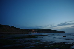
After my early (very early) morning wander on the beach, the family got together over breakfast in the self-catering kitchen of the hostel to discuss the day ahead … I was delighted when everyone agreed to a walk and I’d soon sorted out a nice looking circular on the map. In next to no time, we’d put up packed lunches and drinks and were soon outside the hostel boots on and raring to go (even daughter).

The Big Loop :-

As most good walks seem to do, the start of this one was a stiffish (but in this case quite short) pull up the coast path starting near the hostel just off the road-cum-slipway and heading in a south-ish direction. The sun was shining and being quite sheltered in the valley and with shrubs/trees around us it didn’t take long for outer layers to be stripped off, down to shirt sleeves. The climb wasn’t long and we emerged onto the cliff top path to some be greeted by some great panoramas.

  • To the north was the promontory of Ness Point protecting the village of Robin Hood’s Bay.
  • Eastwards looked straight out over Robin Hood’s Bay itself, a sweeping Curve of The North Sea maybe 3-miles wide.
  • Looking south-east, the coast-line swept around to another promontory – Old Peak or South Cheek on my map – with the very odd village of Ravenscar perched on top.
  • Inland the cliffs gave way to farmland heading steeply up towards the North York’ Moors.

Once on top of the cliffs, the path opened up considerably, exposing us to a really quite stiff breeze blowing off the land and out to sea. It was strong enough to get nervous about Craig who being the littlest, lightest and most prone to run about was probably the most vulnerable to being blown off the path and at times I grabbed a handful of shirt just to slow him down a tad and get him “land-side” of me. The exposed section didn’t last very long before we dropped down, bounded by coarse hedgerows again, to reach the bottom of the cliff just where Stoupe Beck breaks out onto the beach and then into the sea. This is a lovely quiet spot and rather than head straight over the utilitarian concrete and steel footbridge over the stream we headed down onto the beach where the kids amongst us (Katie, Craig … and me!) threw and skimmed pebbles out into the sea. The little bit of artist in me particularly liked the remains of a tree branch sat part buried in the sands. It was then back to the walk, and all the height lost in the descent to the beach had to be regained in classic coast path mode. The way ahead not in doubt as concrete steps and a railing headed up steeply in front of us.

After regaining the cliff top (didn’t take long) we reached a concrete pill-box (I assume a relic from WW2) which Craig in particular liked. Slowly but surely the cliff is falling away from beneath and around it, how long before it all falls into the waves below is anyone’s guess but it doesn’t look like there’s any attempt to shore it up for prosperity … probably impossible anyway given the state of the cliff. There was a narrow strip of cultivated farmland hereabouts, sandwiched between the cliff and a steeply rising hill side, the most stand-out crop being a small strip of sunflowers not looking overly vigorous but colourful non-the-less. Soon afterwards the path split, one staying close to the cliff edge, the other branching right up a field.

My map showed the inland route to be the right of way, so that’s the way we went although finding our way through some field boundaries proved a tad awkward through long grass, nettles, less than ideal stiles and the like, although we did emerge onto a farm track absolutely spot on (so I was pleased with my map reading) …. it turned out the cliff path had also made an inland turn and rejoined us hereabouts, so we needn’t have put ourselves through our minor difficulties – typical and easy to say in hind-sight!

The track led us on, passing a nearby cottage, looking somewhat isolated against the hill side; I thought it was nicely proportioned with its five windows spaced around the centrally positioned front door – A bit like a child might draw; quite simple clean lines. We’d now climbed a good way above the sea line and the golf links ahead marked us nearing the village of Ravenscar still some way above us. Although I don’t play the game, the golf course looked like it could be quite tricky to negotiate being spread out on the steep hillside and at least one fairway looking very close to the sheer drop to the rocks and sea below. With a strong wind blowing I’d say it looks unplayable – Is that a challenge to all you golfers out there ?

From here the well made track now steepened again and we resolved to take a break where it was due to join an old disused railway bed. We needed to use our powers of encouragement to get Craig and Katie to our intended rest point … right on cue, it started to rain – not hard but it was definitely rain! ughh. We couldn’t join the course of the railway straight away because of a path diversion, but almost doubling back on ourselves wasn’t a problem as a path led us beneath an embankment to a double arched stone bridge where we passed underneath and then swung around and up to reach the old track-bed, but not before chatting to a group of volunteers clearing undergrowth (I think with the national trust?) and doing a superb job.

We’d now made a complete 180 degree turn from our outward journey and the railway stretched out ahead in a generally north westerly direction and the gradient was now extremely easy and on a well maintained surface. Good views could still be seen out over the bay and the rain eased as blue skies returned and we started to make quite quick progress. We played silly word games and sang songs as we went, however, after maybe 2-miles comments were being made about the monotony that was growing. So after a refreshment stop near Browside farm I found a bridle track heading off to the right dropping down towards Allisons Head Wood. This path would sort of cut off the corner instead of taking the railway as it set off on a big almost semi-circular loop inland to maintain its contouring heights. It also meant having to do some proper map-reading, so I was doubly happy, and we soon reached the bottom of a small valley – A brand new looking footbridge aided our route over the small stream. This was the second crossing of this stream as it was the Stoupe Beck crossed earlier in the walk down on the beach. My daughter Katie especially remembers this quiet spot, (now some 8-months on), not for its rural charm but as the place with loads of spiders !!!, a fact long since lost from my memory banks. The route onwards from here was on a track heading gently up through the trees to soon reach the minor road “Bridge Holm Lane” which happens to be the only road serving Boggle Hole about a mile way. The others said they’d be happy to just head back to the hostel at this point, so we all headed off, to the right, down the lane passing occasional farm-houses/cottages as we went.

We were soon back at the small car parking area above Boggle Hole and as we continued on, Craig decided he wanted to head down the lane wearing his bandana as a blind-fold …. Don’t ask why, he’s a boy and he was just 8 years old, so who knows what was going on in his head …. Anyway we held hands with him down the steep road to prevent what would have been the inevitable head over heels accident. At the bottom of the hill we reached our start point and the hostel again, where we made ourselves a cuppa before deciding on what to do next.

The small Loop :-

As the tide was far enough out to allow access around the small cliff protrusion at Boggle Hole (The Nab), we decided to head up towards The Village of Robin Hood’s Bay and as a departure from the norm, I donned sandals instead of the customary boots so that I could paddle along in the sea. It didn’t seem like we were doing “a walk” now … It’s strange how walking on a beach changes the perspective on this.

It’s about a mile along the shore to the village and the beach was quite busy with bank-holiday week-end visitors making the most of the sunshine and fine weather. This was quite a contrast to the morning where we saw very few people … Obviously most people don’t tend to go too far from the honey-pot spots with their ice-creams, fish and chips and pubs. Despite the increased numbers, the walk along the shore line was enjoyable and afforded some good views across the lines of low rocks jutting out into the sea and it didn’t take long to reach the village where we climbed the slip-way to be greeted by the famous Bay Hotel and it’s “Wainwright’s Bar”… The first or last pub on the much lauded walker’s “A Coast to Coast” route. I resisted the temptation of a pint … There was the village to explore.

We then wandered around this lovely picturesque village for quite some time, exploring its steep streets and alley-ways, perusing its touristy gift shops and the like before heading back to the front. There’s plenty of info on the World-Wide-Web about Robin Hood’s Bay, its history, smuggling past, it’s legends and it’s sea-faring links, so I’ll not regurgitate it again here, so instead I’ll just show a few of my photo’s to give a flavour of the place.


After a while, it was suggested that I take myself off and extend my walk and we separated, my family to retrace their steps back along the beach to Boggle Hole Hostel, whilst I set off back to the main street of the village and the steep twisty-turny way to the top of the village. I took a small side street to find the coast path to emerge on the cliffs tops (heading northwards). Soon after, a strange looking post appeared in the field ahead and thankfully there was a notice board explaining what it was – A Rocket Post – and I think it’ll probably be worthy of a post all of its own. I pressed on some more and I managed to catch a glimpse or two back down to the village below and across the bay.

I didn’t want to go too far northwards, but nor did I want to retrace my steps exactly backwards, so as the fields on my left were designated “open access”, I headed inland rising across a field and found a place where I could easily straddle the boundary fence to gain a way onto the disused railway (the same one we were on earlier in the day) snaking it’s way around the coast. Turning left on the old track-bed, I stretched my legs out enjoying the added pace only tempered by grit getting inside my sandals (now there’s a good reason to wear boots). I was very soon at the top of RHB village again and made my way past the car park and old station to head southwards back towards the hostel still on the railway bed. Now it’s maybe a mark of the great views we’d had for most of the day, that I wasn’t really enjoying the old railway and I took the 2nd opportunity available to me to leave it, taking a footpath off to the left (Mark Lane on my map) to rejoin the cliff top path about mid-way between RHB and Boggle Hole. The views across the bay immediately lifted my spirits again, so much better than the old railway.

I was surprised at how soon I was back above the hostel (above roof level) and the path descended very quickly to the hostel front door.

Rather than head straight back indoors, I returned to the shoreline as the evening light was superb and I was doubly rewarded by a little wading bird allowing me to get quite close and take a few photo’s. Using the RSPB’s bird identifier web-site I think it may well have been a Sanderling or a Little Stint, or some other Sandpiper type bird …. any readers who know for sure, please let me know.

.

And that was that … walk over … I hope you enjoyed my scribbling.

Next post … 20090828_Rocket Post – Robin Hoods Cliff Tops

20090828_A Dawn Explore of Boggle Hole Beach

20090828_Dawn Explore of Boggle Hole Beach

When : 28th August 2009

Who : Me and Craig

Where : Boggle Hole Youth Hostel, Robin Hoods Bay, Between Scarborough and Whitby on the North Yorkshire / North Sea Coast.

Map : OS Outdoor Leisure Map no.27 North York Moors Eastern Area.

Grid Ref : 955,041

Summary : A wander down to the sea edge whilst most sane people were still tucked up in bed.

We try to get at least one short break away during the year at a youth hostel and we’d chosen Boggle Hole on the north sea coast for this trip as we hadn’t been that way as a family before and it would allow some beach time for the kids and an opportunity for a bit of coastal walking (and maybe some on the moors as well). As normal, all four of us were sharing a family dorm’ in the youth hostel annexe. We’d tried to black out the windows as much as possible (by adding a couple of blankets in front of the rather thin looking curtains) but as the dawn began to break, my son Craig began to stir …. Craig has always been an early riser (any time from 5am hasn’t been unusual) so rather than him disturbing his Mum and his sister in the confined space of the dorm’, I quickly got him dressed (over his jim-jams as it happens) and we set off to see what could be seen down on the beach, I grabbed my camera on the way out of the room.

Boggle Hole Youth Hostel, (an old mill building) is situated in a fantastic setting, nestling at the foot of a deep valley just as it opens up right onto the beach. The small stream running out onto the beach is tidal almost completely up to the front door of the hostel. We were lucky; the tide was out, allowing access right out onto the beach past a lot of rather smelly seaweed, so that we could look north to Robin Hoods Bay Village and south to the promontory with Ravenscar perched on top.

Whilst the views both to the north and south were great, our gaze was constantly pulled to look straight out to sea to where the sun was rising over the North Sea horizon. There was almost a glow to everything the light touched – absolutely beautiful – There was a little chill in the air as you’d expect so early in the day, but not so much to stop us exploring around the beach area which is a mix of sand and gnarly flat rock slabs running at angles out into the bay.

Although not huge in size these rock slabs are a great example of a “wave cut platform” formed as the rather unstable cliffs are eroded back into the land, the sea seemingly wanting more and more room for its self. I think it’s remarkable how some things from school lessons get engrained in the mind, never to leave you, whilst other subjects disappear in next to no time. In my case physical geography stuff has always “stuck”, hence the little bit of knowledge about wave cut platforms mentioned above and ox-bow lakes in my earlier post on my Lacock circular walk … Just don’t ask me to speak French!!!

Apart from looking at my pic’s there’s not much to tell really, just that we enjoyed our wander, not that we went far, maybe ¼ of a mile in each direction? Before returning back to the hostel, enthused and wide awake for the rest of the day …. whatever that was going to entail – yet to be discussed over breakfast.

I hope you enjoyed my scribblings and pic’s and I hope that you’ll take a look-see at my following posts when done

Next walk : 20090828_Boggle Hole-Coast Path-Ravenscar and Robin Hoods Bay Walk

20090827-31_Boggle Hole (Robin Hood’s Bay) Holidays – An Overview

20090827-31_Boggle Hole (Robin Hoods Bay) Holidays – An Overview

When : 27th thro 31st August 2009

Who : Me and my family

Where : Boggle Hole Youth Hostel, Robin Hoods Bay, Between Scarborough and Whitby on the North Yorkshire / North Sea Coast.

Summary : An overview of a short holiday (or long bank holiday weekend) in a simply stunning location on The North Yorkshire Coast, including sightseeing, some walking, some lovely early mornings on the beach and a little bit of re-living some of my childhood holidays.

27th August :

  • Travel to Boggle Hole Youth Hostel,
  • Brief stop at The Hole of Horcum.
  • Arrival at Boggle Hole Youth Hostel and an evening on the Beach.

The journey up from The Midlands, past Leeds and York and into North Yorkshire was pretty uneventful, one or two traffic jams but on the whole fairly straight forward. So as we neared our destination we decided we had time to take a slightly longer route and headed up over the moors to take a gander at The Hole of Horcum. I’d walked in the area a lot of years earlier and had remembered it as quite beautiful. I wasn’t disappointed this time around either, as the heather was in flower and the colours across the moors were lovely. We parked in a very busy car-park off the Pickering to Whitby road just south of Saltergate – Levisham Moor. It was just to stretch our legs really, and to take in the views across the impressive 300 feet deep depression in the ground that is “The-Hole-of-Horcum”. It’s amazing where all the people that had left their cars had disappeared to … almost as if the ground had swallowed them up (or maybe the giant of local legend had eaten them!).

I remembered from my trip here long ago, that the legend says that the giant scooped out a huge handful of earth and threw it some distance to form some nearby hills. I imparted my sketchy info’ to my kids …. I wonder if they’ll remember and pass on the legend to a future generation … Now back home, a very little research has now filled in a bit of detail: The general consensus agrees that the giant was called Wade, his wife Bell; well, it seems Wade scooped up a handful of earth (the depression becoming The Hole of Horcum) and threw the soil at Bell, (the resulting hills are now known as Blakey Topping). It seems his aim was not good and he missed his intended target. If you study the land it’s said you can still see the marks left by the giant’s fingers in the sides of the bowl.

The perhaps less romantic but much more plausible explanation is the feature is really the result of glacial action and the subsequent erosion by springs. A little further afield running through the moors is the Pickering to Grosmont, North Yorkshire Moors Railway, a stunning sight when the steam trains wend their way along the twisty-turny route through the moors.

Once we’d stretched ourselves out and loosened off a little, we again clambered back into the car for the final few miles to Boggle Hole Youth Hostel …. I love the name; it conjures up all sorts of ideas in your head, but more of that later. The Hostel is set at the bottom of a steep sided valley right where it reaches the sea. There is an access road, but is really a single track lane with a dead end at the bottom and as such there is no access for the general public and hostellers alike. This is very ably advertised by a humorous sign at the top of the hill. Instead, there is a small car park and roadside places for a good number of vehicles … It’s then a bit of a trek down to the hostel with bags etc. As the week-end progressed the distance seemed to become shorter (but not much!) but the first time it did seem to go on for some way. The first glimpse of the hostel, looking down onto its roof was very welcome.

A bit further on and the meaning behind the skull and cross bones warning at the top hill became most evident … The road became a steep slip-way onto the beach directly onto the sands and at times depending on the tides, straight into the sea! The hostel land rover has to negotiate the sands and masses of semi-rotting seaweed as well as fording the stream in order to get up to the hostel with provisions etc. However, a narrow path gave foot access bypassing the beach route.

A Boggle is a sort of imp or hobgoblin of the local area, and quite mischievous …. I kind of remember the story that a particular “Boggle” was banished from Robin Hoods Bay Village after some ill-doing, and he made his new home in the nearby valley now known as Boggle Hole …. For a bit more info on Boggles I’m going to make a separate diary post that might be of interest.

Well, that’s the start of the break – The following notes lay out the rest of the holidays … but they’re gonna have their own diary pages writing as well.

28th August :

  • Dawn explore of Boggle Hole Beach.
  • Family Walk-Boggle Hole-Coast Path-Ravenscar Circular then on to Robin Hoods Bay Village along the shore line and back to Boggle Hole again.


29th August :


30th August :

  • Boggle Hole–Robin Hoods Bay–Whitby Linear Coastal Walk (Just me)
  • Family visit to Whitby.


31st August :

  • Yet another dawn explore on Boggle Hole Beach.
  • A very short walk on Jugger Howe Moor.
  • A visit to The Staintondale Shire Horse Farm.
  • And the trip home to the Midlands.


I hope you enjoyed my scribblings ….

Next post : 20090828_Dawn Explore of Boggle Hole Beach.