20180326_Some Extra Bilton Green Crocus Pics

20180326_Some Extra Bilton Green Crocus Pics

…. Just because I can

…. and there were too many for my previous walks diary post “20180326_Cawston to Bilton Green & Back (after knee op’s)

…. so, here they are :-

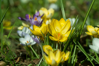
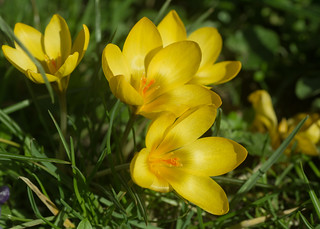
20180326-23_Crocuses - Bilton Green (Rugby)

20180326-24a_Crocuses - Bilton Green (Rugby)

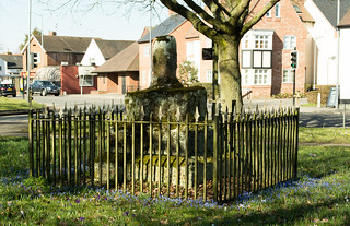
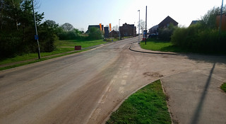
20180326-26_The George (Pub) Bilton Green - Rugby

20180326-32_Crocuses - Bilton Green (Rugby)

20180326-34_Crocuses - Bilton Green (Rugby)

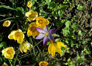
20180326-35_Crocuses - Bilton Green (Rugby)20180326-36a_Crocuses - Bilton Green (Rugby)

20180326-37a_Crocuses - Bilton Green (Rugby)

20180326-37b_Crocuses - Bilton Green (Rugby)

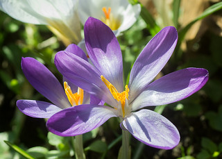
20180326-38_Crocuses - Bilton Green (Rugby)

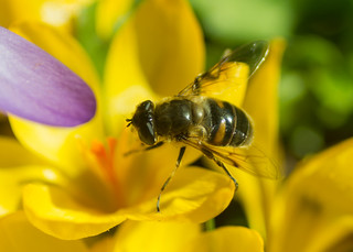
20180326-39a_Bee on Crocuses - Bilton Green (Rugby)

20180326-40a_Bee on Crocuses - Bilton Green (Rugby)

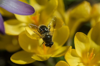
20180326-40b_Bee on Crocuses - Bilton Green (Rugby)

20180326-41a_Bee on Crocuses - Bilton Green (Rugby)

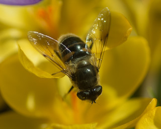
20180326-41b_Bee on Crocuses - Bilton Green (Rugby)

If you click on a pic’, it should launch as a larger image on my photostream on Flickr … a right click should give you the option of launching in a separate window/page.

Well, I hope you enjoyed my pic’s …. If you’d like to comment on my diary or any of my pic’s please feel welcome. I’d love to hear from you.

T.T.F.N. Gary.

20180326_Cawston to Bilton Green & Back (after knee op’s)

20180326_Cawston to Bilton Green & Back (after knee op’s)

When : 26th March 2018
Who : Just me (oh, and my camera and my new metal knees)
Where : Cawston/Bilton to the south west of Rugby Town, Warwickshire

20180326-39b_Bee on Crocuses - Bilton Green (Rugby)

Start and End Point : SP470,735 Trussell Way.
Distance : Approx 2.6 miles (4.2 km)
Significant heights : None to speak of.

Maps : There was no point in using a map as this was only a local wander, but, if you want to know, the 1:25,000 OS Explorer map that covers the area is Map No.222 Rugby & Daventry.

Summary : A very little walk in some rare 2018 spring sunshine to stretch my legs after recent knee surgery.

If you click on a pic’, it should launch as a larger image on my photostream on Flickr … a right click should give you the option of launching in a separate window/page.
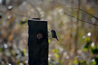
20140202_18_Coombe Country Park -Blue-Tit at the feeding postIf you’ve read my previous post [Coombe Abbey Walk] you’ll know that I’ve recently had surgery giving me two, brand new, half knee replacements (done at the same time), and as part of my recuperation I’ve been trying to get some walking miles “under my belt”, or really “in my legs” trying to get back to some kind of fitness.

Well, the day after the “Coombe Walk”, I mentioned on FB this comment :-

“After my 2.3 miler yesterday, thought a wander down to Mosaic Coffee shop for brunch would be good – So, today my muscles felt like I’d done a 17 miler the day before – Strewth I’ve got some work to do to get back to reasonable fitness levels !!!!!!!!”.

20180326-18_Mosaic Coffee Shop Main Street Bilton RugbyThat little walk to the lovely little coffee shop, on the 23rd March, was only ¾ mile, but was probably needed, just to loosen the muscles up a tad. So, to keep up the effort, I decided another local walk was needed and this time I decided a little further would be in order.

Now, the weather of late winter and early spring 2018 had been particularly poor, with periods of snow and ice making going outside a tad hazardous, especially hobbling around with two crutches, and even when there was no snow and ice, it was cold and wet and grey and miserable; Pretty much trapping me indoors and limiting me to just wandering around a supermarket’s aisles – Not very inspiring at the best of times. So, when the weather finally 20180326-26_The George (Pub) Bilton Green - Rugbyrelented, and a drop of sunshine decided to make an appearance, I decided a “stroll” down to the local village of Bilton would be a good thing to try.
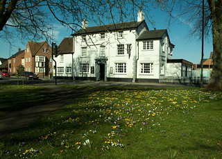
I made Bilton Green the focal point of the walk, as it was covered in its annual display of crocuses and I thought trying to get a few photos would be a good motivator. It’s also a perfectly pleasant walk through the Cawston Grange estate, especially the green spaces that have been provided as part of the housing development. The area is becoming more mature now, trees and shrubs reaching a decent size, softening the hard edges of roads and houses.
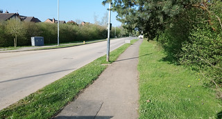
20180420-H_Trussell Way (Looking Towards Cawston Grange Drive)_XperiaAs several of my past walks diaries have used Trussell Way as a start point, I’ll once again describe starting on Trussell Way on the outskirts of the estate. Until recently this was a “dead-end”, with direct access onto the perimeter path and there was roadside parking that wouldn’t have infringed too much on local residents. However, the dead-end has recently been removed; the road now pushing further on into what was farmland and is now being built on by Mssrs William Davis enlarging the housing estate further south. There are currently restrictions on the house builders parking here, but I guess the restrictions will only be relatively temporary.

To describe getting to the start-point:-

Leave Cawston Grange Drive at an island, into Trussell Way, pass the side roads of Cave Close (on the right) and Durrell Drive (on the left), and then soon after, Trussell Way crosses a grassy area, just before it starts to rise again into the new housing being built.

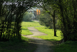
20180420-G2_Trussell Way (was dead end - Now extended southwards)_Anotated

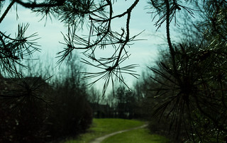
20180420-I_Cawston Grange Perimeter PathThe grassy strip includes the current perimeter cinder path, which I picked up gently rising in a south easterly direction, to pass through a tall hedge line, the small trees forming an inviting arch over the path, to emerge into a narrower strip of greenery with the established houses of Durrell Drive on my left and new housing going up behind trees/hedging/shrubbery on my right. Continuing on, the path flattens out and much of the existing housing is shielded by shrubs (red stemmed cornus predominantly) maintaining a rural feel, although I guess that will wane as 20180326-01_Cawston Grange Perimeter Paththe new housing goes up and becomes lived in. I particularly like the shapes some conifer trees made here against the pale blue sky in the weak sunshine.


20180326-02_Conifer needles

20180326-03_Sunlight through the conifer branches

20180326-04_Conifer branches - Cawston Perimeter Path

At the top of the path, after passing through another hedge line, a tarmac path (walking and cycleway) is reached in front of a stand of large trees and undergrowth separating the path from the B4642 Coventry Road (was the A4071 until a few years ago).
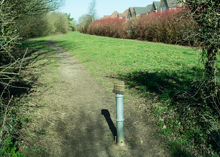
20180326-05_Cawston Grange Perimeter PathIncidentally, the anti-vehicle post here was adorned with a woolly hat, I don’t know if it had been lost or if someone had taken pity on the metal post and decided it needed warming up during the recent chilly weather.

Anyway, that’s beside the point really, because, I was to turn left here, but immediately stopped to take a few photos of some cheery daffodils/narcissi that come up here every year. It wasn’t the best display I’ve seen since they were planted, but I guess that might be down to the comings and goings of all the building works happening nearby, or maybe just down to the awful winter weather.
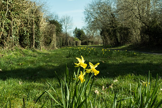
20180326-06_Daffodils - Cawston RugbyGetting low enough to take the pic’s wasn’t terribly easy as my knees didn’t want to bend very far, and I certainly couldn’t kneel down (far too painful !), so it was a case of spreading my feet as far as I dared, bending over as far as possible, using the live view rotatable screen on my camera and at full stretch trying to keep the camera as still as I could. Being 6’4”plus, I must have looked like some kind of strange giraffe trying to take a drink in that position. I must admit most pics failed due to camera shake, but some I think look Okish.
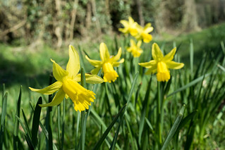
20180326-08_Daffodils - Cawston Rugby20180326-09_Daffodils - Cawston RugbyOnce I’d managed to stand upright again and just a few paces further on, the combined path/cycleway reaches Cawston Grange Drive, which I crossed straight over to a “Welcome to the Parish of CAWSTON” brick-built planter 20180326-10_Welcome to Cawston Grangeand sign. To my mind an attractive way to say hello to the estate. However, I have heard a dissenting voice from residents of what could be described as “old Cawston” down the Coventry Road, who feel the sign should be further down towards the Brickhouse Spinney area and so include them in the welcoming of visitors; either that or it was suggested the sign ought to read welcome to Cawston Grange Estate. Looking at the parish boundary map, they do have a teeny-weeny bit of a point. Whatever the politics, personally I have no problems with the wording or the sighting of the sign, which is backed by a small stand of trees and shrubs, an attractive way to welcome visitors to the area.

20180326-11_Silver Birch (Betula) - Cawston GrangeAnyway, I passed to the left of the signage and the stand of trees to pick up a wide tarmac footpath heading across a green with a large Christmas Tree to my right [that gets lit up in the winter each year], and a line of individual trees just to the left, including some quite mature cherry trees that were just waiting for warmer times to burst into flower. They look great when they do, albeit for a very short time, and the cherries taste good later in the year too. The tarmac path follows the line of an official right of way (a bridle track) which dates way, way back, to long before the idea of a housing estate here had probably ever been dreamt up.
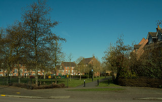
20180326-12_Green Space + The Bridle Way - CawstonAfter a short stretch down the tarmac bridle way, I reached and crossed Turchil Road passing a small fenced off play area designed for younger kids. This is a roughly triangular space surrounded by grass and trees softening the hard edges of the adjacent houses. All in all, a quite attractive estate green space. I particularly liked some catkins and cones hanging from a tree against the perfect early spring sky-blue sky; even local to home it’s worth looking for the little details that bring a little happiness – after-all, who doesn’t like spring catkins?
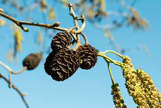
20180326-14_Catkins + Cones - Cawston

20180326-13_Catkins by the Bridle Path - CawstonThe next bit I’m gonna skip over quite quickly as I continued on, on the tarmac path, reaching Gerard Road where I then turned right, passed the small group of shops (A Chippy, Chinese Take-Away, Hair and Beauty Salon and a local CO-OP store), reaching and then crossing directly over Calvestone Road, across a small green with a few 20180326-15_Path beside the big playing field - Cawstontrees to pick up another tarmac path that soon emerges into a wide open “sports” field.

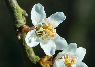
I say sports field but in reality, there’s only one “goal post” for anyone to use, but it is a large expanse of flat grassland. The path follows the edge of the field with a boundary fence separating the public space from Bilton School’s sports/playing fields along with a series of trees and large shrub hedging just coming into flower – I think probably Blackthorn (Sloe), the pretty slightly off-white petalled flowers with yellow centres indicating warmer times were on their way, hopefully a good spring being just around the corner.
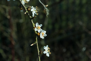
20180326-16a_Spring Flowers (Blackthorn I think)

20180326-16b_Spring Flowers (Blackthorn I think)

20180326-16c_Spring Flowers (Blackthorn I think)

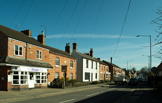
20180326-17_Mosaic Coffee Shop Main Street Bilton RugbyAgain, trying to stay a little brief, the path emerges onto the Coventry Road (B4642) where I crossed to the opposite side, turned left and walked into Bilton Village where the road continues as the B4642 but under the name of Main Street. Bilton itself is to me an unassuming place with a pleasant mix of housing (from old to brand spanking new), a selection of shops (including a Tesco Express and a CO-OP), some small businesses, a doctors surgery, Two Pubs (The Black Horse and The George), a butchers, a specialist cheese shop, several take-away outlets, four churches (Bilton Evangelical, Bilton Methodist, Sacred Heart RC, all within shouting distance of each other and at the opposite end of the village is St. Mark’s CofE not reached on this walk). There’s also a small (and free at the time of writing) car park just behind the Tesco store.
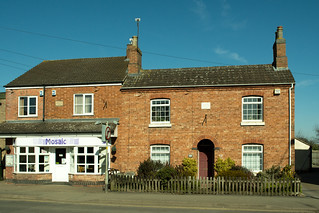
20180326-19_Ewart House 1890 + Rose Cottage 1885 Main Street BiltonThe other place I haven’t mentioned above, is Mosaic Coffee Shop/Café, a lovely friendly place that I would have called in to for a coffee or maybe a hot chocolate, but unfortunately, it’s closed on Mondays, so wasn’t available today.

Mosaic’s building has a plaque saying it’s called Ewarts House built 1890 and next door is Rose Cottage built 1885. If only the red brick walls could speak of all the changes they’ve seen over the last 130 years or so.
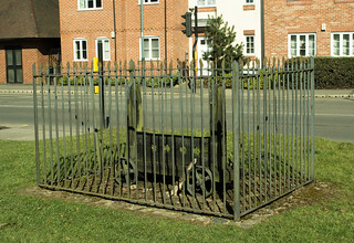
20180326-20_Stocks - Bilton GreenTalking of history, outside the CO-OP is a set of wheeled stocks kept safely behind a set of be-spiked metal railings and then a short distance away in the middle of the Triangular Green (bounded by roads) is the old Butter Cross. I say cross, but the top half is now long gone leaving just the heavy tiered stone base and bottom stump of the cross itself. The monument is also kept safe inside metal railings also adorned with spikes and with crosses at each corner. I wonder how many people even notice it’s there as they negotiate this busy junction of roads controlled by traffic lights and overlooked by the white-washed frontage of The George pub across the road.
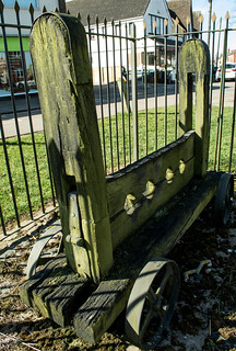
20180326-21_Stocks - Bilton Green

20180326-25_Bilton Green - Butter Cross - The George (Pub) - Rugby

20180326-27_Fence Railings Around the Butter Cross - Bilton Green

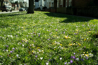
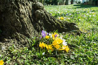
20180326-28_Fence Railings Cross - Butter Cross - Bilton Green20180326-29_Fence Railings Cross - Butter Cross - Bilton Green20180326-30_Fence Railings - Spikes - Butter Cross - Bilton Green20180326-22_Crocuses - Bilton Green (Rugby)It was this area of “The Green” that was my motivation for the walk, as each spring the ground is briefly bedecked in the whites, purples and yellows of crocuses.

It really is quite special, especially with the sun shining and it was well worth pushing my knees to reach here for a closer lingering look, rather than a passing glance from the car window.

Anyway,I shot off far too many pic’s (again!) …. there really isn’t a shot to take that couldn’t be described as a cliché in one way or another, but hey, I don’t care.

20180326-24b_Crocuses - Bilton Green (Rugby)Crocuses are cheery, happy little flowers and I enjoyed trying to capture their character as best I could, and I make no apologies for the images contained here.

I particularly enjoyed watching a few bees attracted to the flowers, braving the chill in the air despite the early season sunshine being quite pleasant, especially compared to some of the sub-zero temperatures we‘d been experiencing not long before.
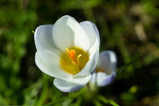
 

20180326-31_Crocuses - Bilton Green (Rugby)

20180326-33_Crocuses - Bilton Green (Rugby)

20180326-36a_Crocuses - Bilton Green (Rugby)My knees were feeling the strain somewhat, so I took time out to sit on a bench just inside the nearby Assheton Recreation Ground for a bit of rest and recuperation before thinking about the walk home. I must admit it made me feel just a little sad that a slow, flat, easy walk for little more than a mile had resulted in having to sit and rest because of pain and tiredness. I guess having to overcome self-doubt about whether it was right to have such surgery is just as important as working the physical side of building muscles and stretching tendons.

20180326-42_Perimeter Path beside the big playing field - CawstonSorry, that got a little downbeat there, but no, I picked myself up, brushed myself down and gave myself a bit of a talking to, re-motivating myself and re-cajoled my knees to straighten-up as much as possible again and carry me back down Main Street, re-passing all the previously mentioned places en-route, and re-crossing the Coventry Road back into the large sports field effectively separating Cawston from Bilton. Instead of heading back up the boundary to Bilton School, I turned left following the tarmac path running parallel to the Coventry Road separated by a mature hedge.

20180326-43_Perimeter Path beside the big playing field - CawstonThe path here is bounded by a line of trees which will in time become an avenue to walk down. Also here several stands of trees/shrub planting are now growing to be quite sizeable and break up the view across the large field. I like this path – in fact I like living on our housing estate, and it’s not only the physical surroundings, it’s the people too. Invariably most people I pass on these paths will nod, smile or say hello – I guess it’s called community.
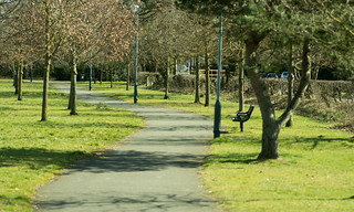
20180326-44_Perimeter Path beside the big playing field - Cawston

Anyway, at the end of the path, it was back into streets, where I followed Kalfs Close left into Gold Avenue and left onto Calvestone Road crossing over to meet Cawston Grange Drive back at the stand of silver birch trees and the brick “welcome to Cawston” planter/sign.

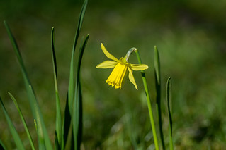
20180326-45_Silver Birch (Betula) - Cawston Grange

20180326-47_Daffodil - Cawston RugbyIt was now back to re-following my earlier steps, crossing Cawston Grange Drive, passing the daffs (more pic’s taken), then right onto the perimeter path down to Trussell Way and the start point and then back to home.

20180326-46_Daffodil - Cawston Rugby20180326-01_Cawston Grange Perimeter Path

20180420-I_Cawston Grange Perimeter Path

20180420-G1_Trussell Way (was dead end - Now extended southwards)_XperiaNot quite 2½ miles but I was pretty much cream-crackered, but really very satisfied that I’d managed it, although the amount of post exercise discomfort was yet to kick in. But that’s why they supply prescription strength drugs! …. The walk also had the knock-on effect of giving me something to occupy my mind whilst in enforced rest – namely reviewing, deleting and editing my pic’s.

Well, I hope you enjoyed my scribblings …. If you’d like to comment on my diary or any of my pic’s please feel welcome. I’d love to hear from you.

T.T.F.N. Gary.

PS. I’ve now finished and published the above diary in July 2018, some 4-months after I did the walk ….. and I’m now back at work and, amongst other walks, I’ve completed a 12 miler up in the White Peak, and a nearly 14-miler locally. Knees seem to be holding up. When I find time I’ll have to write them up/publish as well.

 

20140309_A Short Springtime Warwickshire Walk Cawston to Dunchurch

20140309_A Short Springtime Warwickshire Walk Cawston to Dunchurch

When : 9th March 2014
Who : Me and Craig
Where : Cawston and Dunchurch (near Rugby), Warwickshire
Map : 1:25,000 OS Explorer Map No. 222, Rugby & Daventry
20140309_A short Springtime Walk Cawston to Dunchurch (Nr Rugby)Start Point : SP 470,737
End Point : SP 485,713
Distance : Approx. 2.5 miles (4 km)
Significant Heights: None to speak of

Summary : A short spring time walk in Warwickshire – Just because we could, and because the weather had improved enough to think we might enjoy no rain and maybe not much mud underfoot – Both a rarity in the winter of 2013/2014 as we’d had excessive amounts of rain and therefore lots of mud to go with it. After over six years of writing about my walks, this is my first ever sponsored blog post.

If you click on a pic’ hopefully it should launch as a larger image on my flickr photostream.

I’m currently sat at home during the Christmas Holidays (2014 if you happen to be reading this in some future year). It is very cold and frosty with temperatures barely reaching above freezing during the day. It feels as if winter is just really taking hold and that spring is some way away. 20140309-20_Dunchurch Roofs + St Peter's Church TowerWell, spring IS just around the corner, and I thought that this short walk I did last March would be good reminder that pussy willow, daffodils, spring crops and the like are maybe just eight weeks or so away.

We’d planned a family lunch time meal at The Dun Cow Inn in Dunchurch, so, just because I could, I decided that a quick walk there would be a pleasant thing to do. I would then meet my family who would have driven the short distance up Cawston Lane. It then transpired that my 12 y.o. son wanted to come with me, so we sorted out our walking boots and set off with just ourselves, my ancient old Karrimor Hot Ice ruck sack (more of that later) and my camera for the short walk after throwing a change of shoes into the boot of the car for when we got to the pub/restaurant. We guesstimated it would take about 40-45 minutes if we put our best foot forward.

20140309-01_Cawston Grange Perimeter Path

Cawston Grange perimeter path. (looking back towards Trussell Way)

Now, we live on the new Cawston Grange Estate to the South West of Rugby, but you don’t really want to hear of the route taken through the estate, so, just for the purposes of this blog post, I’ll start on Trussell Way just past Cave Close and Durrell Drive on the edge of the estate. If you fancy doing this walk in some form or another, it’s a good parking spot at the moment as Trussell Way is currently a dead end and with no house drives or side roads/traffic to contend with. However, I’m pretty sure Trussell Way will be extended into what is currently local farmland when (that’s WHEN, not IF) the housing estate is enlarged right down to the old railway bridge near Potford’s Dam/the A4071 Western Bypass island.

20140309-02_Cawston Grange Perimeter Path

Cawston Grange perimeter path, heading towards B4642.

Anyway, that’s by-the-by for now, we made our way to the nearby path that runs around the estate, turned left and walked up to meet the B4642 Coventry Road, (which used to be called the A4071 before the Rugby Western Relief Road was built). From here we turned right to follow the road on a tarmac path. We are right on the edge of Rugby here, with a view over farmland on the other side of the main road bounded by an attractively ramshackle old wooden picket fence. I’m trying to make the most of this view every time I pass by, because this field too is earmarked for a housing development which I understand could be started imminently. As we walked, it was a joy to see the spring flowers in the soft sunshine, I especially like the newly budding pussy-willow and large clumps of happy smiley daff’s growing around the base of the trees lining the roadside.

20140309-03_Cawston Grange Pussy Willow

Springtime pussy willow

20140309-04_Cawston Grange Path near B4642 Coventry Road (old A4071)

Daff’s near B4642 – Coventry Road – Cawston

20140309-05_Road-side trees + Fence_Cawston B4642 Coventry Road (old A4071)

This view soon to be obliterated when the field becomes a new housing development.

20140309-08_Road-side Daffs + Hedge_Cawston B4642 Coventry Road (old A4071)

Roadside daff’s – A happy sight.

20140309-06_Cawston Rugby - Renatus

Renatus – Cawston

Anyway, we stayed on our side of the road, on the tarmac path, passing the older part of Cawston with some rather grand looking houses, the first of which is now a much extended, rebuilt and re-invented building which is some-sort of cosmetic procedure clinic nowadays (Renatus I think it’s called).

20140309-07_Cawston Rugby_B4642 Coventry Road (old A4071)

B4642 Coventry Road (Junction with Cawston Lane)

20140309-09_Cawston Farm + Public Footpath

Cawston Farm

We soon reached the point where we needed to cross the road (opposite the Nature Trails Nursery) to pick up a farm track heading down the side of brick built farm buildings and the nursery school building. The farm by the way is, unimaginatively (but perfectly descriptively) called Cawston Farm.

20140309-10_Cawston Farm + Public Footpath

Farm Track – Heading towards Cawston Woods

Continuing on, the track heads gently downhill (very easy walking) past a series of low wooden sheds. I’ve often wondered what these sheds are for :-

• They seem far too low for sheep or cow barns.
• Maybe pigs ? (but there’s never been much smell as we pass by).
• So chickens would be my next guess ? (always far too quiet for that).
• It’d remained a mystery for the 12+ years we’ve lived near-by.
• Well today, for the first time amongst all the times I’ve passed by, all the shed doors were wide open and the mystery was solved :-

20140309-11_Cawston Farm + Chitting potatoes

Chitting potatoes

In each shed there were thousands of boxes-cum-trays stacked one on top the other in long rows. Between the rows were a series of vertically hanging fluorescent strip lights – Very odd! …. It just HAD to be investigated closer – and then it all made sense, the trays-cum-boxes were filled with POTATOES! being “chitted” ready for the forthcoming planting season. Chitting is the term given to where little shoots are encouraged to grow from the “eyes” or dimples on the potatoes, and this gives the plants a head-start when they do eventually get planted. My dad used to do this when I was a lad when he kept an allotment. The only difference here was the industrial scale.

20140309-12_Approaching Cawston Woods_Public Footpath on farm track

Gentle descent towards Cawston Woods

Moving on, the track heads into an area of woodland, known locally as Cawston woods, but more accurately these are Cawston Spinney on one side (no entry-nature reserve these days) and Fox Covert (access allowed at owners discretion, but in practice just open to the public). I think the woods are owned by Mitchell’s Potatoes, which would link nicely with the sheds’ usage just passed by). Today’s walk took us straight through the wooded area, now rising gently but staying on the track, to emerge into farmland of both ploughed fields and pastureland bounded by mature hedges. There’s nothing overly exciting here just typical pleasant mixed Warwickshire farmland. Livestock kept hereabouts are sheep and cattle and one or two fields have horses and crops grown are of course the spuds as well as wheat, oil seed rape, maize and beets.

20140309-13_Stile _ Farmland near Cawston Woods

Looking back toward Cawston Woods (from the path joggle)

At the end of the first field, the farm track makes a 90-degree bend to the right and heads off into the distance, but, the right of way, now a path, goes straight on, with a hedge on the left and a ploughed field on the right, to reach a stile in the field’s far left hand corner. Once over the stile, the route here joggles left and then right ignoring the path off to the left heading towards a different part of the woods. The path then follows another hedge (still on our left) to reach Windmill Farm. The route here carries straight on through part of the farm yard via a couple of stiles. Please be warned it can be rather muddy underfoot here, but you’ll soon emerge out onto another wide farmtrack/drive, which is Northampton Lane.

20140309-14_A little bit of mud (bypassable today) at Windmill Farm - Dunchurch

It is often muddy through Windmill Farm and on Northampton Lane

Navigation and gradient (or lack of) is easy here, as it’s a simple turn to the left along Northampton Lane to just follow the wide track for quite some distance (we passed a group of farm implements including a muck-spreader en-route). These bits of equipment always seem to be here and somehow have a timelessness about them, they’re still of a scale to suit smaller fields rather the larger “prairie” fields that seem to be so prevalent in many places these days. Still, such is modern farming practices I suppose. Happily the farm fields around Dunchurch still appear on the whole to be on the smaller scale.

20140309-17_Northampton Lane - escaped chicken (Red Hen) Dunchurch

Braving the traffic ? – A game of chicken I suppose

Northampton Lane is quite long and straight, disappearing into the distance but is easy going (especially today, as it wasn’t at-all muddy, which it can be) to reach Cawston Lane (where there was a little mud to negotiate). Directly opposite, Northampton Lane continues, but now as a proper tarmac’d road, with houses along one side. However, the only “traffic” today was a lone red hen looking for food on the path and road. I was going to call the bird a chicken, but I understand chicken is a term reserved for when a hen is dead and about to become food!

20140309-16_Spring Crocuses_Dunchurch

Cheery spring crocuses

The continuation of Northampton Lane was not our route now though, although road walking was indeed required to our final destination …. We turned right into and along Cawston Lane, the path after crossing to the opposite side, becoming more built up with houses along the way, passing Addison Road and a Methodist Church en-route, and including passing a patch of cheerful crocuses on a patch of green. After re-crossing Cawston Lane we soon reached a Tee-junction with a main road (A426, Rugby Road) where we turned right heading towards Dunchurch Village Centre with an attractive mix of cottages, some thatched, but all slightly dominated by the tower of St. Peter’s Church.

20140309-18_Dunchurch Cottages + Church Tower

Dunchurch cottages & St. Peter’s Church tower.

20140309-19_Dunchurch Thatched Roof + Bird Sculpture

Ornamented thatch + peacock sculpture.

We arrived at The Dun Cow just before 1pm almost exactly 45 minutes 20140309-21_Dunchurch Cottages + Dun Cow Inn - Signageafter we’d set off, changed foot-ware and threw rucksack and boots into the boot of the car, which we found quite easily in the pub’s car park and went in to find my lovely wife and daughter, enjoyed a good dinner and a well-earned pint (or three) for me.

Just to finish, a little about my favourite ever ruck sack – I bought this way back in the mists of time and at some point I modified the waist strap by stitching on a wider padded version for a more comfortable carry. It has served me tremendously well for many years now, but is n20140309-23_Hot Ice 30 - Karrimorow finally showing its age (a bit like my knees), the bright red when new is now a dusky pinky colour and the stitching in places is finally giving way. I’ve been looking for a new day-sack for some time now, but nothing has quite fitted my criteria as I’m 6-foot 4-inches tall and I’ve not found a 30/35 litre capacity sack long enough to suit my back length. It seems most sacks have gone kind of short and bulbous, meaning I have to go to a small back-pack sized sack. I have a decent Berghaus Verden 45+8 litre sack with an adjustable Biofit back, but it’s really just a bit large and heavy for a day walk and now 20140309-22_Clean Boots - Salomonmy son is walking with me more often, he tends to carry the Hot Ice leaving me with the big bag.

Now, there are very few outlets in Rugby, meaning I have to travel to try on kit. Normally, I go to the far side of Coventry or down to Leamington Spa where there are a couple of decent sized shops but I’ve just learnt that Cotswold Outdoors have recently opened a store just off the M6 in Coventry (in the Leekes shop) which will be easy to get to. So, now that Christmas is over, I think a visit will be in order, especially as I’ve read on-line that they do a ruck-sack fitting service. Perhaps it’ll kick start my 2015 walking.

I hope you enjoyed my scribblings …. If you’d like to comment on my diary or any of my pic’s please feel welcome. I’d love to hear from you.

T.T.F.N. Gary.

20140222_Staverton (Northamptonshire) – Flecknoe (Warwickshire) Circular Walk

20140222_Staverton – Flecknoe Circular Walk

20140222-30a_Horse (Near Flecknoe)When : 22nd February 2014

Who : Me and Craig

Where : Staverton and Flecknoe, Northamptonshire and Warwickshire.

Start and End Point : SP 539,612

Distance : Approx 6.1 miles (9.7 km)

Heights : 3 separate rises, although nothing significant. See end of post for details.

Map : 1:25,000 Ordnance Survey Explorer Map No.222, Rugby & Daventry

Summary : A pleasant countryside walk over rolling Midlands farmland.

If you click on a pic’  it should launch as a larger image on my flickr photostream.

This walk was unusual, but only in that it was on a Saturday (Sunday walks being much, much more common), daughter had been dropped off at her job and my lovely wife was unfortunately suffering with flu, not just a heavy cold as many people call flu, but full 20140222-01_Staverton Village Green + Cottagesblown diagnosed by a doctor type of flu and as such I felt it best to leave her to rest and take my 12 year old son out for a walk. Apart from leaving the house quiet for my wife, it would also serve two other purposes : I’d been feeling quite over-loaded at work and I’d been doing a fair few extra hours and I really needed some exercise and fresh air to recharge my internal batteries. Craig on the other hand had been ensconced indoors for the best part of a week during the first half-term of 2014 and I felt some good old-fashioned “get-out-and-about” would do him a world of good too, to burn off some of that energy that all young men have an excess of.

I’d left out my fave’ three books of local walks for Craig to look through and so pick out a walk or two, whilst I was taking my daughter to work; he chose a 5.25 miler straddling the border between Warwickshire and Northamptonshire and taking in two villages : Staverton and Flecknoe, neither of which I could remember having ever visited in the 20140222-50_Cottages + Village Green Stavertonpast. Why get Craig to pick a walk ? … well, I figured if he’d picked the walk, he’d potentially be much more engaged in the day. I reckon it was nearer 6-miles long in the end.

A little note about the title – Maybe a little more descriptive would have been Staverton – Flecknoe A Triangular walk rather than Circular; the route basically being north, then west and finally south-east making a right angled triangle, with the last and slightly longest leg being the triangles hypotenuse. It’s also probably worth mentioning the three books I often dip into for local walks, either to follow exactly the walks described within them, or, just as an idea to adapt using my map(s) to suit my needs on the day.

20140222_Staverton - Flecknoe Circular Walk

Map plotted on WalkJogRun – will launch bigger if you click on it

• Evening Telegraph Country Walks, Brian Keates [Coventry Newspapers Ltd.]
• Country Walks in the Rugby Area, Jim Watson [This Way Books]
• More Country Walks in the Rugby Area, Jim Watson [This Way Books]

This walk was lifted straight out of the last one of these books, perhaps it’s a tad lazy, but hey why not every now and again? So off we set, with me getting Craig to follow the drive to the start on the map, through Dunchurch, Willoughby, Braunston and on to Daventry 20140222-07_Staverton Village Cottageson the A45 and then the A425 for the last mile and a bit to Staverton; entering the village via a side road and then following my nose to reach the village green where I parked up as neatly and as considerately as possible. We booted up, I found my bearings, and we set off with light hearts and a spring in our steps.

Staverton village is charming, an eclectic mix of old and new; many of the cottages are very attractive indeed. In fact the village as a whole is attractive with warm Cotswoldy stone side by side with red brick, detached and terraced properties, different roof levels, buttressed walls, some cottages around the green even had corrugated rusting metal roofs. These in themselves weren’t unattractive but had obviously seen better days; I wouldn’t mind betting they let water in, especially around the chimney stacks. …. all in all Staverton is a very pleasant place to walk through, which 20140222-08_Heading North out of Staverton on Jurassic Waywe obviously had to do, firstly picking up Oakham Lane, walking away from the green and then joining Braunston Lane heading north away from the village.

After not very far, Braunston Lane becomes a dead end for traffic, leaving the village behind, but continues on as tarmac, reducing in width beyond a pair of metal gates serving no other purpose than preventing vehicular traffic. The way ahead is on The Jurassic Way and is bounded by grassy verges, ditches and large hedges interspersed with mature trees. It 20140222-12_Across the Fields to Flecknoe (from Staverton)looks for all the world that this may indeed have once been a “proper” road between Staverton and Braunston just like its name implies.

The views from the track are super, with a wide vista over both Northamptonshire and Warwickshire farmland. Off to the left across a shallow valley the fields rise to the village of Flecknoe near the top of its own hill. A dominant feature much further in the distance, protruding 20140222-09_Rugby Cement from Staverton (approx 9-10 miles)well above the horizon, is the Rugby Cement works (currently called Cemex) which is some 9-10 miles away as-the-crow-flies. Continuing pretty much due north (give or take a bend or two) the tarmac’d surface gives way to a wide farm track, quite rutted and muddy in places, reasonably firm and dry in others, dropping down off the hill that Staverton sits upon. Craig was quite happy with the change in surface, as he didn’t really want to be on the hard man-made stuff, preferring the natural ground underfoot.

 20140222-10_Jurassic Way Track North of Staverton (Nikon)     20140222-13_Jurassic Way_Track north of Staverton

20140222-15_Manure Heap + Slurry Mud

20140222-16_Lots of Mud + PuddlesThis was to change though, as the track levels out, crossing over a couple of small streams and being at the bottom of the surrounding hills (on three sides) the track had become very churned up, muddy and slurry-like. In fact some of it was real slurry, as there was a large pile of farmyard manure in a field on our left and it was seeping smelly yukky liquid into the tractor ruts along our route. Although the ugghy stuff didn’t stretch a long distance, it still necessitated some careful negotiating before the track started to rise again and in the process return to much dryer, easier and more pleasant walking.

20140222-18_Braunston Church Spire from Jurassic Way (Nr Berry Fields)Our route was to turn left (westwards) at a “cross-road” of bridle-paths, but rather than do that straight away, we decided to carry on up to the top of the rise to regain the views lost whilst we were in the dip, although I wasn’t sure quite what could be seen from here, I was hoping for a decent view to Braunston Village. I wasn’t disappointed, as the sun had picked out the church spire and the old windmill at the western end of Braunston village well over a mile away, and it gave the opportunity for me to try out my new 300mm lens on my camera. I was quite happy with the results. Once pic’s were taken, we turned around, 20140222-19_Wet Soggy Farmland_Just off the Jurassic Waydropped back to the afore-mentioned cross-road of paths, turned right and followed a farm track with a hedge on our right and an open unbounded field on our left (looking south into the sun). As a recurring theme over the winter of 2013-2014, the field was sodden with water and the infant crop looked far from healthy. I wonder how many 20140222-21_Tractor Tracks + Rutscrops will have failed and just got ploughed back into the ground so becoming the latest victims of the wettest winter since official UK records began over a hundred years ago.


Anyway that’s by-the-by really, we now had to follow the hedge on our right, dropping down a slope (with more deep tractor ruts), to reach the bottom where it again became a little soggy underfoot, but we picked our way through to a sturdy, utilitarian wooden bridge across a small river. This is the infant river Leam, which forms the border between Northamptonshire and Warwickshire here.

20140222-22_Miry Bridge over infant River Leam

20140222-23_Infant River Leam at Miry BridgeNow, despite its spelling, this isn’t pronounced “Leem” as might be thought, but “Lem”. However you might pronounce its name, the river isn’t very big at this stage of its life. Its future path is north almost to Braunston, bisecting the now disappeared medieval villages of Braunstonbury and Wolhampcote before swinging west past Draycote Water (it is used to top up the reservoir at times) and then on, eventually to Royal Leamington Spa to join The River Avon (The Warwickshire Avon or Shakespeare’s Avon) at Warwick.

All that is superfluous really, as we crossed straight over – No we didn’t ! I’ve lied to you : We first stopped for a rest and to take on board some refreshment, a drink of water and some nibbles – and only then did we cross straight over via the wooden bridge, called Miry Bridge on my map, heading away uphill (not steep) across a field in a westerly direction. 20140222-26_How Deep (Flooded ridge and furrows near Flecknoe)As it levels out, one of the fields has the rolling remains of ancient ridge and furrow farming methods. Each of the furrows were rather waterlogged to start with, and as we progress across the field these became areas of standing water, too deep for my walking boots, so necessitating a series of zig-zags along the top of the ridges to avoid the fingers of mini-lakes. Craig in wellies however had no problems wading straight through, in a much more direct line to reach a bridge over an old disused railway.

There are so many of these old railway routes criss-crossing our countryside; it’s hard to imagine the steam traffic that must have serviced all the villages and towns along their routes. This particular one heads north into Rugby which was once a major rail interchange, but now less so. Just to one side of the bridge, the railway has been deliberately flooded making a small fishing pond, although I think probably not used much looking at the state of the small landing stages. A little further on the fields on our right became horse paddocks – One horse in particular was a right poser in front of the camera!

20140222-27_Fish Pond + Dilapidated Landing Stages          20140222-30a_Horse (Near Flecknoe)

 20140222-32_Short signpost FlecknoeFrom here we picked up a farm track, which soon led us into the village of Flecknoe. The first thing of note is a traffic sign-post. Nothing particularly unusual in a road having a sign post you might think; except in this case its height above the ground. There can’t be many signposts much shorter than this one, even the surrounding snowdrops almost reached the bottom edge … in text speak – LOL.

From here we walked up the road passing the rather imposing Manor House. There were a couple of happy smiley daffs in the verge here in full flower – The 20140222-36_Old Olive Bush Pub - Flecknoefirst of the year. Moving on up the road, brought us into the village proper; the road bending one way and then the other, passing attractive cottages on the way, soon bringing us to the pub – The Old Olive Bush.

The hostelry looked very inviting in a homely understated sort of way and it would have been rude not to partake of a drink (I’d planned to stop anyway).

Rather than drink inside though we sat at a small table just outside the front door in the sunshine; me with an excellent pint of Doombar ale plus a bag of cheese & onion crisps, Craig with a J20 and his fave pub nibbles, salted peanuts. Without fail, every local who either came in or out of the pub passed the time of day with us – Friendly people!, Friendly Pub!.

 20140222-37_Full Pint of Beer - Doombar Ale          20140222-39_Emptied Pint of Beer - Doombar Ale

As much as a second pint would have gone down a treat, we really needed to move on, so, ignoring the path almost directly opposite (more of that in a mo’) we headed off down the road in the same direction as before (roughly westerly). At the next road junction we turned left (away from Nerthercote), and then, around left again still on the road. Now, the guide book suggests carrying on up the road to then take the next left on another minor road. However at a small chapel there is a passageway (marked as a public footpath on my map), so we decided to leave the road-walking and head off eastwards looking out for the 2nd footpath on the right for our route away from the village.

20140222-40_Pink Washed Cottages - FlecknoeNow you may have worked out that after this many left turns, we were now heading more or less back towards the pub, and yes indeed we were, the passageway track/path crossing the top of the little footpath directly opposite the pub mentioned earlier; so we could have cut out the walk around the village. Anyway, we found the path we wanted, crossing a grassy field towards a group of buildings. Where upon we had to enter the back garden of one of the houses and then head down the side of the house (on its left) to then pass through the front garden. It does feel strange doing this, and Craig actually said he didn’t like it as we passed through the nicely kept gardens. But it’s a right of way, so no problem is what I told him.

We had to then cross a minor road to pick up a path heading through the middle of a sizeable field, although it was worth the turn around to view the pink washed dwellings we’d just come past. We were also now back “on-route” per the guide book directions. Dropping across the field it would have been easy to assume it heads straight to the bottom, but no, about half way down the route takes a slight bend to the left, passes through a line of a hedge and then continues in more or less the same direction (SE) to rise up the bank of a disused railway (the same one as crossed earlier by the fish pond). After a little joggle to the right along the old track bed the path drops down the far bank, through a stand of trees and then following a sign post across the corner of a field to reach a small footbridge over a ditch/brook. The path then carries on in the same direction across a few fields to reach and the cross the River Leam again and in doing so cross back in Northamptonshire leaving our home county of Warwickshire behind.

Our walk was now nearing its final section, with about five fields to negotiate before arrival back at Staverton. 20140222-44_Dwarfed by the reedsThe crop in the first couple of these fields was one I’d never come across before. Not your normal, beets, wheat, maize, potatoes, etc., that are often encountered but reeds. Tall, dry, blown about in the wind type reeds, or maybe it was bamboo.

What-ever the actual stuff was, Craig wanted to walk straight through, I didn’t!!! So he disappeared (almost literally) into the margins, the height of the crop dwarfing him, but I soon called him back out to join me 20140222-45_Silver Birchin the walk around the left hand side of the crop, following alongside a small stream. A wide margin had been left uncultivated and apart from some surface slipperiness the going was quite easy, just rising gently as we went (Craig heading off into the reed crop margins every now and again enjoying the adventure. After a while of steady uphill we crossed over the stream/ditch and through the hedge line via a small bridge and then immediately turned right to continue upwards (with the hedge on our right), just a few yards further on we reached what looked like a point-to-point horse jumping rail and fence marking the start of a wood. Continuing on between the wood and the hedge, we reached another fence/jump, entered the next field leaving the trees behind and promptly passed by a couple more jumps. How having a cross country horse jumping route following the line of a public footpath works I don’t know, but that’s exactly how it is on the ground. However, we soon had to cross a fence (near a 20140222-48_Cottages + Village Green Stavertonsmall animal house) and the path steepened as it made its way up the middle of a small valley, eventually picking up a drive way (Well Lane Track) as the path passed a large house and then up into the village of Staverton reaching Manor Road.


20140222-54_Cottages StavertonTurning right along the road, passing attractive cottages as we went, brought us back to our car, parked by the side of the village green. The next few minutes were spent removing boots (Craig sat in the car boot to do this) and I wandered around the green taking a last few photo’s and then in the car for the drive home. But first I drove around to join the A425 Daventry Road, just to see what the pub looked like and find out its name – Purely to add it at the end of this diary, and so give you the final bit of info’ that you might find useful …. We didn’t go in, so I can’t comment on what it’s actually like, I’ll leave you to discover that yourself if you want to. Oh and it’s name? : “The Countryman”.

20140222-55_The Countryman Pub _ Staverton

Approx’ Heights “climbed” during the walk.
• Muddy valley bottom north of Staverton to Berry Fields = 25m (82 ft)
• River Leam at Miry Bridge to Flecknoe Village = 35m (115 ft)
• River Leam to Staverton Village = 70m (230 ft)
The last 30-35m in height being the steepest part of the walk, but not by any means a problem.
• Total = 130m (427 ft)
• None of the downhill sections were difficult enough to warrant a separate mention.

So, that’s it …. I hope you enjoyed my scribblings …. If you’d like to comment on my diary or any of my pic’s please feel welcome. I’d love to hear from you.

T.T.F.N. Gary.

20140110_Happy Walking – A conversation by email

Hi everyone,

Well after what seems far too long, here’s my first post of the year ….

A little while ago, a person from the Rugby area contacted me by email, (about one of my Lawfords walk posts). It’s always nice knowing that someone has not only happened upon my stuff, but even nicer when they’ve read a post and then either commented via wordpress or contacted me directly. So, just thought I’d share some of the conversation that grew from that first contact (names etc. removed), as it goes to show how all kinds of peeps and of all abilities can enjoy and get enthusiastic about walking as a great past-time. so here goes :-

28th Dec 2013 :-

Hi Gary, being a novice and late starter of doing country walks can you tell me do all your routes have right of way and we wont be chased off the land?? i would like to do The Lawords route but unsure.

29th Dec 2013 :-

Thanks for contacting me, sorry I didn’t get back to you yesterday. Virtually all of my routes are on rights of ways (Public Footpaths, Bridleways, Byways, etc. …. Personally I feel very uncomfortable when finding myself off rights-of-way. The exception is in wilder country when in designated open country. The Lawfords walks I’ve done are all on rights of ways and featured in several books of walks covering Coventry and Warwickshire. The only bit on the Lawfords walk that could be considered non-right-of-way, is immediately after crossing the Avon and then the mill race at Little Lawford, where I have walked on the drive between the buildings in order to access the track down to the ford. It’s only a matter of yards though and if you’re not comfortable doing this there is a path that heads up to the tarmac’d road north of the ford.

The only place locally where you might find I’ve been on non-rights-of-way is the area south of Potfords Dam Pool/Cawston Woods – The path is always ploughed up and field boundaries have to be used. Also, over the years all the farm tracks have been used around there by dog-walkers and the like but in recent times there have been signs going up warning about trespass and the like. Perhaps the farmer has changed and is being a little more pedantic these days, but until he marks the proper route, then you’ve got to find the best route possible.
The best advice I can give is to buy the local 1:25,000 OS map and follow the words written onto the map before you set out. I never walk purely on anybody’s written route descriptions – I always rely on my maps. I hope this helps, but if you have any more questions, I’m happy to email or comment against a particular blog post …. or, if you email a phone no. I would be happy to talk. Best regards and happy walking, Gary
29th Jan 2014 : –
Brilliant, thanks Gary…went over to Go Outdoors today for the said OS map…and came away with a new base layer, a mid layer, a new coat for Jill my wife…and the map.!! worse than going to Wilkos…
29th Jan 2014 :-
Welcome to the world of walking …. As with all hobbies there always seem to be new gadgets and the latest technology especially in clothes and boots. I was in “Go” yesterday with my wife and she bought new walking trousers and a fleece top.  If you’d like to meet up we could maybe do a local walk together ? TTFN.Gary
30th Jan 2014 :-
Hi Gary, that sounds good, thank you, give me a while to work up to a descent level as we have only just started. So far it seems 6 hours planning route, 1+ hours walk, 2hrs. cleaning boots!! all good fun.

4th Jan 2014 : –

Hi Gary, went on a good walk on Monday 30th. Harbro Magna, Easenhall across a few very muddy fields, towpath to Cathiron and back up to H. Magna. Quite hard work for us with the mud. Good walk tho…but got home and realised I had dropped my Mob phone and sunglasses..DOH!! fell out when I was checking map. Retraced steps next day and found both in a field of sheep next to Oxford canal towpath..How lucky.The main reason I am emailing is to ask you if you could recommend any good walking books or literature of Walks around Rugby. Even tho I have bought the 222 O/S map the details are still pretty small to read, I am experimenting in scanning parts of the map and blowing them up to read en route.

7th Jan 2014 :-

Great that you found a good walk …. I have passed through Cathiron before, on foot, by car, and  a long time ago by double kayak.

 As for losing things, I’ve done something similar with belongings in the past [most notably a leather clad hip flask on the north Devon/Somerset coast path – Never did find it – and it was full of a decent malt ! and sun-glasses and the like.
My fave way to suss out a walk is by trying to make up my own routes on the map, looking for natural links and trying to avoid roads where possible. However, when I’m feeling lazy or in a bit of a hurry, the four books I always return to are the ones noted below …. they’re really little more than booklets, but if the walks are good enough to be published and sold, then they’ve got to be OK I think :-
I have a couple of Coventry Evening Telegraph Books dating to the late 80’s/early 90’s by Brian Keates … Entitled “Evening Telegraph Country Walks” and are based in a big circle centered on Coventry.
The other two that are written in the same way are:-
Country Walks In The Rugby Area (2003) and More Country Walks In The Rugby Area (2007). Both are by Jim Watson and published by THISWAY BOOKS. They cost me under £5.00 each.
All the routes range from about 3.5 to 7 miles and really none are very strenuous (we haven’t got many big hills around us have we) … what I tend to do, is use the books to get an idea of an area worth going to, be it a nice view, pretty villages, or points of interest. Then, reviewing with my maps, I then decide whether to follow the route exactly, adapt it or maybe extend it somewhat. I’m confident enough to add bits on or chop bits off as I go, on the fly so to speak, whilst on the walk itself. In some cases two walks in the books may overlap, and so make for a longer figure of eight route.
Another book that I’ve bought and dipped into occasionally (and intend to do more from) is the “A Coventry Way Circular Walks” … The Coventry way is a big circular route taking in Brinklow nearest Rugby, Meriden farthest away in the west, Bedworth to the north and Stoneleigh in the south. The book has a series of circular walks that all link up so that the full way can be walked eventually.
Another way I sometimes plan my walks is for my wife to drive me out to somewhere and then I walk home in a linear route or occasionally leave home heading to some pre-arranged pick up point (a pub maybe) and get picked up from there. On several occasions over the years I’ve tried to do one of these linear routes when away on a family holiday … the sense of discovery and feeling of journey can then feel much more rewarding.
8th Jan 2014 : –
Excellent, thank you Gary for all that info. That will steer me in the right direction (no pun intended)!! last weekend, we were short of time on Sunday so we opted for a shortened walk and avoided the muddy & soaked fields around Pailton to Monks Kirby. enjoyable though. More research to do, thanks again. Best foot forward.

ps my son and his wife went up Glencoe and Fort William for a week over Christmas and New Year, bit extreme for me nowadays. Fantastic photos from that trip.

And just to finish,

I hope anyone dipping in gleans a little info. and – if there’s anyone else that would like to contact me, please do, I always try to respond as soon as I can. TTFN, Gary

20131103_Subscriptions + Notifications

Hi everyone,

I’ve just received this message from a person who subscribes to my blog …. I wont say their name, but thanks for contacting me, as I didn’t know the method I use for updating was annoying to anyone.

Nov 3, 7:43 pm

I subscribed to receiving emails updating me on your walks. I heard nothing until now when I have just received 19 of them in the last 10 minutes and I suspect they are still coming through. How do I stop them it’s very annoying. I am going to delete them so they don’t clog up my in box which is not what I wanted to happen.


Unfortunately, I don’t know how to stop the above happening, because, when I share my photo’s from Flickr to my blog, I have to do each one, on its own and it automatically posts it “live” to its own blog post. I then try as quickly as possible to then copy/paste the image into the relevant blog post where I want them to finally reside ….. I then delete the stand alone image/blog post as quickly as possible.

I wish there was a simpler/better way of doing this, as I’d like to share the pic’s into the walks diary post directly, but I’m told by the guys at flickr that this is not possible.

As it stands, it’s quite a cumbersome and time consuming method I’m using, but ultimately it does seem to work, with my Flickr images and WordPress blog both linking quite nicely to each other,

What I’ll try to do now that I’ve had this feedback, is ascertain from flickr whether it’s possible to share a pic to a draft WordPress post rather than a live post. If this is at-all possible, it would stop the multiple notifications to my subscribers.

I’m really sorry that this method has ended up being annoying,; because I don’t post as often as I’d like, I hope it doesn’t put you off reading my walks diaries and associated posts.

Best regards to all my readers,

Gary.


20130807_An early morning wander at Bugsworth Canal Basin

20130807_An early morning wander at Bugsworth Canal Basin

When : 07 August 2013

Who : Just me

Where : Buxworth, sort of midway between Chapel-En-Le-Frith and Whaley Bridge, just off the A6 [ grid-ref. SK023,821 ]

Map = OS. 1:25,000 Explorer map OL1, The Peak District, Dark Peak Area

20130807_Bugsworth Canal Basin

20130807-25_Narrow Boats at Bugsworth Basin near Buxworth by gary.haddenNot a walks diary as such, just a quick word on this quiet, hidden way spot we just happened upon whilst looking for budget accommodation [The Navigation Inn] for a short break in/near The Peak District ….. This was the middle of the 3-days of our break; we’d done a walk the previous day (at Alstonefield) and today was earmarked for a “touristy“ day at Chatsworth House and Gardens (see separate diary for some blurb about our time at Chatsworth).

20130807-06_Stone Wall - Bugsworth Basin near Buxworth by gary.haddenI awoke really quite early and was up and about much earlier than the rest of my family, so I decided to take advantage of “The Golden Hour” of just before/just after sunrise, especially as the weather was perfect, with a slight chill in the air but the promise of some sunshine to come.

So I quickly donned some clothes, grabbed my camera and crept out of the room so as not to wake my wife (I didn’t need to worry about the kids, as they were sharing in a separate room down the corridor).

Once outside, I first headed to the car to check everything was in order (it was), and I was quite struck by the heavy dew fall on the roof with the early soft light glinting off the droplets of water.

20130807-01_Early morning dew and sunlight by gary.hadden    20130807-02_Early morning dew and sunlight by gary.hadden

20130807-07_Early morning mists at Bugsworth Basin near Buxworth by gary.haddenI then had a good wander around the historic site of Bugsworth Canal Basin, which is the end (or the beginning ?) of The Peak Forest Canal. This was once a hugely important industrial site for the vicinity, and whilst I could try to make up my own words about the area, it’s far easier and much more accurate for me to regurgitate the words of much more knowledgeable folk, as noted on some info-boards placed around the basin area.
To start with, some official looking info’, from an official looking info board :-

BUGSWORTH BASIN

Scheduled Ancient Monument.

Derbyshire County SMR No.242.

Protected under the Ancient Monuments and Archaeological Area Act 1979.

Restored, Maintained and Managed by the Inland Waterways Protection Society Ltd.

Navigation Managed under the British waterways General Canal Bye-Laws 1965.

48 Hour Moorings Only.

Please help us to preserve this Internationally Important Industrial Heritage Site.

Sponsored by :-

Mersey Basin Campaign.

Bechtel Water Technology Limited.

High Peak Borough Council.

English Heritage.

20130807-16_Bubbles-Ripples and Concentric Circles by gary.hadden

And now for some more text, arguably far more interesting than the “blurb” above, from another info’ board :-

PEAK FOREST TRAMWAY

Over a hundred years ago, the quiet footpath in front of you was a tramway track (sorry I didn’t get a picture of this). A railway with a difference – here there was no hissing of steam! Instead, imagine the sound of horses’ hooves and the rattle of wagons being pulled along a track known as The Peak Forest Tramway. The tramway and the nearby canal were developed together as a means of transporting limestone from quarries at Dove Holes onto the canal network. Limestone was in demand for use in the many different industries of Cheshire and Lancashire.

Using the natural incline of the hills, the wagons rolled down to Bugsworth Basin. A workman known as a wagoner, who was in charge of the team of horses and wagons, supervised the journey by riding on the side of a wagon. Teams of horses 20130807-26_Fence + Shadows - B+W by gary.haddenwere used to pull the wagons back up. Many local people were employed on the tramway and in the mills that grew up along the route as a result of its success. Several of the original mill buildings are still in use. A short way up the trail is one such mill, Whitehall Works at Whitehough.

Spot the Tramway! With no rails left to show the route of the tramway, the only visible clue is the occasional stone sleeper block that the rails were fixed upon. Further along the trail, they are still in position. At Bugsworth Basin, they are along the side of the path, just a short distance from Crist Quarry where they were extracted. A bed of hard gritstone was discovered when the route for the tramway was being excavated. Realising that they had found a hard wearing stone, the constructor built a connecting line to the quarry from the tramway. As well as the sleeper blocks for the tramway, the stone was used to build the warehouses, bridges and locks along the canal. The quarry has now completely disappeared into the surrounding landscape.

For nearly 130 years, the Peak Forest Tramway was an effective means of transporting heavy goods between Dove Holes and Bugsworth Basin.

20130807-09_Grasses in early morning light by gary.hadden    20130807-11_Ferns growing in the walls - Bugsworth Basin near Buxworth by gary.hadden

20130807-15_Canal Side Flowers - Bugsworth Basin near Buxworth by gary.hadden     20130807-12_Canal Side Flowers - Bugsworth Basin near Buxworth by gary.hadden

And to paraphrase (rather than copy exactly) some final bits of info’ from a couple of other info boards around the basin area:-

Lads who worked on the tramway were called “nippers”. They helped with the teams of horses pulling the wagons up the line until being swapped with a fresh team. Today (rather than being an industrial site) the Tramway Trail is a haven for wildlife. Dippers can be spotted on the Black Brook and the surrounding hawthorn provide great food and cover for wildlife. Bugsworth Basin today is a tranquil place to walk and relax but in the 1890s, up to 80 boats a day were loaded here and Lime Kilns burnt limestone into lime.

20130807-21_Narrow Boat - Bugsworth Basin near Buxworth by gary.hadden

And now back to my own words :

Even though it was quite early there were already a few joggers out and about, taking advantage of the lovely start to the day, using the trail, canal tow-paths and another path 20130807-04_A6 near Buxworth + Whaley Bridge - Lone red car by gary.haddenthat made its way up to a modern footbridge over the nearby A6 road. This footbridge was about as far as I got, overlooking the dual carriageway and the first of the day’s traffic speeding along, effectively bypassing the old-world infrastructure I was encountering.

I suppose the engineers of the late 1800’s couldn’t possibly imagine (even in their wildest dreams) the scale of modern quarrying still going on in the Dove Holes area today and  how quickly and efficiently our road and rail systems transport the spoils of that labour around the country.

20130807-18_Bugsworth Basin near Buxworth by gary.haddenI was quite happy wandering, enjoying the wild flowers and reflections in the soft light, trying to make some half-decent images (all pic’s here are by me) and I hope I’ve captured a sense of tranquility of the morning.

20130807-20_Canal Side Flowers - Bugsworth Basin near Buxworth by gary.hadden   20130807-19_Canal Side Flowers - Bugsworth Basin near Buxworth by gary.hadden

At one point, I spent some time chatting to an older gent’ who was out walking his small dog; he’d lived in the area for many a year and had even worked in The Navigation Inn when 20130807-24_Heron in flight by gary.haddenit was owned by Pat Pheonix (Elsie Tanner of ITVs Coronation Street fame) …  The gent’, one of several dog walkers who had started to emerge as the morning progressed, explained that a heron had taken up residence on the far side of the cut, in a steep wooded bank. Since its arrival, no ducklings had managed to survive in the basin area this year. As I moved on, I happened to see the said heron in flight, making its way between the trees with its long, languid wing strokes, folded neck and tucked in head. Luckily, I didn’t witness it swoop down to eat any stray ducklings.

20130807-17_Bugsworth Basin near Buxworth by gary.hadden

I could happily have stayed out much longer. However, time was moving on and, after well over an hour, I decided it was time to head back inside, shower, breakfast and get ready for our day over on the other side of the Peak District National Park, at Chatsworth House and Gardens.

20130807-27_Roses and beer terrace - Navigation Inn - Bugsworth Basin - Buxworth by gary.hadden

Anyway, that’s enough for now, I hope you enjoyed my pic’s, and the words (albeit most of them were composed by others – but I’m sure they won’t mind their text being spread a little wider than before).

If you’d like to comment on my scribblings or my pic’s, please free to; I’d love to hear from you.

T.T.F.N.

Gary

PS. As an aside, looking on my OS. map, there are footpaths, bridleways and canal towpaths (including The Goyt Way and Midshires Way) heading into the hills both to the south and north of Buxworth. Also, just 3-4 miles to the north (as the crow flies) and a little longer by road, is Hayfield. Hayfield is the famous starting point of The Mass Trespass up onto the moors of Kinder Scout, which ultimately led to today’s fantastic network of public footpaths in our hills, across our beautiful countryside and open-access to our high open spaces – Brave, dedicated people with a great vision of how society can be and actually needs to be, fair for all, encapsulated in the phrase “a right to roam”.

20130807_ Chatsworth House and Gardens

20130807_ Chatsworth House and Gardens

When : 07 August 2013

Who : Me and my family

Where : The Peak District – Central England …. Chatsworth House near Baslow

Directions : Get reasonably close and there are loads of good signage to direct you down the correct roads to car-parking – Just look for the brown signs.

Maps = OS. 1:25,000 Explorer map OL24, The Peak District, White Peak Area.

Grid ref. : SK260,702

Not a walks diary as such, just a quick word on the family day out we had on a short 3-day break in The Peak District … this was the middle day of the three, sandwiched between two days that involved country walks, but I guess we must have walked at least four miles around the grounds, seeing as we were there for most of the day and there are literally miles of paths that can be wandered around, and we didn’t venture up the hillside much at-all.

If you click on a photo’ it should launch as a larger image on my flickr site … or … if you just want to see the pics without the wordy bits, use this link to the set of images on flickr and there are a few more than shown below.

I’d awoke early and was up and about much earlier than the rest of my family, so I had already headed out (from our digs at The Navigation Inn) for an 20130808-01_Navigation Inn - Buxworth by gary.haddenearly morning wander around the historic site of Bugsworth Canal Basin. I’m writing another diary post for that part of the day …. (to follow) ….  so enough said about that here.

Anyway, after breakfasting we headed off to the other side of the Peak District National Park, to Chatsworth House and Gardens. I’m not going to say much about this extremely well known and loved tourist destination, suffice to say, it’s well worth a trip out. I’ve visited here numerous times over the years, and I’m sure it won’t be my last.

20130807-79_In Chatsworth's Rockery Garden by gary.hadden    20130807-73_Redwood Tree in Chatsworth's Rockery Garden by gary.hadden

20130807-45-B+W_Fountains at top of the staircase waterfall - Chatsworth by gary.hadden

20130807-44_The staircase waterfall - Chatsworth by gary.hadden

My fave bits ? :-

  • The “rockery” in its magnificently over-the-top huge scale.
  • The spouting tree fountain.
  • The “violin” hanging on a “door” in the house.
  • The staircase waterfall.
  • Edensor Village out in the deer park (pronounced Endzer by the way)
  • And just the huge scale of the grounds/gardens – Formal, informal, pinetum woods, huge gravity fed fountain, classic maze, and if you’re feeling fit enough, miles of pathways heading up into the wooded hills above the house and expansive views across the estate.

20130807-84_Traditional Sculpture - Chatsworth by gary.hadden               20130807-100_Chatsworth House - tall fountain + long pool by gary.hadden

20130807-112_The famous Violin hanging on a door - Chatsworth by gary.hadden

20130807-117_Inside Chatsworth House by gary.hadden

As a bit of added interest, there was also an exhibition of art sculptures dotted around the grounds:

  • Some I quite liked (Revelation + Tongue-In-Cheek)

20130807-38_Revelation Artwork - Chatsworth by gary.hadden

20130807-82_Tongue In Cheek - Art Sculpture (2010) by Tony Cragg by gary.hadden     20130807-83_Tongue In Cheek - Art Sculpture (2010) by Tony Cragg by gary.hadden

  • Some I was really ambivalent about.

20130807-122_The Pavilion artwork - Chatsworth by gary.hadden     20130807-129_Polishing the Lens Scuplture artwork - Chatsworth by gary.hadden

  • The turbine was interesting, but I don’t know if was an art exhibit at-all.

20130807-29_Turbine - Chatsworth by gary.hadden

20130807-31_Turbine - Chatsworth by gary.hadden     20130807-32_Turbine - Chatsworth by gary.hadden

  • And some I plainly disliked (La Machine A Rever in particular) – thinking maybe a toddler could have done better.

20130807-89_Odd Art Sculpture - La Machine A Rever (1970) by Niki de Saint-Phalle by gary.hadden

But I guess that’s the idea of an art exhibition, it’s supposed to raise questions and views – but some modern art just really doesn’t do anything for me! … and … I don’t think many really enhanced the beauty of the landscapes all around us, albeit manicured into a “fake” landscape per Mr. “Capability” Brown.

20130807-86_Book Bench with Ball and Chain - Art Sculpture - Chatsworth by gary.hadden

20130807-99_Queen Elizabeth II + Prince Charles (bronze busts) - Chatsworth by gary.hadden

20130807-47_Chatsworth House + Ivy Art Sculpture from the staircase waterfall by gary.hadden

Anyway, that’s enough of that, I hope you enjoy my pic’s, and hope it’s given food for thought if you’re looking for a day out with a bit of culture.

T.T.F.N.

Gary

Header Photo Change

As much as I liked my previous header picture of Coombe Abbey Country Park, it didn’t feel right to go with my blog title “Tothehills”, so I’ve changed it to my recent photo of The Great Ridge north of Castleton …. The dark shadowy peak is “Mam Tor”, then “Barker Bank” followed by “Back Tor” (with the lone tree near the top) …. The hill off to the right, with the summit not seen in the image, is “Lose Hill” other wise known as “Ward’s Piece”.

Why this image? Simply, I just love this ridge, it’s a superb walk with fantastic views for the full length …. To the south is the Hope Valley and the expanse of The White Peak; to the north is The Vale of Edale and across to the Kinder Scout plateau. East and West have equally impressive vistas ….. as I said, I love this ridge walk … the last time I walked it ? – This week (August 2013) with my 11 year old son.

20130502 + 20130503_Coventry War Memorial Park + Top Green

20130502 + 20130503_Coventry War Memorial Park + Top Green

20130502-06_War Memorial Tower Cenotaph_Coventry War Memorial Park by gary.haddenWhen : 2nd & 3rd May 2013

Who : Just me

Where : The War Memorial Park (Kenilworth Road) and the nearby Top Green, (Warwick Road), Earlsdon, Coventry

Parking : On southern end of Davenport Road, just off The Kenilworth Road.

Maps : 1:25,000 OS Explorer Map No. 221, Coventry & Warwick

Map Ref : SP 328,776

If you  click on a pic’  it should launch as a larger image on my flickr photostream.

My WordPress blog gives some basic statistics on how many “hits” I’ve had each day, saying which diary posts had been viewed; how many times, and also what search terms were used. Searches based on “Coventry Memorial Park” come up very often, on average over twice a week. Some of the terms searched for in the last year include:-

  • Distance around memorial park Coventry … x35
  • War memorial park Coventry … x31
  • Distance around war memorial park Coventry … x18
  • Memorial park Coventry … x15
  • Distance around the memorial park Coventry … x6
  • And others, all variations on a theme, so I guess you get the gist …..

20130502-02_Formal Garden Flower Beds_Coventry War Memorial Park by gary.haddenTherefore, as it had been a while since I’d written anything about The Memorial Park, or even visited Coventry’s premier public park (excluding Coombe Country Park, which is in fact in Warwickshire albeit run by Coventry City Council), I thought I’d spend a couple of lunch times updating my photo’s of the area near to the Memorial Tower. The decision was also with the knowledge that the authorities had recently been spending a wodge of money sprucing the place up; re-tarmacing the pathways, cleaning up the paving around the memorial and similar such stuff and I thought I’d see if it was noticeable how the money had been spent.

20130502-07_War Memorial Tower Cenotaph_Coventry War Memorial Park by gary.haddenI get an hour for lunch, and I work about 10-15 minutes drive away (depending on traffic), so I can get about ½ an hour or maybe 35 minutes comfortably at the park, not long really, which explains why I ended up going 2-days on the trot. I had planned on using the recently resurfaced and extended small car park off The Leamington Road (north-eastern corner of the park) but probably because of the quite nice spring weather, it was choker-block full on both days; So, rather than using the main car-park off The Kenilworth Road or the alternative small parking area on Coat of Arms Bridge Road, I decided to park at the southern end of Davenport Road ( just off The Kenilworth Road) near to the park’s formal area, and to my mind the most interesting part of the park I wanted to visit.

20130502-05_Formal Garden Flowe Beds_Coventry War Memorial Park by gary.haddenNow, most of the searches I mentioned earlier seem to revolve around how far it is around the perimeter path. This seems to suggest most people searching are walkers or more probably runners/joggers doing circuits of the park, maybe heads down not really seeing anything of the park itself. Well, I can understand that whilst circumventing the large area of sports pitches (pretty much just a big grassy field), there isn’t much to focus on, but the formal area has much more to offer and hopefully this diary can open a few eyes to this area a little.

20130502-07_War Memorial Tower Cenotaph_Coventry War Memorial Park by gary.haddenThe formal area includes The War Memorial Tower itself, which really dominates the area helped by the fact that the large area of surrounding trees is laid out with several avenues radiating out like spokes of a wheel giving visita’s up to the tower from many directions.

.

20130502-06_War Memorial Tower Cenotaph_Coventry War Memorial Park by gary.hadden          20130502-04_Inscription_Coventry War Memorial Park by gary.hadden

Picking out some words from a nearby info board :-

The Memorial was inaugurated on 8th October 1927 by Field Marshall Earl Haig. The ceremony was attended by approximately 50,000 people many of them ex-service personnel. The contract for construction of the War Memorial was issued in 1925 and building works were completed including lighting by August 1927. The discs around the memorial show the names of the five soldiers associated with Coventry who were awarded the Victoria Cross. The bronze band around the memorial incorporates the wording of the “Kohima” named after a village in north eastern India in the Nago Hills. This was the point of the furthest Japanese advance into British India during the Second World War. The bronze band also includes the words of the poem “For the Fallen” by Laurence Binyon. Both sets of wording are widely used as an important part of Remembrance Services. The final wording on the band is that of Winston Churchill’s famous wartime speech from 20th August 1940, referring to the efforts of the aircrew that were fighting overhead to prevent a possible invasion.

20130503-01_Rose Garden + War Memorial Tower_Coventry War Memorial Park by gary.haddenNearby is a small rose garden with low hedging on a theme of playing card suits and some formal annual flower beds are planted alongside the main approach drive. Also nearby are ; the new children’s play area, skate-board park, bird display house and the old pavilion near the tennis courts which houses a cafe and toilets.

20130502-03_Pavilion_Cafe_Coventry War Memorial Park by gary.hadden

20130502-01a_Poppy Tree Carving_Coventry War Memorial Park by gary.hadden      20130502-01b_Poppy Tree Carving_Coventry War Memorial Park - Copy by gary.hadden

Near the pavilion is a tree carving, depicting a series of poppies, fully in keeping with being in the War Memorial Park (it’s just by the perimeter path if you want to see it). Another info board gives the following text :-

This poppy sculpture has been created out of a damaged Atlantic Cedar tree. In the early 1990s there was a massive amount of snow fall and many of the Atlantic Cedar trees along the main path were damaged. This Damage is still evident today. One of the trees could not cope with the amount of wet snow. The branches snapped under the weight and a healthy tree was totally decimated. As the tree died it seemed appropriate to turn what was left into a piece of art. The chain-saw artist, John Wakefield, who had used his skills to create a monk out of a dead redwood in Coombe Country Park, created the poppy you see today.

Despite this tree now no longer growing, there are many old and really quite superb tall trees still lining the perimeter path here, their spiny needle covered branches framing the view across the bowling greens and beyond the bird-display enclosures to the Memorial Tower. 20130502-09_Original Childrens Area_Coventry War Memorial Park by gary.haddenBetween the perimeter path here and The Kenilworth Road is a long narrow strip of grass bounded by hedges. This used to be the old children’s play area (I can remember playing there as a child). The area was known as Children’s Corner and included a miniature railway between 1952 and 1980. I’ve always felt quite sad that the railway had disappeared depriving the most recent generations of Coventry’s kids the chance to ride on it, however, the info boards that have recently been placed around the park state that it is in fact the miniature railway now at Ryton Pools Country Park just outside the city boundary, so now I’m not so sad.

20130502-08_Main Entrance Gates_Coventry War Memorial Park by gary.hadden   20130503-02_Strolling_Main Entrance Gates_Coventry War Memorial Park by gary.hadden

The perimeter path drops down gently to the park’s main entrance gates. These are normally kept locked with just foot passage to the sides of the wide iron-work gates. Just outside the park is an attractive area of grass and trees which has an informal display of spring bulbs adding a splash of cheerful colour along-side The Kenilworth Road/Leamington Road/Warwick Road junction.

20130502-10_Main Entrance Gates Spring Flowers_Coventry War Memorial Park by gary.hadden    20130502-11_Main Entrance Gates Spring Flowers_Coventry War Memorial Park by gary.hadden

20130502-12_Block of Flats_Leamington Road near Coventry War Memorial Park by gary.hadden

Crossing over the road leads you on into another area of parkland, known as Top Green. This is a mix of the formal (flower beds and benches) and informal (spring bulbs and trees) and includes some super flowering cherries lining the side of the Warwick Road. It’s a lovely little area and a really attractive approach to a major city centre. From here it’s really only a matter of minutes to reach Coventry’s main railway station on the west coast main line.

20130503-03_Top Green Flowers - Kenilworth Road Coventry by gary.hadden

20130503-04_Top Green Water Fountain + Flowers - Kenilworth Road Coventry by gary.hadden   20130503-06_Pink Blossom by gary.hadden

20130503-08_Top Green Bench + Flowers - Kenilworth Road Coventry by gary.hadden   20130503-09_Top Green Flowers - Kenilworth Road Coventry by gary.hadden

20130503-05_Top Green Spring Flowers - Kenilworth Road Coventry by gary.hadden   20130503-07_Top Green Path + Flowers - Kenilworth Road Coventry by gary.hadden

Coventry War Memorial Parke Perimeter PathOh, and if you aren’t at-all interested in the blurb above and just wanted to know how far the full perimeter path is around the park; By mapping it out on Walk-Jog-Run, I reckon it’s about 1.66 miles (or 2.7 Km if you like your distances in metric) and this pretty much matches the city council website that says it’s 1.6 miles for the full circle.

So, that’s about it. I hope you enjoyed my scribblings …. If you’d like to comment on my diary or any of my pic’s please feel welcome. I’d love to hear from you.

T.T.F.N. Gary.